
Across the United States, an invaluable network of historic and recreational trails, etched into diverse landscapes from California’s chaparral-clad ridgelines to the dense forests of the eastern seaboard, faces an accelerating threat. These pathways, some bearing the ancient footprints of Indigenous peoples like the Chumash, others remnants of early industrial and land management efforts, are increasingly succumbing to the relentless pressures of a rapidly changing climate and decades of systemic underinvestment. What once served as lifelines for commerce, exploration, and cultural connection now frequently appear on official maps as open routes, yet on the ground, they have vanished – swallowed by erosion, overgrown by wilderness, or obliterated by natural disasters, signifying a profound loss of public access and national heritage.

The Los Padres National Forest in California exemplifies this acute vulnerability. Here, trails clinging precariously to steep slopes, many originally constructed for purposes long obsolete such as cattle drives, mining prospecting, or early U.S. Forest Service fire patrols, now shed soil and stone with alarming regularity. Despite historical evidence of careful construction, including old bench cuts and hand-built retaining walls, these features are often half-buried or entirely consumed by encroaching vegetation like manzanita. As the region experiences deeper droughts punctuated by more intense, atmospheric river-driven floods, the inherent fragility of these trails has been dramatically amplified. Drainages carved into sandstone disappear overnight, and entire sections of trail slip off mountainsides, leaving a system shaped more by environmental forces and abandonment than by the agencies tasked with their stewardship.
This localized crisis reflects a much broader national predicament. The U.S. Forest Service, a primary steward of America’s natural infrastructure, manages an astonishing 370,000 miles of roads and approximately 160,000 miles of trails, representing 85% of all federal land trails. Yet, this colossal responsibility is met with woefully inadequate resources. A sobering 2013 Government Accountability Office (GAO) report revealed that only about 25% of these trails met the agency’s standards for maintenance and safety. Furthermore, only 37% of the entire national trail network receives any maintenance attention annually, condemning vast stretches to a slow, irreversible decline from both the physical landscape and public consciousness. This neglect has profound implications, as a single missing trail line in a federal database can translate into hundreds of thousands of dollars lost in appropriations requests, directly impacting the ability to fund essential upkeep. Conversely, an "open" symbol on the National Map—the collective database maintained by the U.S. Geological Survey’s National Geospatial Program—can tragically mask years of storm damage and render a path impassable for users relying on official information.

The severity of this issue was starkly illuminated in December 2025, when a confidential internal Forest Service report, the "Trail Program Status Report," became public. This document painted a grim picture of widespread decay within the agency’s trail maintenance capabilities, detailing a loss of up to 100% of trails staff in some districts, resulting in hundreds of years of invaluable trail expertise evaporating. The report cited "widespread burnout and declining morale" among remaining personnel, noting that maintained trail miles were 22% lower than average, and the number of miles meeting maintenance standards had plummeted by 19%—reaching the lowest level in 15 years. This internal assessment underscores how decades of chronic underfunding have contributed to the rapid deterioration of this critical public asset.
According to a 2022 Congressional report, the Forest Service faces an estimated $460 million backlog in trail maintenance alone, a component of a much larger $10.8 billion infrastructure deficit across its managed lands. Natural disasters, ranging from escalating wildfires to devastating floods and pervasive beetle kill infestations, now destroy infrastructure at a pace far exceeding the capacity of even fully staffed crews to rebuild. In many regions across the American West, the burden of maintaining these national systems has increasingly fallen to dedicated volunteers and small, often underfunded, non-profit organizations, highlighting a fundamental imbalance in stewardship. These localized efforts, while heroic, can only stem the tide of decay, not reverse the systemic decline.

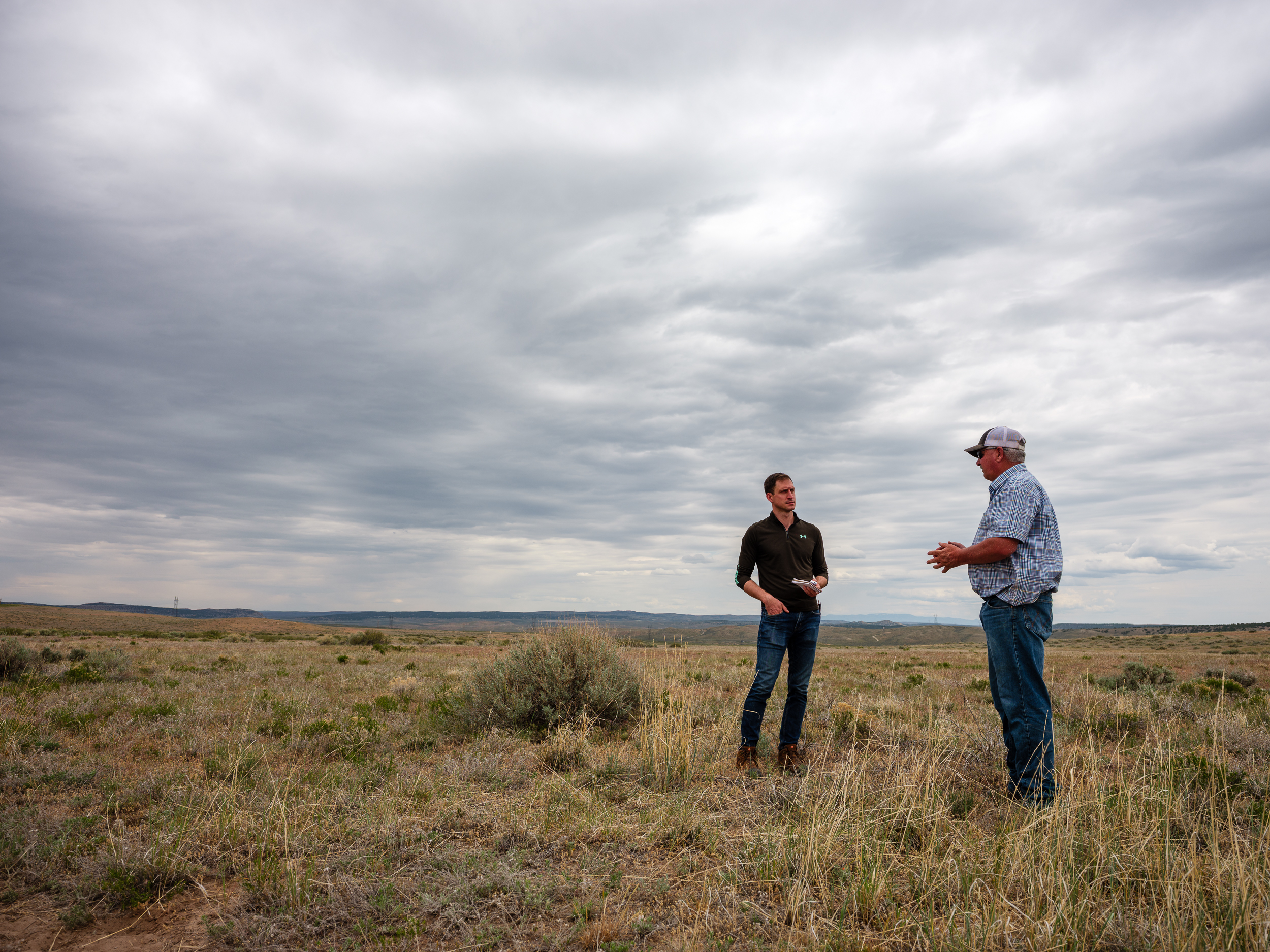
The direct impact of this neglect is palpable on the ground. A recent reconnaissance mission into the Los Padres National Forest, to verify a trail clearly marked on official digital and paper maps, revealed a disheartening reality. What should have been a well-trodden path, used for millennia, had been utterly reclaimed by chaparral and agave. The faint suggestion of a ridgeline, once a clear route, was now a dense, thorny thicket, rendering the trail indistinguishable from the surrounding hillside. This firsthand experience confirms that in the Los Padres, as in many other national forests, the deferred maintenance backlog has transformed into a slow-motion collapse, eroding iconic routes into deep ruts, impassable tangles of vegetation, and dangerous washouts.
The roots of this crisis lie in significant workforce contraction within the Forest Service. Staffing reports from 2019 indicated a 20% reduction in the agency’s overall workforce over the preceding three decades, with further cuts during subsequent administrations. Recreational trail staff, once a robust presence in the 1980s, have dwindled to critically low levels, with many districts reporting zero or just one permanent recreation staff member and fewer than three seasonal workers to oversee hundreds of miles of trails. A July 2025 internal report further revealed that each of the agency’s nine regions was missing up to 80% of its trail and recreation personnel. The profound human cost of this decline was captured in anonymous ranger quotes from the December report: "My trail program is suffering the worst morale setbacks of all my district programs," stated one acting district ranger, while a forest recreation manager lamented, "We lost 200 years of trail experience this year."

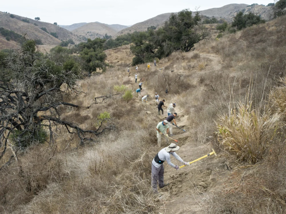
In the face of this systemic neglect, American citizens have stepped forward. In fiscal year 2023 alone, 71,660 volunteers dedicated 2.6 million hours of service to the Forest Service, more than double the hours logged by agency employees. This immense contribution, while invaluable, underscores the public’s deep connection to and reliance on these lands, yet it remains insufficient to overcome decades of compounded mismanagement and resource depletion. Even at the highest echelons of government, the issue is acknowledged. During his Senate confirmation hearing, Secretary of the Interior Doug Burgum emphasized the critical importance of addressing the maintenance backlog, warning, "We are creating liabilities for future generations if we are not taking care of that deferred maintenance."
The integrity of public land management relies fundamentally on accurate mapping—documents that serve as a social contract, guiding access, informing wildfire response, and shaping billions in recreation spending. For decades, federal land managers have grappled with a fragmented archive of legal access records, often handwritten easements, decades-old agreements, and conflicting maps. Recognizing this challenge, Congress passed the bipartisan MAPLand Act (Modernizing Access to Our Public Land) in 2022. This legislation mandated that the Forest Service, Bureau of Land Management, National Park Service, and Fish and Wildlife Service digitize and publicly release all recorded access easements, trails, roads, and boundaries by 2027. The ambition is to consolidate a century of scattered records into a single, authoritative digital basemap.

However, the implementation of MAPLand faces significant hurdles. While the National Map currently lists approximately 300,000 miles of official trails, volunteer-driven datasets like OpenStreetMap, which power popular private navigation apps, add hundreds of thousands more, including both sanctioned and informal routes derived from user GPS data. Inaccuracies in federal datasets propagate into these widely used apps, but the reverse is also true: the proliferation of unsanctioned, user-generated trails places additional strain on already overstretched agency resources and complicates maintenance priorities. A September update on MAPLand implementation, presented by American Trails, indicated progress in compiling existing digital layers but highlighted vast swathes of paper maps and legacy agreements that remain undigitized. Crucially, the Forest Service has not met its goal of verifying 1% of its trails in the field annually since 2012, demonstrating a persistent gap between digital ambition and on-the-ground reality. Despite limited funding being channeled towards digitization efforts, the core problem remains: a severe shortage of "boots on the ground" to conduct the necessary field research and verification. The risk is that the resulting "authoritative" basemap, while polished, may inadvertently obscure the very gaps and inaccuracies the MAPLand Act sought to rectify, creating a false sense of comprehensive access.
The consequences of this underfunding and climate change converge dramatically across different ecosystems. In Oregon’s Oakridge-to-Ashland corridor, for instance, severe drought combined with climate change-induced earlier autumn freezes have led to widespread beetle kill, leaving vast slopes of standing dead trees. When winter windstorms sweep through, these weakened trees fall en masse, burying trails under impenetrable tangles of blowdown, rendering once-beloved routes impassable for months, sometimes years. The sheer scale of this disturbance overwhelms even full trail crews, leaving forests increasingly susceptible to catastrophic wildfires.

Indeed, wildfire poses perhaps the greatest existential threat to the trails of the American West. A 2023 report by the Outdoor Alliance, "Wildfire and Outdoor Recreation in the West," estimated that over 5,000 miles of trail are impacted by wildfire annually. Colorado’s 2020 fire season, the worst on record, incinerated more than 665,000 acres and over 200 miles of trail. With extreme fires now six times more common than in the 1990s, many trails simply vanish beneath deadfall and unstable, post-burn slopes. Subsequent destruction from landslides and erosion further complicates recovery. While millions of dollars flow through federal programs like Burned Area Emergency Response (BAER) to protect roads and utilities, trail reconstruction often remains a low priority, effectively erasing these routes from the public domain. Colorado’s 2020 Cameron Peak Fire, one of nine significant blazes in the Roosevelt National Forest in the last decade, exemplifies this, burning hundreds of miles of trail in a heavily used recreation district. Volunteer efforts to restore these paths are Sisyphean, undertaken with the grim acknowledgment that another fire is almost inevitable.
As Jamie Ervin, Senior Policy Manager at the Outdoor Alliance, observes, "Agencies’ ability to respond to increasingly worsening climate disasters is hamstrung." This is powerfully illustrated in North Carolina, where Hurricane Helene triggered torrential rain and landslides in the Pisgah and Nantahala National Forests. Entire trail segments were buried under tons of mud, fractured bedrock, and toppled timber. With community infrastructure also devastated, emergency funds and staff were diverted to essential travel corridors and utilities, relegating trail repair to the lowest priority. Many trails remain closed, not only due to the complexity of the work but also the sheer absence of dedicated crews to reopen them, showcasing how quickly a maintenance backlog can escalate into a complete loss of access. Climate events, in essence, do more than reshape the landscape; they divert critical attention and resources away from long-neglected public land infrastructure.

While it is tempting to lay blame solely on government agencies for the scale of these losses, the users of public lands also bear responsibility. The prevailing outdoor recreation culture, often fostered by an industry that profits from access, has too frequently encouraged a mindset of beneficiaries rather than stewards. Americans spend an estimated $1 trillion annually on outdoor recreation, yet the specific federal accounts dedicated to funding its physical foundation—roads, conserved landscapes, and trails—are shockingly limited, often smaller than the annual operating budgets of some state park systems. This disconnect represents a profound market failure.
The optimal solution requires federal agencies and the public to work in concert, maintaining trails as living infrastructure, supported by accurate, up-to-date mapping and robust Congressional funding. Outdoor recreationists could play a more proactive role, perhaps through a dedicated funding stream such as an excise tax on gear, mirroring the successful conservation funding models established by hunters and anglers for decades. Maps are more than navigational tools; they embody a social contract—a promise that what is depicted can be found, used, and defended. Each trail represents not just a recreational opportunity but a vital connection to the landscape and the nation’s rich history. As the terrain transforms faster than maps or management budgets can keep pace, this critical contract frays, leading to a loss of public connection and advocacy. We have inherited an expansive network of roads, trails, and easements woven through nearly every U.S. ecosystem. The profound challenge ahead lies in making informed, moral decisions about which of these lines to preserve, which to allow to recede into the wild, and which to actively fight to redraw for future generations. Every map revision, in this context, is a moral imperative.