
Etched into the rugged sandstone of California’s Los Padres National Forest, winding through chaparral, and clinging to ancient coastal ridgelines, the intricate network of trails embodies both a rich heritage and a growing vulnerability. Many of these pathways were not initially designed for modern recreational use, but rather for historical purposes long past: cattle drives, mining prospecting routes, or the vital fire patrols of the early U.S. Forest Service. Others trace the ancient footsteps of Indigenous peoples, like the Chumash, whose presence predates the very concept of North American colonization. Sections of these trails often traverse precariously steep slopes, their foundations barely resisting gravity, continuously shedding soil and stone with each passing winter storm. Close inspection still reveals the faint outlines of old bench cuts and meticulously hand-built retaining walls, now partially buried or reclaimed by dense manzanita thickets.
This inherent fragility has been dramatically accelerated by the relentless pressures of a rapidly changing climate. As severe droughts intensify across the Western United States and atmospheric rivers unleash increasingly powerful, destructive floods, the physical integrity of these trails is compromised at an alarming rate. Routes proudly listed as "open" on official maps frequently vanish down mountainsides. Entire drainages, once stable, are obliterated by a single extreme weather event. What remains is a system largely shaped by the relentless forces of erosion and abandonment, rather than by the diligent stewardship of the federal agencies constitutionally mandated to sustain it.

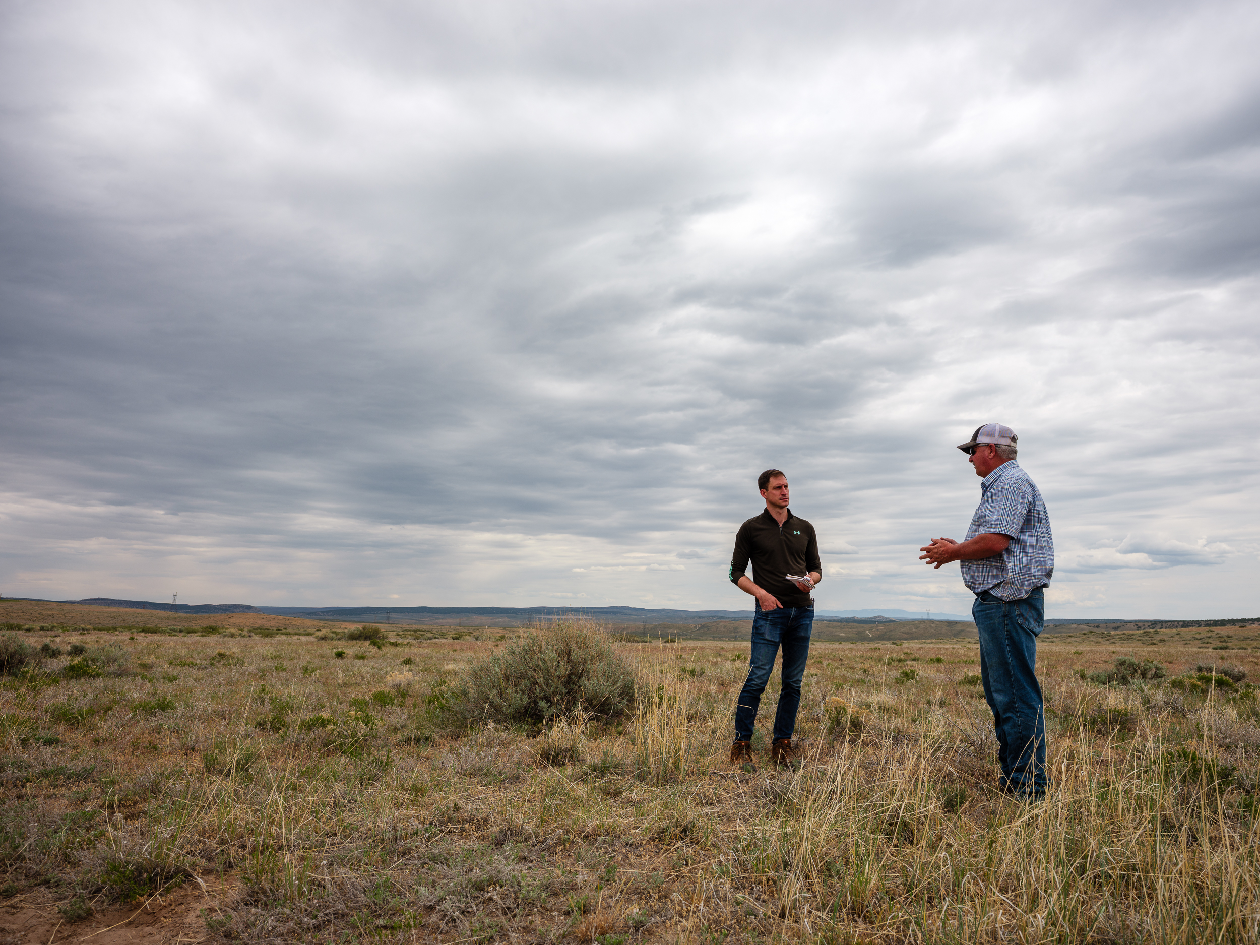
For those dedicated to their preservation, the challenge is deeply personal and acutely observed. Experts who have spent years restoring hundreds of miles of Forest Service trails, from the majestic Sierra Nevada to the verdant eastern seaboard, often rely on outdated agency maps to locate paths that have been physically and digitally erased from the landscape. The absence of a single trail line in a federal dataset can drastically alter budget requests, potentially reducing appropriations by hundreds of thousands of dollars, as funding allocations are directly tied to the total mileage recorded in an agency’s database. Conversely, an "open" trail symbol on the National Map – the comprehensive geospatial database maintained by the U.S. Geological Survey’s National Geospatial Program – can misleadingly mask years of severe storm damage. Corridors painstakingly cleared by dedicated crews can disappear entirely within a single season without consistent, ongoing maintenance.
The sheer scale of the Forest Service’s responsibility is staggering: it manages over 370,000 miles of roads, enough to circle the Earth nearly fifteen times, and approximately 160,000 miles of trails, representing a vast 85% of all trails on federal lands. Yet, a sobering 2013 Government Accountability Office report revealed that only about 25% of these trails met the agency’s own standards for maintenance, public safety, and environmental protection. Alarmingly, only 37% of the entire national trail network receives any form of maintenance each year, consigning a significant portion to fade from both the physical landscape and public consciousness.
The gravity of this situation was underscored in December 2025, when a stark internal report from the Forest Service, titled the "Trail Program Status Report," came to light. This document painted a grim picture, detailing a reported loss of up to 100% of trails staff in some districts, the forfeiture of hundreds of years of invaluable trail expertise, and widespread reports of "burnout and declining morale" among remaining personnel. The report indicated that trail miles maintained were 22% lower than the historical average, and the number of miles meeting maintenance standards had plummeted by 19%, marking the lowest level recorded in 15 years.

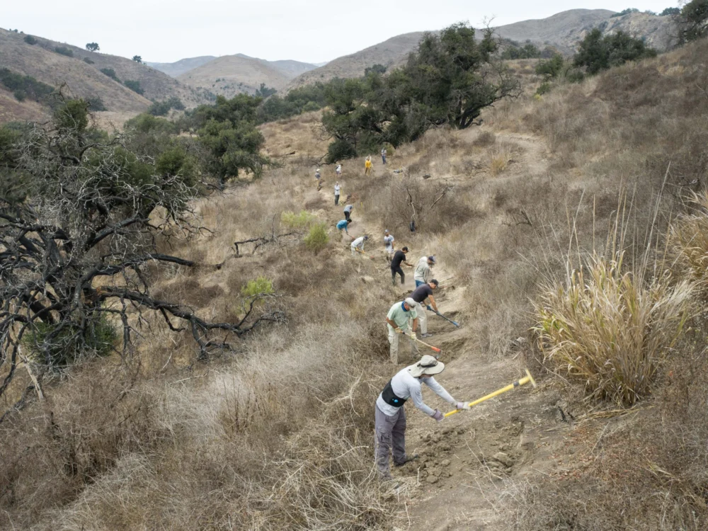
This pervasive decay is a direct consequence of decades of chronic underfunding. A 2022 Congressional report estimated a colossal $460 million backlog in trail maintenance alone, forming part of an even larger, daunting $10.8 billion infrastructure deficit facing the agency. Natural disasters, including devastating wildfires, catastrophic floods, and widespread beetle infestations, now obliterate critical infrastructure at a pace far exceeding any capacity of staff, where they even exist, to rebuild. Across the vast landscapes of the American West, a patchwork of dedicated volunteers and small nonprofit organizations has increasingly become the de facto caretakers of these essential national systems.
The challenges confronting these trails are multifaceted, with each region telling a distinct yet interconnected story. From California’s chaparral-covered hillsides to Oregon’s beetle-killed forests and Colorado’s wildfire-scarred mountains, the narrative is consistent: climate change, natural disasters, and a chronic lack of resources are causing public land trails to vanish faster than authorities can hope to maintain them.
A tangible example of this decline can be found just 30 minutes north of Santa Barbara, in the Los Padres National Forest. During a late summer expedition, a trail that appeared clearly on the National Map and on commercially available paper maps proved to be utterly impassable on the ground. What was once a well-trodden route, pressed by countless foot and hoofprints over millennia, was now thoroughly consumed by dense chaparral and agave. The soft dust yielded beneath boots as a faint suggestion of a ridgeline was pursued between encroaching manzanita, until the brush formed an impenetrable wall of branches. Crawling beneath agave fronds and pushing through thorny chamise, the expected trail bed, according to every official source, was simply nonexistent. It had become so neglected that it was indistinguishable from the surrounding hillside. Here, in the Los Padres, the Forest Service’s maintenance backlog is starkly evident, with storms, wildfires, and heavy use transforming once-iconic routes into deep, eroded ruts, overgrown thickets, and complete washouts. Volunteer crews now shoulder the majority of maintenance for the few accessible miles, leaving countless others to vanish, their histories slowly erased.

The systemic deferred maintenance is rooted in a significant contraction of the Forest Service’s workforce. According to staffing reports from 2019, the agency has lost approximately 20% of its staff over the last three decades, with an additional 10% reduction in full-time personnel under the Trump administration due to departmental layoffs. While recent Congressional appropriations bills have mitigated some of the more drastic budget cuts proposed, the long-term trend of understaffing persists. Recreational trail staff, once a robust presence in the 1980s, has dramatically dwindled. Many districts now report having zero or just one permanent recreation staff member, supported by fewer than three seasonal staff, to oversee hundreds of miles of trails. An internal Forest Service report from July 2025, shared by a confidential source, concluded that each of the agency’s nine regions faced deficits of up to 80% in their trail and recreation workforce.
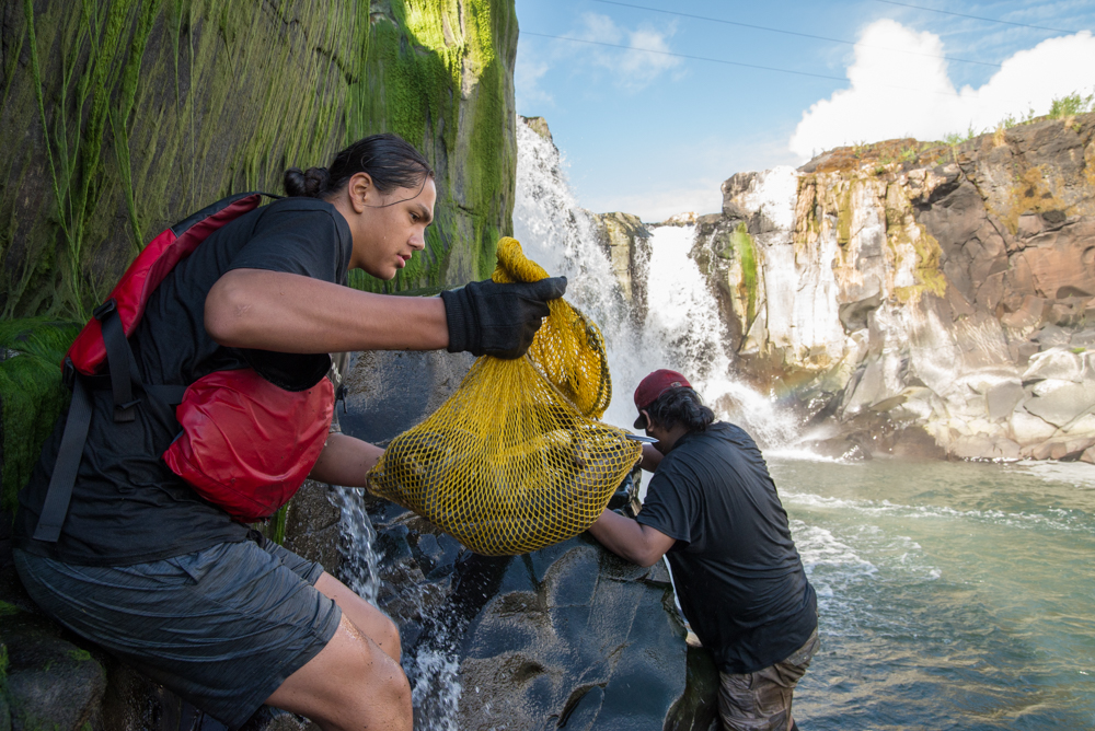
The follow-up Forest Service report in December echoed the sentiments of disillusioned rangers. One acting district ranger lamented, "My trail program is suffering the worst morale setbacks of all my district programs." A forest recreation manager starkly stated, "We lost 200 years of trail experience this year." Another district trail manager, contemplating the end of a multi-decade career, expressed, "It feels like 24 years of trails and wilderness work, rolling back to the bottom of the hill." In the face of this institutional decline, volunteers and local stewardship groups have stepped forward with remarkable dedication, demonstrating the profound value Americans place on access to public lands. In fiscal year 2023 alone, 71,660 volunteers contributed an astonishing 2.6 million hours of service to the Forest Service, more than double the hours logged by agency employees. Yet, even this immense wave of donated labor can only mitigate, not reverse, the relentless deterioration of infrastructure compounded by decades of neglect and mismanagement.
The systemic neglect has not gone unnoticed at the highest levels of government. During his Senate confirmation hearing, now-Secretary of the Interior Doug Burgum acknowledged the critical need to address the maintenance backlog across federal lands. He emphasized, "We just have to make sure not just the national parks, but across the whole department, we have to get the formulas right, because we are creating liabilities for future generations if we are not taking care of that deferred maintenance."

Public trust in maps as reliable guides to our shared inheritance is fundamental. Maps define where we can go, delineate legal access, aid wildfire response, and inform billions in recreation spending. Yet, for decades, even federal land managers have struggled to accurately track public access, often relying on handwritten easements in archaic filing cabinets, decades-old agreements never digitized, and conflicting trail data across different maps. To address this critical deficiency, Congress passed the bipartisan MAPLand Act (Modernizing Access to Our Public Land) in 2022. This legislation mandates the Forest Service, Bureau of Land Management, National Park Service, and Fish and Wildlife Service to locate, digitize, and publicly release all recorded access easements, trails, roads, and boundaries by 2027. The objective is seemingly straightforward: to consolidate a century of disparate records into a single, authoritative digital basemap.
However, the implementation of this mandate has proven far more complex. The National Map currently lists approximately 300,000 miles of official trails across public lands. In contrast, OpenStreetMap – the public, volunteer-driven dataset powering popular navigation apps like Gaia GPS, Strava, Apple Maps, and AllTrails – includes hundreds of thousands more, encompassing both sanctioned routes and informal paths derived from user GPS data. Inaccuracies and omissions in federal datasets directly propagate into these widely used apps, creating confusion and potential safety hazards. Conversely, the proliferation of unsanctioned, user-generated trails feeds back into agency workloads, complicating maintenance priorities and further straining already scarce resources. The latest MAPLand implementation update, presented at a September webinar by the nonprofit American Trails, revealed that while agencies have made progress compiling existing digital layers, vast quantities of paper maps, access agreements, and legacy easements remain undigitized. Troublingly, the Forest Service has not met its annual goal of verifying 1% of its trails in the field since 2012.
Despite proposed budget cuts to the Forest Service, the Interior Secretary has directed limited funds toward access-related projects, including the digitization mandate, partly in response to lobbying efforts from groups like the Outdoor Recreation Roundtable. However, this political momentum has not resolved the fundamental issue: the urgent need for more personnel on the ground. The emerging basemap, while ambitious in scope, remains incomplete and frequently inaccurate. Current funding is only sufficient to compile existing digital layers, not to deploy staff into the field to research historical paper records and trail segments lost to the system decades ago. This has steered the effort toward producing a polished digital product based on readily available data, rather than the more challenging, but essential, outcome of expensive, on-the-ground verification. Ultimately, the public risks receiving a map that appears authoritative but inadvertently obscures the very access gaps the MAPLand Act was designed to rectify.

The consequences of the Forest Service’s underfunding manifest in diverse forms across the nation. In Oregon’s Oakridge-to-Ashland corridor, for instance, a combination of prolonged drought and widespread beetle kill, exacerbated by climate change-induced later autumn freezes, has left entire slopes covered in standing dead trees. When powerful winter windstorms sweep through, hundreds of thousands of these beetle-killed trunks fall like matchsticks. Crews returning each spring discover trails buried beneath impassable tangles of blowdown, rendering once-cherished routes unusable for months, even years. The sheer scale of this disturbance overwhelms even full trail crews, let alone volunteer groups, making it impossible to keep pace. Furthermore, these vast expanses of downed trees significantly increase the forest’s susceptibility to devastating wildfires.
Perhaps no greater threat reshapes the forests of the West than wildfire. A 2023 report by the nonprofit Outdoor Alliance, "Wildfire and Outdoor Recreation in the West," revealed that over 5,000 miles of trails are impacted by wildfires annually. Colorado’s 2020 fire season, the worst on record, incinerated more than 665,000 acres and over 200 miles of trail. With extreme fires now six times more common than in the 1990s, many trails simply vanish beneath layers of deadfall and unstable slopes. A 2023 analysis from the Regional Economic Development Institute indicated that Colorado has averaged approximately 72 wildfires per year in the 2020s—a six-fold increase over the 1990s. Post-fire landscapes unleash a secondary wave of destruction: deadfall collapsing across trails, unstable slopes sloughing off during subsequent storms, and pervasive safety hazards that can close entire trail networks for extended periods. While millions of dollars flow through the federal Burned Area Emergency Response (BAER) program, these funds are primarily directed towards roads, culverts, and utility protections, rarely towards comprehensive trail reconstruction. This leaves countless routes functionally disappeared, their restoration deemed too costly or too low a priority. Colorado’s 2020 Cameron Peak Fire, one of nine significant wildfires in the Roosevelt National Forest over the last decade, burned hundreds of miles of trails in a heavily used recreation district. Volunteers work tirelessly to restore what they can, often under the tacit, disheartening acknowledgement that another fire is all but guaranteed, rendering their efforts Sisyphean.
Federal agencies like the Forest Service are frequently criticized for perceived failures in public land management, sometimes providing a rationale for further budget reductions. As Jamie Ervin, senior policy manager at the Outdoor Alliance, observed, "Agencies’ ability to respond to increasingly worsening climate disasters is hamstrung. Even with good intentions from local staff and volunteers, as well as funding from Congress in the case of disaster relief, a lessened Forest Service staff cannot organize to restore public land infrastructure for years after wildfire or hurricanes." In essence, climate change is outpacing both the physical infrastructure on the ground and the institutional infrastructure designed to protect it. A compelling example unfolded in North Carolina during Hurricane Helene. Torrential rains triggered widespread landslides across the Pisgah and Nantahala National Forests, burying trails under tons of mud, fracturing bedrock, and toppling vast amounts of timber. Entire trail segments vanished overnight. With roads, bridges, and community infrastructure devastated across western North Carolina, emergency funds and agency staff were justifiably diverted to protect essential travel corridors and utilities. Trails on public lands, already grappling with years of deferred maintenance, plummeted to the bottom of the priority list. Many remain closed, not only due to the complex nature of the repair work but critically, because no dedicated crews exist to reopen them, starkly illustrating how quickly a maintenance backlog can escalate into a permanent loss of access. Climate events, therefore, do more than merely reshape the landscape; they fundamentally divert attention and critical resources away from its long-term care.

While it is tempting to attribute the scale of these losses solely to government shortcomings, the public, as users of these lands, must also acknowledge its shared responsibility. Too often, the prevailing outdoor recreation culture—and the burgeoning industry that profits immensely from it—has fostered an ethos of beneficiary rather than steward. Millions enjoy access to public lands while contributing little to the labor or financial investment required to maintain them. Americans spend an estimated $1 trillion annually on outdoor recreation, yet the specific federal accounts dedicated to funding its foundational infrastructure—roads, conserved landscapes, and trails—are so severely limited that their combined totals are often smaller than the annual operating budgets of some individual state park systems.
The ideal resolution would involve a concerted effort between federal agencies and the public, working in harmony to maintain trails as vital, living infrastructure. This effort would be guided by accurate, up-to-date mapping and underpinned by robust Congressional funding. Outdoor recreationists could play a more proactive role, perhaps through the implementation of a dedicated excise tax or other funding stream that directly supports public lands, mirroring the successful models employed by hunters and anglers who have fueled federal conservation efforts through similar taxes and license fees for decades.
Maps are more than mere charts of terrain; they embody a social contract between the public and the agencies tasked with stewardship. They represent a promise that what is depicted can be found, utilized, and defended. Each trail signifies not just an opportunity for recreation, but a profound chance to connect with the landscape and the nation’s intricate history embedded within it. As the physical terrain transforms at a pace faster than maps or management budgets can possibly keep pace, that fundamental contract frays. When landscapes become inaccessible, when their true condition is obscured, or when the public no longer believes they are intact, the ability to advocate for their preservation diminishes. We have inherited an expansive network of roads, trails, and easements carved through nearly every U.S. ecosystem. Some of these pathways may naturally revert to the wilderness; others remain vital lifelines for access, cultural identity, and economic well-being. The challenge ahead lies in making discerning choices: which lines to painstakingly maintain, which to allow to fade, and which to vigorously fight to redraw. Ultimately, every revision to our national map of public lands is a profound moral decision, reflecting our collective commitment to the natural world and future generations.