
Etched into sandstone, nestled between chaparral, and tracing coastal ridgelines, the trails of California’s Los Padres National Forest are inherently delicate, a fragility now amplified by a rapidly changing climate. Many of these paths, once vital for cattle drives, mining exploration, and early U.S. Forest Service fire patrols, now exist as ghosts of their former selves. Others were trodden by the Chumash people for millennia before European colonization, their historical significance often overlooked. These routes cling precariously to steep slopes, shedding soil and stone with each winter storm, their original engineering—evident in half-buried bench cuts and stone retaining walls swallowed by encroaching manzanita—slowly succumbing to the elements.
The compounding pressures of deepening droughts, intensifying floods, and dwindling federal budgets have accelerated this decay. Trails officially marked as open on maps are literally disappearing from mountainsides, while drainages carved into sandstone are obliterated by single atmospheric river events. The result is a trail system shaped more by erosion and abandonment than by the agencies responsible for its upkeep. Over the past decade, in an effort to document and sometimes restore these vanishing routes, hundreds of miles of Forest Service trails have been surveyed, often relying on outdated agency maps to locate paths lost to both the physical landscape and digital databases. The impact of such omissions is significant; a single missing trail line in a dataset can alter federal budget requests by hundreds of thousands of dollars, as appropriations are directly tied to an agency’s recorded trail mileage. Similarly, an "open" trail symbol on the National Map, the comprehensive geospatial database maintained by the U.S. Geological Survey, can mask years of unaddressed storm damage, leaving painstakingly cleared corridors to vanish within a single season without consistent maintenance.

The U.S. Forest Service manages an immense network of over 370,000 miles of roads, enough to circumnavigate the Earth nearly fifteen times, and approximately 160,000 miles of trails, representing 85% of all trails on federal lands. However, a 2013 Government Accountability Office report revealed that only about 25% of these trails met agency standards for maintenance and public safety. Furthermore, a mere 37% of the national trail network receives any form of maintenance annually, leaving vast stretches to fade from both the landscape and public awareness.
A stark internal report from the Forest Service, surfacing in December 2025 and obtained by The Washington Post, underscored the critical state of these trails. This "Trail Program Status Report" detailed a crisis within the agency, with Forest Service districts reporting the loss of up to 100% of their trail staff. This loss represents hundreds of years of accumulated trail expertise, contributing to widespread burnout and declining morale. The report indicated that trail miles maintained had decreased by 22% below the average, and the number of miles meeting maintenance standards had fallen by 19%—the lowest levels recorded in fifteen years.
Decades of chronic underfunding have fueled this deterioration. A 2022 Congressional report estimated a $460 million backlog in trail maintenance alone, a figure that is part of a larger infrastructure deficit totaling $10.8 billion across the agency. Natural disasters such as wildfires, floods, and bark beetle infestations further accelerate the erosion of this infrastructure, often outpacing the capacity of the remaining staff to rebuild. Across the Western United States, volunteers and small non-profit organizations have increasingly become the de facto caretakers of these national systems, filling a void left by insufficient government resources.

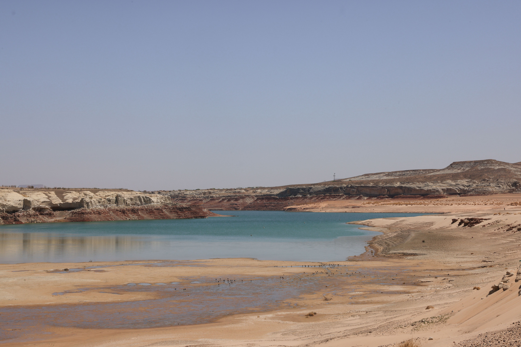
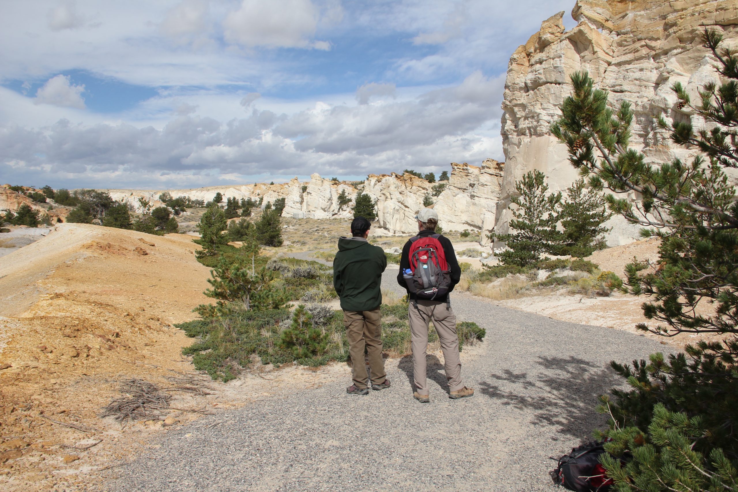
The maps accompanying this narrative aim to illustrate the profound challenges confronting trail systems, demonstrating how climate change, natural disasters, wildfires, and a persistent lack of resources are causing trails to vanish faster than they can be maintained. In late summer, a journey into California’s Los Padres National Forest, just thirty minutes north of Santa Barbara, revealed the tangible reality of this decline. A trail, clearly marked on the National Map and even on a readily available paper map, proved to be a phantom. What was once a route trodden by feet and hooves for centuries was now reclaimed by dense chaparral and agave. Pushing through thorny chamise and crawling under agave fronds, the search for a trail bed—one that official sources insisted should be underfoot—yielded nothing but an indistinguishable hillside.
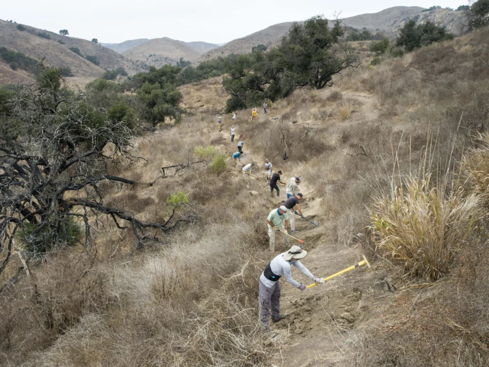
Here in the Los Padres, the Forest Service’s backlog of trail maintenance is starkly evident. Severe storms, wildfires, and heavy recreational use have transformed once-iconic routes into deep ruts, overgrown thickets of chaparral, and impassable washouts. For the hundreds of miles of trails within this national forest, volunteer crews now shoulder much of the burden, leaving countless miles unmaintained and their historical significance fading away.
The root cause of this extensive deferred maintenance is multifaceted, with a significant factor being the substantial contraction of the Forest Service’s workforce over the past three decades. Staffing levels have decreased by roughly 20%, with further reductions under the Trump administration due to layoffs. While recent Congressional appropriations have provided some relief from proposed drastic budget cuts, the long-term trend of declining staff has had a devastating impact. Recreational trail staff, once a robust force in the 1980s, has dwindled dramatically. Many districts now report having only one permanent recreation staff member and fewer than three seasonal staff to manage hundreds of miles of trails. An internal Forest Service report from July 2025 indicated that each of the agency’s nine regions was missing up to 80% of its trail and recreation workers.

This staffing crisis has led to palpable frustration among remaining personnel. Anonymous rangers quoted in the December 2025 report expressed deep concern, with one acting district ranger lamenting, "My trail program is suffering the worst morale setbacks of all my district programs." Another forest recreation manager noted, "We lost 200 years of trail experience this year," while a district trail manager considered leaving a multi-decade career, stating, "It feels like 24 years of trails and wilderness work… rolling back to the bottom of the hill."
In response to this systemic neglect, volunteers and local stewardship groups have stepped forward, demonstrating the profound public value placed on access to public lands. In fiscal year 2023 alone, 71,660 volunteers contributed 2.6 million hours of service to the Forest Service, more than doubling the hours logged by agency employees. However, even this immense outpouring of volunteer labor can only slow, not reverse, the decline of infrastructure that has accumulated over decades of underinvestment and mismanagement.
Acknowledging the severity of this situation, political leaders across the spectrum have voiced their commitment to addressing the maintenance backlog. During his Senate confirmation hearing, Secretary of the Interior Doug Burgum emphasized the critical need to "get the formulas right" for maintaining not only national parks but all federal lands, warning that failing to address deferred maintenance creates "liabilities for future generations."

Our trust in maps to accurately represent reality is fundamental. They delineate the contours of access and ownership, guiding where we can go and what remains of our shared natural heritage. Especially when produced by government agencies, these maps underpin laws that guarantee access, inform wildfire response, and shape billions in recreation spending. Yet, for decades, even federal land managers have struggled to ascertain the true extent of legal access, relying on handwritten easements in filing cabinets, agreements never digitized, and trails appearing on one map but absent from another.
This challenge prompted Congress to pass the MAPLand Act in 2022, a bipartisan initiative aimed at "Modernizing Access to Our Public Land." The act directed the Forest Service, Bureau of Land Management, National Park Service, and Fish and Wildlife Service to locate, digitize, and publicly release all recorded access easements, trails, roads, and boundaries by 2027. The mandate, though seemingly straightforward, aims to consolidate over a century of scattered records into a single, authoritative digital basemap.
However, the reality is considerably more complex. The National Map lists approximately 300,000 miles of official trails on public lands. OpenStreetMap, a publicly maintained, volunteer-driven dataset that underpins most private navigation applications like Gaia GPS, Strava, Apple Maps, and AllTrails, adds hundreds of thousands more miles, capturing both sanctioned routes and informal paths derived from user GPS data. Errors and omissions in federal datasets inevitably find their way into these popular navigation apps, and conversely, the proliferation of unsanctioned, user-generated trails complicates agency maintenance priorities and strains already limited resources. An update on MAPLand implementation presented in September revealed that while agencies have made progress in compiling existing digital layers, vast quantities of paper maps, access agreements, and legacy easements remain undigitized. The Forest Service has not met its goal of verifying 1% of its trails in the field annually since 2012.

Despite these hurdles, the effort has not entirely stalled. Interior Secretary Burgum has directed limited funds toward access-related projects, including the digitization mandate, responding to lobbying efforts from groups like the Outdoor Recreation Roundtable. However, this political momentum has not resolved the fundamental issue: a critical need for more personnel on the ground. The emerging basemap, while ambitious, remains incomplete and frequently inaccurate. Current funding is sufficient only to compile existing digital layers, not to dispatch staff for on-the-ground research of paper records and trail segments lost to the system decades ago. Consequently, the effort has shifted towards producing a polished digital product based on readily available data, rather than the comprehensive result of costly, on-the-ground verification. The risk is that the public may receive a map that appears authoritative but obscures the very gaps the MAPLand Act was intended to address.
The challenges confronting the Forest Service’s trail network manifest in diverse ways across the nation. In Oregon’s Oakridge-to-Ashland corridor, for instance, drought and bark beetle infestations—exacerbated by climate change causing later autumn freezes—have decimated entire slopes of standing dead trees. During winter windstorms, hundreds of thousands of these beetle-killed trunks fall like matchsticks, burying trails under dense blowdown. Crews return each spring to find routes impassable for months, sometimes years, with the sheer scale of the disturbance overwhelming the capacity of full trail crews, let alone volunteer groups. Furthermore, these dead forests are rendered increasingly susceptible to wildfire.
Wildfire poses perhaps the most significant threat to Western forests. A 2023 report by the Outdoor Alliance, "Wildfire and Outdoor Recreation in the West," found that over 5,000 miles of trail are impacted by wildfire annually. Colorado’s 2020 fire season was the most devastating on record, burning over 665,000 acres and impacting more than 200 miles of trail. With extreme fires now six times more common than in the 1990s, many trails simply vanish beneath deadfall and unstable slopes. A 2023 analysis from the Regional Economic Development Institute indicated that Colorado has averaged approximately 72 wildfires per year in the 2020s, a six-fold increase compared to the 1990s. Post-fire landscapes create a secondary wave of destruction: deadfall that collapses across trails, unstable slopes prone to slides during storms, and safety hazards that can keep entire trail networks closed for extended periods. While millions of dollars are allocated to the federal Burned Area Emergency Response program for roads, culverts, and utility protections, trail reconstruction often receives minimal funding, leaving many routes functionally erased. Colorado’s 2020 Cameron Peak Fire, illustrated in accompanying maps, was just one of nine significant wildfires in the Roosevelt National Forest over the past decade, incinerating hundreds of miles of trails in a high-recreation-use district. Volunteers have undertaken restoration efforts, though the work is often Sisyphean, given the high probability of future fires.

Federal agencies like the Forest Service are frequently criticized for perceived failures in public land management, which can then be used to justify further budget cuts. As Jamie Ervin, senior policy manager at the Outdoor Alliance, noted, "Agencies’ ability to respond to increasingly worsening climate disasters is hamstrung. Even with good intentions from local staff and volunteers, as well as funding from Congress in the case of disaster relief, a lessened Forest Service staff cannot organize to restore public land infrastructure for years after wildfire or hurricanes." In essence, climate change is outpacing both the physical infrastructure on the ground and the institutional capacity to maintain it. A compelling example of this dynamic is unfolding in North Carolina. Following Hurricane Helene, torrential rains triggered landslides in the Pisgah and Nantahala national forests, burying trails under tons of mud, fracturing bedrock, and toppling timber. Entire trail segments disappeared overnight. With roads, bridges, and community infrastructure devastated across western North Carolina, emergency funds and agency staff were diverted to critical travel corridors and utilities. Trails on public lands, already burdened by years of deferred maintenance, were relegated to the bottom of the priority list, with many remaining closed not only due to the complexity of the repairs but also the absence of dedicated crews to reopen them. This illustrates how quickly a maintenance backlog can transform into a permanent loss of access. Climate events, therefore, do more than reshape the landscape; they divert attention and resources away from areas already suffering from long-term neglect.
While it is tempting to solely blame government agencies for the scale of these losses, users of public lands must also acknowledge their own responsibilities. The culture of outdoor recreation, and the industry that profits from it, has too often fostered a mindset of entitlement rather than stewardship, encouraging enjoyment of public lands while contributing little to the labor or funding required for their upkeep. Americans spend an estimated $1 trillion annually on outdoor recreation, yet the federal accounts dedicated to funding its physical infrastructure—roads, conserved landscapes, and trails—are so limited that their total funding is often less than the annual operating budgets of some state park systems.
The ideal scenario involves federal agencies and the public collaborating to maintain trails as vital infrastructure, guided by accurate, up-to-date mapping and supported by robust Congressional funding. Outdoor recreationists could also play a more proactive role, perhaps through an excise tax or a similar dedicated funding stream that directly supports public lands maintenance. This model is already in place for hunters and anglers, who have historically funded federal conservation efforts through excise taxes and license fees.

Maps serve a purpose beyond charting terrain; they embody a social contract between the public and the agencies tasked with stewardship—a promise that what is depicted is accessible, usable, and protected. Each trail represents more than an opportunity for recreation; it is a conduit to connecting with the landscape and the historical narratives embedded within it. As the physical terrain changes at a pace that outstrips the ability of maps and management budgets to keep up, this contract frays. Without access, experience, or belief in the integrity of these places, public engagement and advocacy wane.
We have inherited an extensive network of roads, trails, and easements woven through nearly every U.S. ecosystem. Some of these routes may naturally recede back into the wilderness, while others serve as essential lifelines for access and identity. The critical challenge lies in discerning which lines to maintain, which to allow to fade, and which to actively fight to preserve or redraw. Every revision to a map is, in essence, a moral decision about our commitment to our shared natural heritage.