Rocky Gerung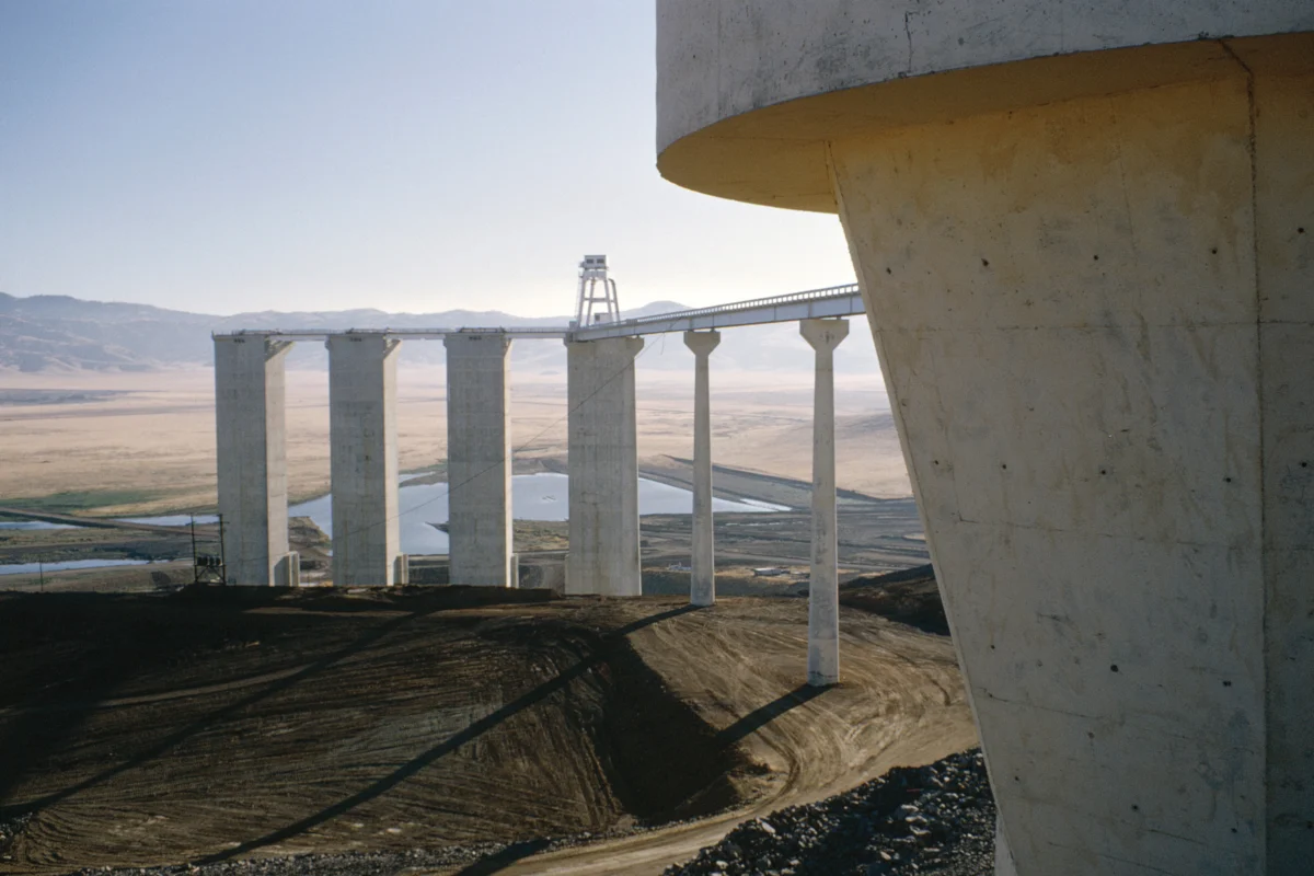
The California State Water Project, initiated in 1961, stands as one of the most ambitious water infrastructure undertakings in American history, a testament to 20th-century engineering prowess and a symbol of the Golden State’s determination to overcome its arid climate. This sprawling network, spanning over 700 miles from the Feather River watershed in the state’s northeast to Lake Perris in the south, commenced its first water deliveries to Southern California in 1972, fundamentally reshaping the distribution of vital water resources. The construction process, meticulously documented by both public entities and state agencies, has yielded a vast photographic archive, particularly from California’s Department of Water Resources (DWR). These images capture a majestic vision of California’s belief in its capacity to engineer solutions for the West’s persistent water challenges, showcasing a utopian optimism that characterized the post-World War II era.

Photographs from the project’s formative years, roughly between 1962 and 1968, reveal a pervasive confidence that monumental infrastructure could fundamentally re-engineer landscapes and overcome natural limitations. This sentiment aligned with a broader national belief in technological dominance and the power of large-scale projects to solve complex problems. The construction of facilities like the B.F. Sisk Dam and San Luis Reservoir, a joint venture between the federal Bureau of Reclamation and the California Department of Water Resources, exemplified this ethos. These joint-use facilities, located in Merced County, California, were a critical component of the San Luis Complex, designed to manage and distribute water across vast distances. The Dos Amigos Pumping Plant, also a crucial State Water Project facility completed in 1966, played a vital role in lifting waters over 100 feet from the aqueduct, enabling its southern journey. The intricate rebar assembly for its discharge lines underscores the immense labor and technical precision involved.

Beyond their technical achievements, these images convey a profound political and aesthetic message. As anthropologist Brian Larkin notes, the "aesthetic dimension of infrastructure" often takes precedence over its technical function, serving to "rearrange the hierarchy of its functions." This visual grandeur was intentionally cultivated to celebrate the state’s capacity to solve its water problems and to reinforce a public narrative of progress and self-sufficiency. The Oroville Dam Diversion Tunnels, for instance, were a marvel of engineering during the dam’s construction phase in Butte County. Initially built to divert the Feather River, these 35-foot diameter tunnels were later repurposed to discharge water from the underground Edward Hyatt Powerplant, demonstrating a long-term vision for the infrastructure’s utility. The dedication of Oroville Dam itself, a 1967 landmark and then the tallest earth-filled dam in the United States, drew an estimated 3,500 attendees, including Governor Ronald Reagan, underscoring the public and political significance attached to these grand public works.

The Sacramento-San Joaquin Delta, a critical nexus where the state’s major rivers converge before flowing into the Pacific Ocean, serves as the heart of California’s intricate water management system. Here, water is channeled into two colossal networks: the federal Central Valley Project (CVP) and the southern reach of the State Water Project (SWP). The delta, a complex mosaic of over a thousand miles of levees, approximately 50 reclaimed islands, and hundreds of miles of waterways, has been the focal point of water politics for decades. The construction of the California Aqueduct, a key artery of the SWP, transformed this landscape into what former DWR information officer Erwin Cooper termed an "Aqueduct Empire." The construction of the Delta Pumping Plant, the first major facility of the SWP, photographed on July 2, 1965, marked a significant step in this grand endeavor. Similarly, the Whiskeytown Dam and its unique "Glory Hole" overflow drain, completed by the U.S. Bureau of Reclamation in 1963, further illustrate the scale and ambition of water management projects undertaken during this era.

This period of ambitious construction coincided with the nascent stages of the modern environmental movement. Rachel Carson’s seminal work, Silent Spring, published in 1962, marked a turning point in public awareness regarding the environmental consequences of human intervention. The State Water Project, conceived and built during this transition, embodied a mid-century optimism that often prioritized human control over nature. Today, over six decades later, that optimism has been tempered by the stark realities of environmental challenges. Climate change, prolonged droughts, and the over-allocation of water resources have inflicted significant damage on the Western landscape, prompting a re-evaluation of the long-term sustainability of such massive infrastructure.

The aging water infrastructure, once symbols of progress, now often require substantial repairs and pose potential risks. The 2017 near-failure of the Oroville Dam’s spillways, which necessitated the emergency evacuation of nearly 200,000 people, served as a dramatic reminder of these vulnerabilities. The continuous need for maintenance and upgrades highlights the ongoing financial and technical challenges associated with managing these vast systems. The DWR Photography Unit, still active today, plays a crucial role not only in documenting current water management activities but also in preserving the historical record of these monumental projects. Archivist Bill Kelley III estimates that hundreds of thousands of negatives and slides await digitization, a testament to the sheer volume of photographic material generated over seven decades. This extensive archive serves a dual purpose: it functions as a visual history of state water management and as a tool to support the DWR’s ongoing operational and expansion efforts.

California’s population has surged from 16 million at the time the SWP was approved in 1960 to nearly 40 million today, exacerbating the perennial challenge of balancing human demand with available water resources. This imbalance is particularly acute given that the majority of the state’s population resides south of Sacramento, while a significant portion of its precipitation falls in the northern regions. The historical narrative of California’s development, from the Gold Rush to the present era of climate change, is inextricably linked to its ongoing struggle with water scarcity. The photographs of the State Water Project, while celebrating past achievements, also serve as a poignant reflection of California’s persistent pursuit of a utopian ideal—a future where water flows abundantly, sustaining its burgeoning farms, cities, and industries, perpetually defying the region’s inherent aridity. However, the fundamental reality of the West’s dry climate, a geographical truth that has long defined the region, poses an enduring challenge to this vision, irrespective of the scale of engineered solutions. The ongoing debate surrounding water infrastructure, exemplified by recent dam removals and the push for more sustainable practices, signals a potential shift in public perception, perhaps favoring the strategic elimination of outdated or ecologically damaging structures over the celebration of new constructions.