Rocky Georgio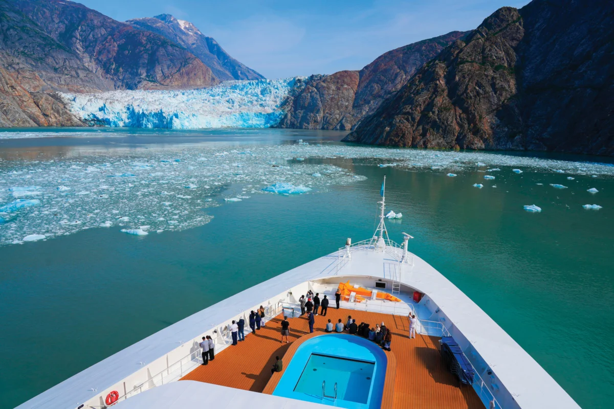
Sasha Calvey awoke to the sound of an approaching tsunami on August 10, 2025, while camping with two friends on a remote island in Southeast Alaska, 74 days into a sea kayaking expedition from Washington. The overnight rain and wind had given way to an alarming, deep roar that grew louder and closer, resonating like a powerful waterfall and vibrating the very ground beneath them. "Everything in my gut told me to check outside," Calvey recounted. Scrambling from their tent, they discovered 15-foot waves had surged into the forest, leaving seaweed strewn beside their campsite and their carefully stowed gear scattered. Half of their provisions were gone, one kayak was lodged in a tree, another hung precariously from a bluff, and the third was adrift in the distance. They considered themselves fortunate; had the tsunami struck just three hours earlier, with the tide 10 feet higher, the inundation could have swept them away while they were still inside their tent. The "chaotic" water, marked by powerful swells and giant whirlpools, persisted for hours, ultimately leading them to radio for rescue and end their expedition.
Investigations revealed the immense wave was generated by a massive landslide approximately 30 miles away, at the terminus of Tracy Arm fjord, a narrow waterway carving through mountains south of Juneau. This dramatic event occurred as the South Sawyer Glacier, like many others globally, recedes, a phenomenon scientists believe can destabilize surrounding slopes and contribute to such catastrophic slides. The landslide created a scar on the mountainside, and the resulting tsunami exhibited an astonishing run-up of 1,580 feet on nearby slopes, stripping away vegetation and soil. This measured surge is the second-largest ever recorded, underscoring the immense power unleashed. As the tsunami propagated outward from the slide, it scoured steep shorelines throughout the fjord, with its residual energy reaching Calvey’s beach outside the fjord’s mouth.
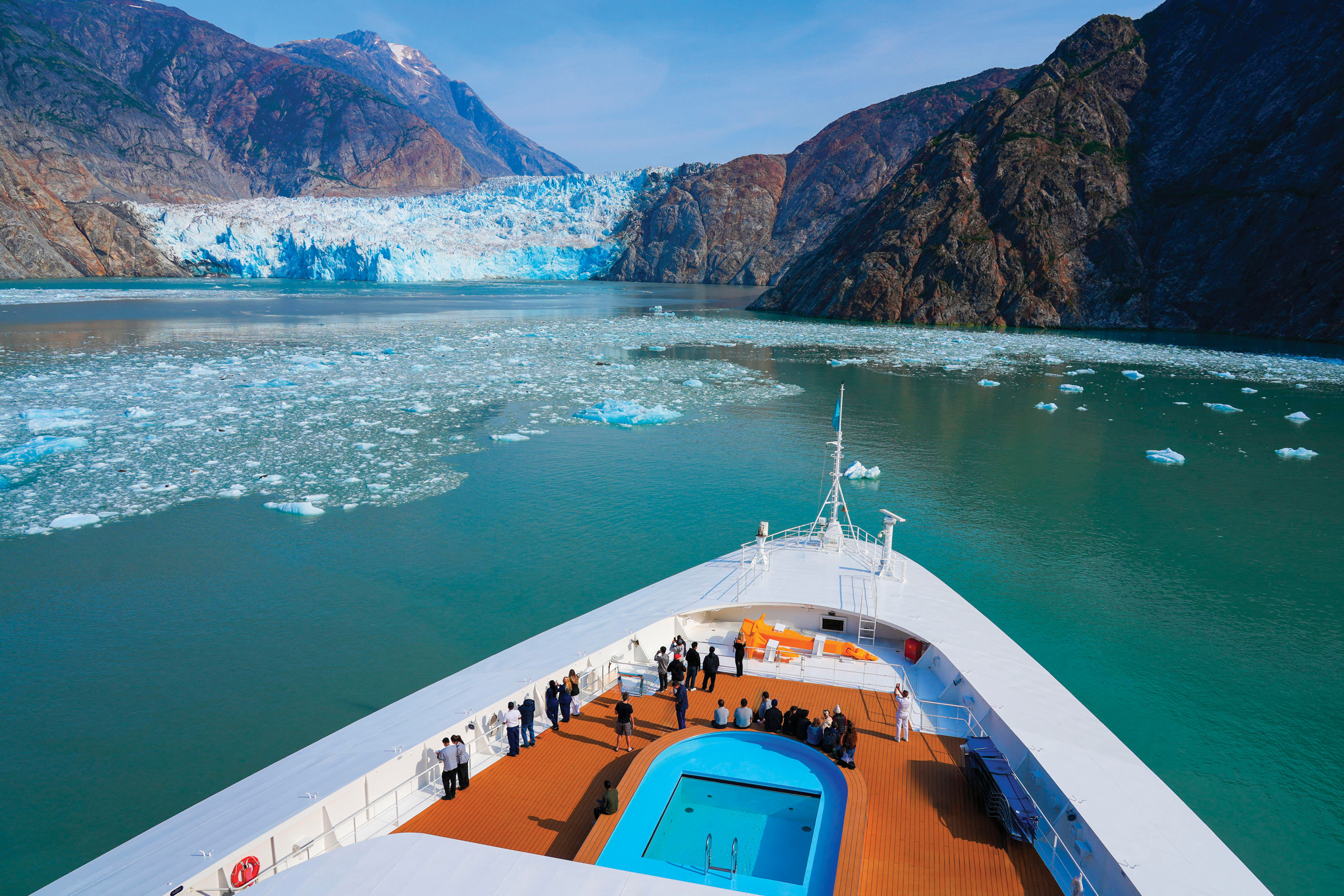
This incident is not an isolated event; evidence points to a concerning increase in landslide-generated tsunamis in Alaska over the past decade. In 2015, a landslide in Taan Fjord, located 400 miles northwest of Tracy Arm, produced a wave with a 630-foot run-up. Furthermore, a slow-moving landslide near the Barry Glacier in Prince William Sound poses a persistent threat, with the potential to generate a tsunami even larger than the one witnessed in Tracy Arm. Scientists, land managers, and tour operators are urgently seeking to understand and mitigate this escalating hazard, particularly as glacial retreat continues worldwide. This climate-driven phenomenon poses a significant risk to coastal communities, vital infrastructure, and the numerous vessels operating in Alaskan waters, including the large cruise ships that transport nearly two million visitors annually to the region.
While researching her kayaking trip, Calvey had encountered warnings about tsunamis in Alaskan fjords, typically linked to seismic activity, such as the 1958 earthquake that triggered a landslide and a staggering 1,720-foot run-up in Lituya Bay, Glacier Bay National Park. However, the possibility of colossal, tsunami-inducing landslides caused by retreating glaciers was not widely publicized. Her experience now serves as a potent reminder and a call for greater attention to this emerging threat.
The sheer scale of the Tracy Arm event, and the fortunate timing for Calvey and her friends, highlights the narrow margin of safety in such popular and dynamic environments. Tracy Arm fjord is a major destination, visited each summer by over 200 cruise ships carrying passengers eager to witness the grandeur of the Sawyer and South Sawyer glaciers. The Tongass National Forest’s fjord attracts an estimated 500,000 boat-based visitors annually. While dozens of vessels were present in the area in the days leading up to the landslide, the early morning hours of August 10th meant that the immediate impact zone was relatively unpopulated. The closest known vessel, the over-100-passenger National Geographic Venture, was in the fjord but approximately 20 miles from South Sawyer when the mountain collapsed. Cruising in deep water, it remained unharmed by the initial tsunami. However, had the landslide occurred just a few hours later, the Venture would have been closer to the glacier, where passengers often disembark onto skiffs to get a closer view. In that scenario, the potential for 100-foot-high waves, laden with icebergs and debris, could have been catastrophic for the tour boat and its occupants.

Similarly, Christine and Jeffrey Smith, owners of the 65-foot tour boat David B, narrowly avoided disaster. They had planned to anchor five miles from South Sawyer the previous evening with six guests. The tsunami would have struck them minutes after the slide. However, due to inclement weather, they rerouted to the neighboring Endicott Arm, anchoring 45 miles away. Despite the distance, the tsunami’s reach was still felt; Christine Smith recalled observing 10-foot swells suddenly engulfing a shoal and an 80-foot vessel struggling against an unusually strong current while she was preparing breakfast. The Smiths’ immediate action was to send a satellite text to their geologist friend, Jackie Caplan-Auerbach, in Washington, asking her to check seismic stations for signs of a landslide. This communication marked the first report of the Tracy Arm tsunami to the outside world.
Caplan-Auerbach, a seismologist and professor at Western Washington University, was alerted to the situation via the Smiths’ text message. She immediately began analyzing seismic data from stations near the David B‘s location. While much seismic data is publicly accessible, the sparse network of seismometers in the vast and remote Southeast Alaska region poses a challenge for comprehensive monitoring. A sensor in Angoon, a Tlingit village about 60 miles west of the Smiths’ location, registered a clear seismic signature indicative of a nearby landslide. Collaborating with colleagues, Caplan-Auerbach and her team quickly pinpointed the landslide’s origin in Tracy Arm. "This is a big deal," she recalled thinking, recognizing the immense volume of water displaced to generate a tsunami that traveled so far.
Intriguingly, Caplan-Auerbach also observed subtle seismic signals emanating from the slope for several hours preceding the main landslide event. These "precursory" signals, though tiny and likely unnoticed without the subsequent major slide, were later identified on other seismometers as well, ceasing abruptly once the mountainside gave way. Caplan-Auerbach has dedicated nearly two decades to studying such signals, exploring their potential for integration into future landslide warning systems. However, she cautioned that such systems are still a distant prospect, acknowledging the inherent difficulty in predicting landslides due to complex factors like rock type, precipitation, and other variables. Furthermore, she noted that precursory signals do not precede every landslide event.

The sheer magnitude of the Tracy Arm landslide is further illustrated by satellite imagery showing the dramatic transformation of the landscape. Before the event, the South Sawyer Glacier met the sea, while the mountainside above appeared stable. After the landslide, a colossal scar marked the slope, and the surrounding shores bore the unmistakable evidence of the tsunami’s destructive passage, with vegetation stripped away to reveal bedrock.
The implications of these events extend far beyond immediate safety concerns. Bretwood "Hig" Higman, an independent geologist with Ground Truth Alaska, is actively researching similar potential hazards. During a visit to Portage Lake, an hour southeast of Anchorage and 500 miles from Tracy Arm, Higman was examining sensors on a slow-moving landslide above Portage Glacier. The area, shrouded in dense fog, was a stark reminder of the inherent instability of steep, mountainous terrain, especially in a region experiencing rapid glacial retreat. In 2020, Higman and other scientists had issued an open letter to The New York Times warning of a potentially catastrophic landslide near Barry Glacier in Prince William Sound. This public warning, while raising awareness, also caused concern among local communities who felt the information should have come through official channels before the peak tourism season.
The Barry Arm landslide is particularly concerning due to its size and proximity to infrastructure. In the summer months, rocks and dust are visible as they cascade down the unstable slope into the ocean, while the Barry Glacier actively sheds ice. Climate modeling suggests that a complete collapse of the slope could trigger a massive tsunami, endangering boats, cabins, campsites, and the people within them across a wide area. Even a diminished wave could impact the nearby city of Whittier, situated 30 miles away, threatening low-lying coastal areas.

In response to the initial warnings, state and federal agencies invested millions of dollars to deploy a sophisticated array of monitoring instruments in Barry Arm fjord. This includes weather stations, seismometers, live-feed cameras, radio repeaters, and ground-based radar, all providing real-time data on the slope’s stability. An experimental tsunami warning system has also been established to alert Whittier officials and boaters via VHF radio. Crucially, research conducted using the Barry Arm instruments has enhanced scientists’ ability to detect and pinpoint distant landslides, including the one in Tracy Arm.
Higman explained that several key factors contribute to the heightened risk of landslides in glacial environments. These include visibly unstable slopes situated above thinning ice, a sufficiently large body of water to generate a tsunami, and the proximity of human populations and infrastructure. Portage Lake exhibits all these characteristics. A Chugach National Forest visitor center, drawing up to 1,000 visitors daily during the summer, is located on its shores. Many visitors board the 140-passenger Ptarmigan tour boat, which navigates the lake. The presence of a nearby road, railroad, campgrounds, and trails further increases the potential vulnerability to a tsunami.
During a hike above Portage Glacier, Higman pointed out fresh cracks in the ground, some so recent that living heather still clung to their edges, roots dangling in the air. These widening fissures, some several feet across, indicated the slope’s ongoing movement. The entire slope was observed to be subsiding by several meters annually, a phenomenon Higman attributes to the thinning glacier’s loss of buttressing support. This "debuttressing," as it’s known, occurs when a glacier, which normally erodes and supports adjacent mountain walls, recedes. The removal of this support can lead to the collapse of steepened slopes. Climate change exacerbates this by thawing permafrost and increasing the frequency of extreme rainfall events, both of which can trigger landslides.

However, the precise mechanisms governing slope failure remain an area of active research. Landslides do not always occur immediately after glacial retreat, and sometimes they do not happen at all. While the Barry Glacier has receded from its unstable slope, the slope has not yet collapsed. Higman expressed frustration at the limited understanding of these complex systems, noting that "It’s frustrating that we don’t know more about how these systems work."
As they traversed the unstable terrain, Higman retrieved an extensometer, a small instrument drilled into the rock to measure its movement. He explained its function as an "electronic tape measure," designed to capture data that could eventually be accessed online, potentially by visitor center staff or the public, especially during periods of heavy rain or rapid glacial retreat. The ideal scenario, Higman noted, would involve a comprehensive network of precise instruments, similar to those at Barry Arm, linked to satellites and a central monitoring hub capable of issuing public alerts in the event of accelerated movement or the detection of critical precursory signals. While his current, low-cost efforts provide valuable, albeit rudimentary, data, they are the only sensors currently deployed at Portage.
The scientific community is grappling with how to best anticipate these events. A recent paper published in the journal Science by Dan Shugar of the University of Calgary, along with Higman, Caplan-Auerbach, and other researchers, details how the rapid retreat of the South Sawyer Glacier likely destabilized the slope, leading to the Tracy Arm landslide and subsequent tsunami. Despite this new understanding, Dennis Staley, a U.S. Geological Survey scientist leading the Barry Arm monitoring effort, emphasized that multiple factors, including weather and inherent slope weakness, contribute to landslides, making specific trigger identification challenging. Higman acknowledged the complexity, suggesting that while the timing of the glacier’s retreat at Tracy Arm was an "extraordinary coincidence," other causes for the slide could exist, but it raised significant concerns about the vulnerability of locations like Portage.

The impact of these events is reverberating through the tourism industry. In Whittier, a town heavily reliant on boat and kayak tours operating in Prince William Sound, a public meeting was held to update operators on the monitoring efforts at Barry Arm. Attendees, including captains and guides, shared their evolving strategies for navigating the changing landscape. Many had ceased visiting Barry Arm after the initial warnings in 2020, while others had returned after monitoring equipment was installed. However, following the Tracy Arm incident and a smaller landslide and tsunami at the Surprise Glacier in 2024, some operators are once again avoiding the area, reflecting a growing pattern of adaptation to the dynamic conditions near Alaska’s melting glaciers.
Jeff Pedersen, operations manager for Alaska Wildland Adventures, described the situation as an "ongoing assessment." His company experienced minor damage from a landslide near the retreating Pedersen Glacier in Kenai Fjords National Park in 2024, which generated a tsunami that overran boardwalks at their backcountry lodge. The incident prompted a review of safety protocols and a decision to avoid that particular glacier. The Smiths of the David B have also reassessed their anchoring practices and safety procedures, acknowledging that their operations will continue to evolve in response to changing conditions and the need for more research.
Major cruise lines, including Carnival, Holland America, and Royal Caribbean, have also responded by announcing their intention to bypass Tracy Arm in 2026, rerouting over 300 scheduled visits to the neighboring Endicott Arm. While these companies declined interview requests, their decision highlights the growing awareness of the risks.

Melenda Lekanof, secretary and treasurer of the Yakutat Tlingit Tribe Council, voiced concerns about the increasing landslide and glacier melt risks in her region. Yakutat, situated between Southeast Alaska and Prince William Sound, is near the Hubbard Glacier, a potential source of future landslides and destructive waves. The Yakutat Tlingit Tribe is collaborating with scientists, including Higman, on the Áut Geohazards Project, which integrates Indigenous knowledge and Western science to better understand landslide risks. Lekanof noted the need to learn more about their changing landscape, particularly concerning the increasing frequency of landslides and melting glaciers. While cruise ships do not dock in Yakutat, they frequently pass the village en route to Hubbard Glacier, raising concerns about potential accidents and the burden of disaster response on the small community. Lekanof advocates for a comprehensive monitoring array in Disenchantment Bay, similar to the one at Barry Arm, but acknowledges the significant funding challenges, especially given past attempts to cut support for essential services like tsunami warning centers.
Traditional Tlingit teachings about glaciers and tsunamis offer valuable insights gained over millennia, emphasizing respect for the natural environment. Lekanof recounted ancestral guidance to "not be loud," "not damage the landscape," and "be careful where you go." She expressed concern about the disruptive impact of cruise ship horns blaring near glaciers, which she believes is spiritually unsettling for the local wildlife. The need for enhanced monitoring and a coordinated approach to disaster preparedness among all stakeholders is becoming increasingly critical as Alaska’s glaciers continue their rapid retreat, reshaping the landscape and presenting new, formidable challenges.