Rocky Georgio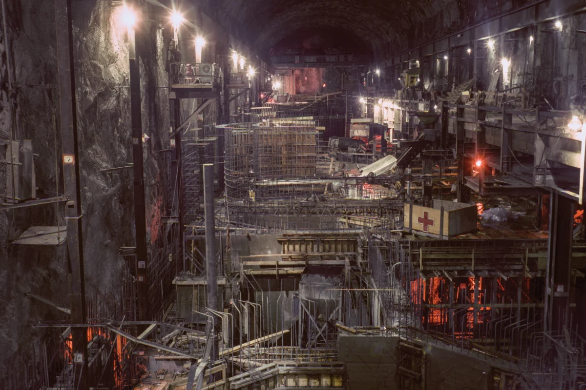
The State Water Project, a monumental undertaking conceived and constructed in the mid-20th century, stands as one of the most significant water infrastructure achievements in United States history. Its genesis in 1961 marked the beginning of an ambitious endeavor to irrigate and supply water to vast, arid regions of California, with the first deliveries reaching Southern California in 1972. This sprawling network, extending over 700 miles from the Feather River watershed in the state’s northeastern mountains to Lake Perris in the south, exemplifies a remarkable fusion of engineering prowess and a mid-century belief in humanity’s capacity to master its environment. The California Department of Water Resources (DWR) has meticulously documented this monumental project through an extensive public photo archive, capturing not only the immense scale of construction but also a prevailing optimism that California could indeed "solve" the persistent challenges of water scarcity in the American West.

These historical photographs, predominantly from the period between 1962 and 1968, reveal more than just the technical execution of an enormous public works project; they articulate a vision of progress and control. They reflect a post-World War II era characterized by a profound faith in large-scale infrastructure to overcome natural limitations. The construction of dams, reservoirs, pumping stations, and the iconic aqueduct itself was seen not merely as a practical solution to water shortages for agriculture and burgeoning urban populations, but also as a potent symbol of state and national power. This infrastructure communicated a narrative of human ingenuity triumphing over environmental constraints, positioning the state as a heroic force capable of delivering prosperity through engineered solutions. As anthropologist Brian Larkin observed, such grand infrastructure projects possess a significant aesthetic dimension that often overshadows their technical functions, serving to "rearrange the hierarchy of its functions so that the aesthetic dimension of infrastructure (rather than its technical one) is dominant." Consequently, the visual representation of these projects becomes a powerful political tool, reinforcing a belief in the state’s ability to provide for its citizens. The widespread public support and celebration of such endeavors in the mid-20th century stand in contrast to contemporary attitudes, where the dismantling of certain water infrastructure, such as the recent removal of the Klamath dams, suggests a growing public willingness to consider deconstruction as a valid environmental strategy.

The intricate web of California’s water system is most prominently represented by the Sacramento-San Joaquin Delta, a vast estuarine region where the state’s two major river systems converge before flowing into the Pacific Ocean via San Francisco Bay. It is here, at this vital confluence, that water is strategically diverted into two colossal engineered arteries: the federal Central Valley Project (CVP) and the southern segment of the State Water Project (SWP). This delta, characterized by over a thousand miles of levees, more than 50 reclaimed islands, and a complex network of waterways spanning an area comparable to Rhode Island, has been the focal point of California’s water politics for decades. The visual narrative of the California Aqueduct, as captured in the DWR’s photographic collection, transforms this intricate landscape into what Erwin Cooper, a former information officer for the DWR, aptly termed an "Aqueduct Empire." The images showcase the dramatic re-engineering of the California terrain, a process that began even as the burgeoning environmental movement, galvanized by Rachel Carson’s "Silent Spring" in 1962, was starting to question the unchecked application of technological solutions to ecological challenges.

The mid-century optimism that fueled the State Water Project has, over sixty years later, encountered the stark realities of the 21st century’s environmental crises. Climate change, characterized by increasingly severe droughts and unpredictable precipitation patterns, coupled with the long-term impacts of extensive water resource development, has inflicted significant and often irreversible damage on the Western landscape. The massive infrastructure that once symbolized progress and aspiration now often appears as a historical artifact, a testament to a different era’s approach to environmental management. Many of these aging water systems, including the Oroville Dam, have faced critical challenges, most notably the near-catastrophic failure of its spillway in 2017, which necessitated the emergency evacuation of nearly 200,000 residents. This incident underscored the ongoing need for substantial investment in maintenance and repair for this vast network, highlighting the inherent vulnerabilities of such large-scale, long-lived infrastructure.

The Edward Hyatt Powerplant, a key component of the State Water Project situated near Oroville Dam, exemplifies the project’s multifaceted design. Completed in 1967, this facility was engineered to maximize power generation through a sophisticated pumped-storage operation. During periods of high electricity demand, water is released from Lake Oroville to generate power. In off-peak hours, excess water, beyond local and downstream needs, is pumped back into Lake Oroville, effectively storing energy and ensuring a consistent power supply. Similarly, the Dos Amigos Pumping Plant, completed in 1966, plays a crucial role in the California Aqueduct’s southern trajectory, lifting water more than 100 feet to continue its journey. The construction of diversion tunnels for Oroville Dam, initially designed to manage Feather River flow during dam construction and later plugged in 1967, demonstrates the adaptable and enduring nature of the project’s components, with these tunnels now serving as conduits for water discharged from the Edward Hyatt Powerplant. The South Bay Aqueduct Surge Tank, painted by a worker in 1965, symbolizes the crucial ancillary structures that regulate water flow and pressure throughout the system.

The scale of the California Aqueduct itself is profoundly illustrated by images where vehicles appear dwarfed by its immense concrete channels, underscoring the human effort and engineering required to reshape the landscape. The B.F. Sisk Dam and San Luis Reservoir, a joint-use facility managed by both the federal Bureau of Reclamation and the California Department of Water Resources, represents another significant element of this interconnected system, serving as a critical storage and regulatory point. The dedication ceremonies, such as the one for Oroville Dam in 1968, attended by thousands and featuring prominent state officials like Governor Ronald Reagan, highlight the public and political significance attached to these projects. These events were not just acknowledgments of construction milestones but were designed to foster a sense of collective achievement and reinforce the narrative of the state’s commitment to water security.

The DWR’s commitment to documenting its vast water management operations continues through its dedicated Photography Unit. Archivist Bill Kelley III presides over a collection estimated to contain over 250,000 negatives and slides yet to be digitized, a testament to the unit’s decades-long effort. Kelley emphasizes that while initially conceived as essential for engineering records, the long-term photographic documentation serves a vital role in illustrating the department’s ongoing work. The sheer volume of images produced over seventy years speaks to photography’s political utility, functioning as both a historical record and a persuasive tool for justifying continued investment and expansion of state water infrastructure.

California’s population has surged from 16 million at the time the SWP was approved in 1960 to nearly 39 million today, intensifying the long-standing tension between the state’s human demand and its natural water resources. This imbalance is particularly acute given that over 90% of California’s population resides south of Sacramento, while approximately 75% of its rainfall occurs to the north. The state’s history, from the Gold Rush to the present era of acute climate change, is inextricably linked to its struggle for water. The photographs of the State Water Project do more than document historical construction; they chronicle California’s persistent pursuit of a utopian ideal—a vision where water flows endlessly through rivers and aqueducts, sustaining its agricultural heartland, bustling cities, and vital industries, thereby perpetually defying the region’s inherent aridity and securing a prosperous future. While the ambition to re-engineer the environment on such a colossal scale is undeniable, the fundamental reality of the West’s position west of the 100th meridian, a geographical divide between humid and arid climates, poses an enduring challenge to this vision of perpetual abundance, irrespective of the scale of infrastructure or the allure of its visual representation.