
 Rocky Gerung

The State Water Project, initiated in 1961, stands as a monumental testament to mid-20th century engineering prowess and California’s audacious vision for managing its arid landscape. This sprawling network, spanning over 700 miles from the Feather River watershed in the state’s northeast to Lake Perris in the south, was designed to quench the thirst of a rapidly growing population and burgeoning agricultural sector. Its construction, meticulously documented by the California Department of Water Resources (DWR) through an extensive public photo archive, reveals a narrative of technological dominance and a profound belief in humanity’s capacity to engineer solutions for natural scarcity. The images capture a sense of utopian optimism, portraying the project as a triumph over the inherent challenges of the West’s dry climate.
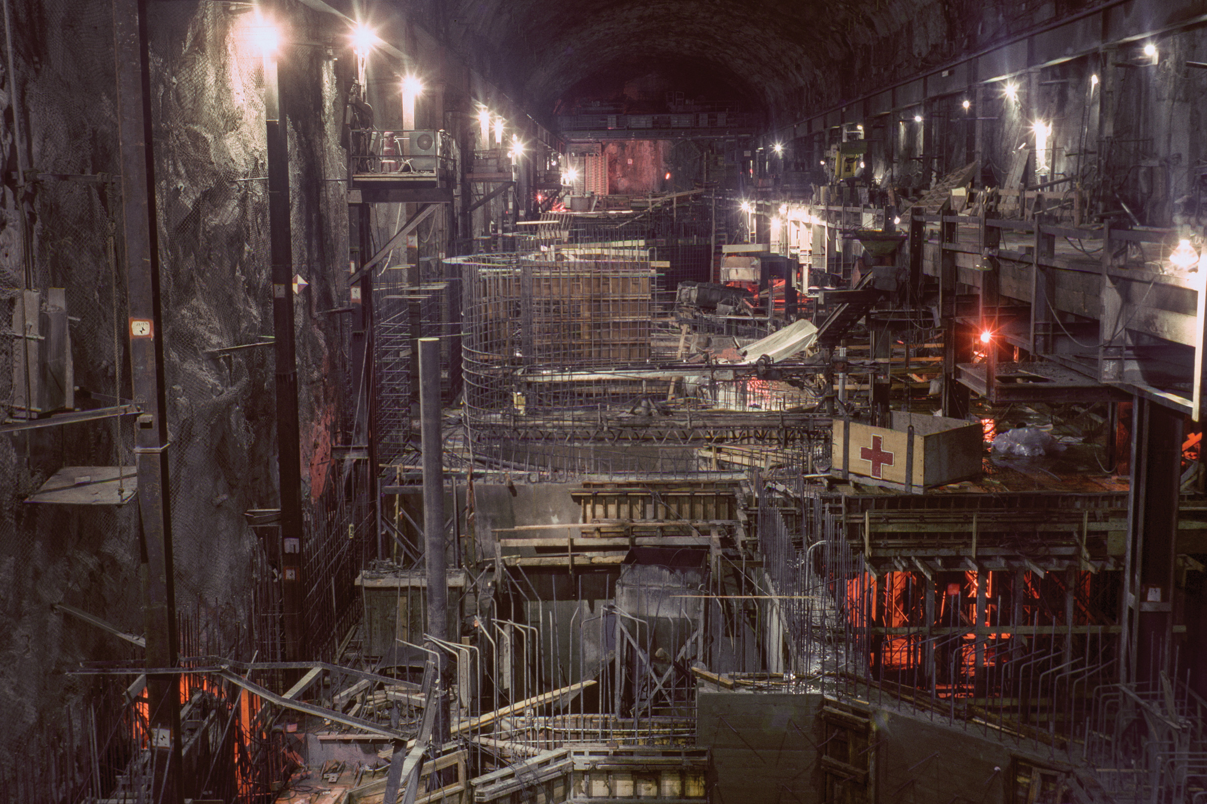
The Edward Hyatt Powerplant, situated near Oroville Dam in Butte County and completed in 1967, exemplifies the project’s multifaceted approach to water management and energy production. This facility utilizes a pumped-storage operation, strategically releasing water for power generation during peak demand periods and returning it to Lake Oroville during off-peak times, thereby maximizing its utility. This dual function highlights the project’s intricate design, aiming to not only deliver water but also to contribute to the state’s energy grid.
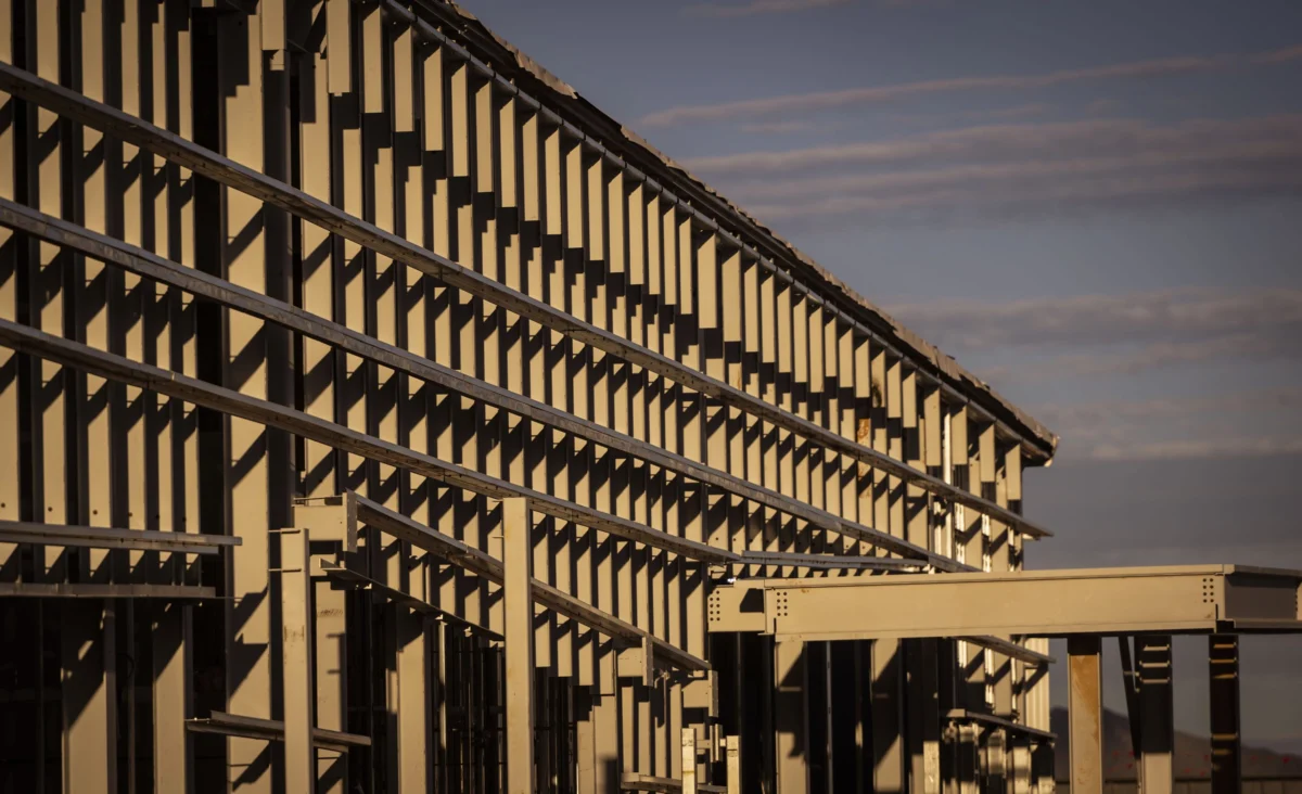
Workers can be seen assembling rebar for a discharge line at the Dos Amigos Pumping Plant, a crucial component of the California Aqueduct-San Luis Canal in Merced County. Completed in 1966, this facility was engineered to lift water over 100 feet, enabling its continued southward journey as part of the State Water Project. The sheer scale of these operations is evident in the photographs, depicting a landscape being fundamentally reshaped by human intervention.

The construction of the Oroville Dam Diversion Tunnel No. 1, a massive 35-foot diameter conduit in Butte County, further illustrates the ambitious scope of the project. Initially built to divert the Feather River during the dam’s construction, these tunnels, plugged upon completion in 1967, now serve a vital role in discharging water from the underground Edward Hyatt Powerplant. The images from this era evoke a sense of awe at the human effort involved in manipulating natural forces on such a grand scale.
In Alameda County, a worker applies a primer coat to a surge tank atop a hill overlooking the South Bay Pumping Plant and Bethany Dams and Reservoir. These structures, part of the South Bay Aqueduct, are essential for regulating water pressure and ensuring the smooth flow of water through the system. The photographs from this period, predominantly from 1962 to 1968, coincide with the burgeoning environmental movement, yet they largely reflect a confidence in large-scale infrastructure as a panacea for environmental challenges. This era celebrated the ability of the state, akin to a nation, to overcome water scarcity through sheer technological might. As anthropologist Brian Larkin notes, such infrastructure projects transcend their technical functions, often prioritizing their aesthetic and symbolic dimensions to convey a powerful political message. The visual grandeur of these projects served to reinforce a narrative of state control and progress, a stark contrast to contemporary sentiments that increasingly favor the dismantling of such structures.

The confluence of the Sacramento and San Joaquin rivers in the Sacramento-San Joaquin Delta forms the critical nexus for both the federal Central Valley Project and the State Water Project. Here, water is captured and redirected through a complex network of levees, reclaimed islands, and waterways that span the region. This delta has been the focal point of California’s water politics for decades, a "theater" where the state’s competing water demands are played out. The photographs of the California Aqueduct serve as a visual chronicle of this transformation, depicting the creation of what Erwin Cooper, a former DWR information officer, aptly termed an "Aqueduct Empire."
The Edward Hyatt Powerplant, completed in 1967 near Oroville Dam, is a key component of the State Water Project, utilizing pumped-storage operations to maximize power production. Water released for power generation, in excess of local and downstream needs, is returned to Lake Oroville during off-peak periods for reuse during times of high energy demand. This innovative approach underscores the project’s commitment to efficiency and resource optimization.

The construction of the Dos Amigos Pumping Plant, completed in 1966, involved workers meticulously assembling rebar for discharge lines. Situated on the California Aqueduct-San Luis Canal in Merced County, this facility plays a critical role in lifting water to sustain the aqueduct’s southern flow. The images from the construction phase vividly illustrate the immense labor and precision required for such colossal undertakings.
The diversion tunnels for Oroville Dam, a significant feat of engineering, were constructed to manage the Feather River’s flow during the dam’s development. Completed in 1967, these tunnels, once plugged, now serve as conduits for water discharged from the Edward Hyatt Powerplant, showcasing a sustained utility of the project’s infrastructure.

In Alameda County, the painting of a surge tank for the South Bay Aqueduct underscores the extensive network of supporting structures necessary for the State Water Project. These tanks are vital for managing water pressure and ensuring system stability, reflecting the intricate design considerations of the project.
The mid-20th century’s post-World War II optimism, a period where grand infrastructure projects were seen as symbols of national progress and problem-solving capabilities, is palpable in these photographs. This era’s faith in human ingenuity to tame nature stands in stark contrast to today’s environmental consciousness, marked by concerns over climate change and the ecological impact of such massive undertakings. The recent dam removals, such as those on the Klamath River, signal a growing public willingness to prioritize ecological restoration over continued construction, a sentiment that diverges sharply from the celebratory atmosphere surrounding the aqueduct’s inception.

The political underpinnings of these water projects are undeniable. The sheer scale of the State Water Project, intended to provide a seemingly inexhaustible supply of water, served as a powerful symbol of California’s ambition and its ability to shape its destiny. The photographs, therefore, are not merely historical records; they are potent political statements, designed to legitimize the project and reinforce the DWR’s role as the steward of the state’s most precious resource. The ongoing archival efforts by the DWR’s Photography Unit, which includes scanning hundreds of thousands of negatives, further highlight the enduring significance of these visual records, serving as both a historical archive and a tool for advocating for the department’s continued relevance and expansion.
The Sacramento-San Joaquin Delta, a complex network of waterways and islands, serves as the crucial hub for water distribution in California. Here, the waters of two major rivers are harnessed by both the federal Central Valley Project and the State Water Project, feeding the vast concrete arteries that traverse the state. This region, roughly the size of Rhode Island, is a testament to the extensive human modification of the natural landscape.

The photographs capture the construction of the B.F. Sisk Dam and San Luis Reservoir, joint facilities managed by the Bureau of Reclamation and the California Department of Water Resources. Located in Merced County, these structures are integral to the State Water Project’s water storage and distribution capabilities. The completed inlet and outlet works, with their imposing access bridge, speak to the engineering marvels that underpin California’s water supply.
The Whiskeytown Dam, an earth-fill structure dedicated by President John F. Kennedy in 1963, exemplifies the early phases of the State Water Project’s development. The inclusion of the "Glory Hole," a significant overflow drain, demonstrates the meticulous planning involved in managing water levels and preventing potential hazards.

The Delta Pumping Plant, the first major facility constructed for the State Water Project, is depicted with a family observing its development. This scene captures the public’s engagement with these monumental projects, reflecting a collective pride in California’s ability to engineer its future.
The Oroville Dam, the centerpiece of the State Water Project, was the tallest earth-filled dam in the United States upon its completion. Its dedication in 1968, attended by Governor Ronald Reagan and DWR Director William R. Gianelli, drew an estimated crowd of 3,500, underscoring the project’s significance and the public’s support for such ambitious undertakings. The construction of this dam, initiated in 1961, involved relentless, around-the-clock work to achieve its impressive scale.

The sheer volume of water infrastructure, from the massive aqueducts themselves to the intricate network of dams, pumping plants, and diversion tunnels, represents a profound human endeavor to re-engineer the environment. The DWR’s ongoing commitment to documenting these efforts through its photography unit, with archivist Bill Kelley III meticulously scanning historical records, speaks to the enduring political and practical importance of this infrastructure. While initially conceived as engineering records, these photographs have evolved into a powerful visual narrative of California’s water history and its ongoing struggle to balance human needs with environmental realities.
California’s population has more than doubled since the State Water Project was approved in 1960, placing immense pressure on its water resources. The fundamental challenge remains: over 90% of the state’s population resides south of Sacramento, while approximately 75% of its rainfall occurs in the northern regions. This geographical disparity has necessitated the continuous development and expansion of water infrastructure, a historical narrative that stretches from the Gold Rush to the present day’s pressing climate change concerns. These photographs, therefore, serve as more than mere historical artifacts; they chronicle California’s persistent pursuit of a utopian ideal—a vision of abundance where water flows freely to sustain its farms, cities, and industries, perpetually defying the arid climate. While the ambition behind such large-scale environmental re-engineering is undeniable, the fundamental reality of the West’s aridity, amplified by the impacts of climate change, poses an enduring threat to this Californian dream, irrespective of the infrastructure built or the images captured to celebrate it.