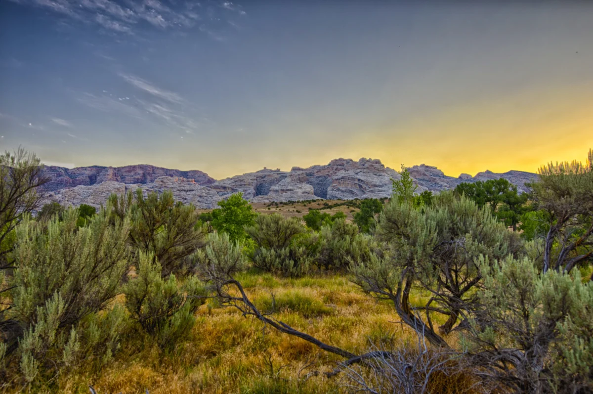

Etched into ancient sandstone, winding through resilient chaparral, and tracing the dramatic contours of coastal ridgelines, the intricate network of trails within California’s Los Padres National Forest represents a heritage both natural and human. Many of these pathways, originally established for purposes as varied as cattle drives, mining prospecting, or early U.S. Forest Service fire patrols, echo the footsteps of the Chumash people who traversed these lands for millennia before colonization. Sections of these historic routes precariously cling to steep slopes, inherently fragile and prone to shedding soil and stone with each passing winter storm, their hand-built retaining walls and bench cuts often half-buried or reclaimed by encroaching manzanita, testaments to past labor now slowly yielding to the elements.

This inherent fragility has intensified dramatically under the relentless pressures of a rapidly changing climate, marked by deepening droughts, increasingly intense atmospheric river events, and diminishing federal budgets. What once appeared as clearly marked trails on official maps now frequently disappear beneath landslides, or have their drainages obliterated by a single, powerful storm. The cumulative effect is a public land trail system shaped more by the forces of erosion and abandonment than by the diligent stewardship of the agencies tasked with its preservation. Decades of personal experience restoring hundreds of miles of Forest Service trails, from the high Sierra Nevada to the eastern seaboard, reveal a disturbing trend: paths vanish not only from the physical landscape but also from digital records, creating a cascading effect on resource allocation. A single missing trail line in a federal database can reduce a budget request by hundreds of thousands of dollars, as appropriations are directly tied to the total mileage recorded. Conversely, an "open" symbol on The National Map, the comprehensive geospatial database maintained by the U.S. Geological Survey, often masks years of severe storm damage, leading hikers into impassable or hazardous terrain. Corridors painstakingly cleared can revert to wilderness within a single season without continuous, dedicated maintenance.
The U.S. Forest Service, managing an astounding 370,000 miles of roads—enough to circle the Earth nearly fifteen times—and approximately 160,000 miles of trails, oversees 85% of all federal land trails. Yet, a sobering 2013 Government Accountability Office report revealed that only about 25% of these trails met agency standards for maintenance, public safety, and environmental protection. Alarmingly, only 37% of the entire national trail network receives any form of maintenance annually, consigning vast stretches to fade into obscurity, both physically and from public consciousness. This systemic neglect was starkly underscored in December 2025, when an internal Forest Service "Trail Program Status Report" brought to light a critical deterioration. Districts across the nation reported losing up to 100% of their dedicated trails staff, equating to hundreds of years of invaluable trail expertise, alongside "widespread burnout and declining morale." The report further detailed a 22% drop in maintained trail miles compared to the average and a 19% reduction in miles meeting maintenance standards, marking the lowest levels observed in 15 years.

This crisis is rooted in decades of chronic underfunding. A 2022 Congressional report estimated a staggering $460 million backlog in trail maintenance alone, part of a larger, overarching $10.8 billion infrastructure deficit plaguing the agency. Natural disasters—including wildfires, floods, and the destructive spread of beetle kill—now erase infrastructure faster than depleted staff can rebuild it. Across the vast landscapes of the American West, dedicated volunteers and small non-profit organizations have increasingly become the de facto caretakers of these vital national systems, stepping into a void left by insufficient government resources. The landscapes themselves, as revealed through geospatial data, vividly narrate this ongoing challenge: climate change, natural disasters, and a chronic lack of funding are accelerating the disappearance of our public land trails faster than the ability to preserve them.
The palpable impact of this deferred maintenance is readily apparent in places like the Los Padres National Forest. During a recent visit north of Santa Barbara, a trail prominently displayed on The National Map and even on popular commercial paper maps proved entirely nonexistent on the ground. What was once a well-trodden route, likely used for centuries, had been completely swallowed by chaparral and agave. The faint suggestion of a ridgeline, where a trail should have been, dissolved into an impenetrable wall of thorny chamise and agave fronds. There was no discernable trail bed, just a corridor so neglected it had become indistinguishable from the surrounding hillside. Here, wildfire scars, relentless storms, and heavy use have transformed once-iconic routes into deep, eroded ruts, impassable thickets, and dangerous washouts. With limited Forest Service personnel, volunteer crews now shoulder much of the burden, leaving countless miles unmaintained and their historical significance vulnerable to erasure.

The underlying cause of this widespread decay traces back to significant workforce contraction within the Forest Service. Staffing reports from 2019 indicate a roughly 20% reduction over the past three decades, with an additional 10% decrease in full-time staff under the previous administration due to layoffs, despite recent Congressional appropriations offering some respite from proposed drastic budget cuts for 2026. Recreational trail staff, once a robust presence in the 1980s, has diminished to critical levels, with many districts now reporting zero or only one permanent recreation staff member, supported by fewer than three seasonal staff, to oversee hundreds of miles of trails. A confidential internal Forest Service report from July 2025 further corroborated this, concluding that each of the agency’s nine regions faced deficits of up to 80% in their trail and recreation workforce. The emotional toll on remaining staff is profound, as echoed by anonymous rangers in the December 2025 report: "My trail program is suffering the worst morale setbacks of all my district programs," lamented one acting district ranger, while a forest recreation manager despaired, "We lost 200 years of trail experience this year." Another district trail manager, contemplating an end to a multi-decade career, described the feeling as "24 years of trails and wilderness work rolling back to the bottom of the hill."
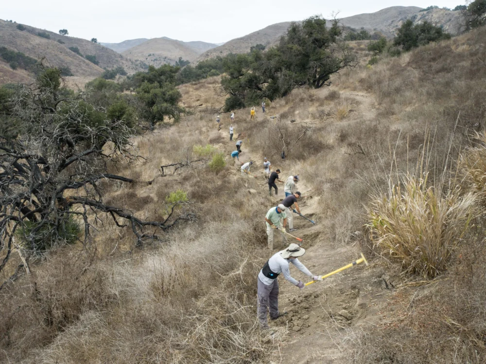
In the face of this systemic decline, volunteers and local stewardship groups have emerged as indispensable guardians, passionately demonstrating the profound value Americans place on access to public lands. In fiscal year 2023 alone, 71,660 volunteers dedicated an astonishing 2.6 million hours of service to the Forest Service—more than double the hours logged by agency employees. However, even this immense wave of donated labor can only slow, not reverse, the cumulative infrastructure degradation that has compounded over decades of under-resourcing and mismanagement. The gravity of this issue resonates at the highest levels of government, with Interior Secretary Doug Burgum acknowledging during his Senate confirmation hearing that addressing the maintenance backlog is "crucial," emphasizing the need to "get the formulas right" to avoid "creating liabilities for future generations."

Beyond the physical decay, the integrity of our maps—our collective trust in them to define our shared inheritance and guide our access—is also at stake. Maps are not merely navigational tools; they underpin laws guaranteeing public access, inform critical wildfire response strategies, and influence billions in recreation spending. Yet, for decades, even federal land managers have struggled to accurately track legal access, with crucial information often buried in handwritten easements, undigitized agreements, and conflicting maps. Recognizing this pressing need, Congress passed the bipartisan MAPLand Act (Modernizing Access to Our Public Land) in 2022. This legislation mandated that the Forest Service, Bureau of Land Management, National Park Service, and Fish and Wildlife Service locate, digitize, and publicly release all recorded access easements, trails, roads, and boundaries by 2027, aiming to consolidate a century of disparate records into a single, authoritative digital basemap.
The reality of this ambitious undertaking, however, is proving far more complex. While The National Map officially lists approximately 300,000 miles of trails across public lands, platforms like OpenStreetMap, a public, volunteer-driven dataset powering popular navigation apps such as Gaia GPS, Strava, Apple Maps, and AllTrails, incorporate hundreds of thousands more, including both sanctioned and informal routes derived from user-generated GPS data. Inaccuracies and omissions in federal datasets directly impact these widely used apps, but the reverse is also true: the proliferation of unsanctioned user-generated trails complicates agency workloads, straining already thin maintenance resources and blurring the lines of official access. A September update on MAPLand implementation, presented by the non-profit American Trails, revealed progress in compiling existing digital layers, but vast troves of paper maps, historical access agreements, and legacy easements remain undigitized. Critically, the Forest Service has not met its annual goal of verifying 1% of its trails in the field since 2012, highlighting a persistent disconnect between data management and ground truth.

Despite the administration’s proposals for significant cuts to the Forest Service’s budget, Interior Secretary Burgum has commendably directed limited funds towards access-related projects, including the crucial digitization mandate, a direct response to lobbying efforts from groups like the Outdoor Recreation Roundtable. However, this political will has not resolved the fundamental challenge: the urgent need for more "boots on the ground." The emerging basemap, while ambitious in scope, remains incomplete and frequently inaccurate. Current funding is only sufficient to compile existing digital layers, not to deploy staff into the field to research paper records or physically verify trail segments that vanished from the system decades ago. This financial limitation risks creating a polished, seemingly authoritative digital product that, in reality, obscures the very gaps and inaccuracies the MAPLand Act was designed to rectify, potentially misleading the public about actual access.
The ramifications of the Forest Service’s underfunding manifest in diverse and devastating ways across the nation. In Oregon’s Oakridge-to-Ashland corridor, for instance, a deadly combination of prolonged drought and an exacerbated bark beetle epidemic—fueled by climate change-induced warmer temperatures and later autumn freezes—has left entire slopes choked with standing dead trees. When winter windstorms inevitably sweep through, hundreds of thousands of these beetle-killed trunks collapse like matchsticks, burying trails under impenetrable tangles of blowdown. Crews returning each spring find once-beloved routes impassable for months, or even years. The sheer scale of this ecological disturbance overwhelms even fully staffed trail crews, let alone volunteer groups, while the accumulating deadfall simultaneously renders forests increasingly susceptible to catastrophic wildfires.

Indeed, there is arguably no greater immediate threat to the forests of the American West than wildfire. A 2023 report by the Outdoor Alliance, "Wildfire and Outdoor Recreation in the West," starkly revealed that over 5,000 miles of trail are impacted by wildfire annually. Colorado’s 2020 fire season, the worst on record, incinerated more than 665,000 acres and over 200 miles of trail. With extreme fires now six times more common than in the 1990s, many trails simply vanish beneath post-fire deadfall and unstable, erosion-prone slopes. A 2023 analysis from the Regional Economic Development Institute noted that Colorado has averaged approximately 72 wildfires a year in the 2020s, a six-fold increase over the 1990s. The post-fire landscape unleashes a secondary wave of destruction: massive tree fall, unstable slopes that slough off during subsequent storms, and pervasive safety hazards that can keep entire trail networks closed for extended periods. While millions of dollars flow through the federal Burned Area Emergency Response (BAER) program to protect roads, culverts, and utilities, trail reconstruction rarely receives adequate attention, leaving many routes functionally erased. Colorado’s 2020 Cameron Peak Fire, one of nine significant wildfires within the Roosevelt National Forest in the last decade, exemplifies this, burning hundreds of miles of trail in a heavily used recreation district. Volunteers work tirelessly to restore what they can, yet operate under the tacit, disheartening acknowledgment that another fire is all but guaranteed, rendering their efforts Sisyphean.
Federal agencies like the Forest Service often face public criticism for perceived failures in effective public land management, which can unfortunately be used as a rationale for further budget cuts. As Jamie Ervin, Senior Policy Manager at the Outdoor Alliance, observes, "Agencies’ ability to respond to increasingly worsening climate disasters is hamstrung. Even with good intentions from local staff and volunteers, as well as funding from Congress in the case of disaster relief, a lessened Forest Service staff cannot organize to restore public land infrastructure for years after wildfire or hurricanes." This illustrates a critical reality: climate change is outpacing not only the physical infrastructure on the ground but also the institutional capacity meant to care for it. A compelling example unfolded in North Carolina following Hurricane Helene, which unleashed torrential rains that triggered landslides across the Pisgah and Nantahala National Forests. Entire trail segments vanished overnight, buried under tons of mud, fractured bedrock, and toppled timber. With roads, bridges, and community infrastructure devastated across western North Carolina, emergency funds and agency staff were understandably diverted to protect critical travel corridors and utilities. Trails on public lands, already contending with years of deferred maintenance, plummeted to the bottom of the priority list. Many remain closed to this day, not solely due to the complexity of the restoration work, but because no dedicated crews exist to undertake the extensive efforts required to reopen them, starkly demonstrating how quickly a maintenance backlog can escalate into a permanent loss of public access. In this way, extreme climate events do more than merely reshape the physical landscape; they divert crucial attention and resources away from its long-term stewardship.

While it is tempting to attribute the scale of these losses solely to government shortcomings, the public, as users of these lands, must also acknowledge its shared responsibility. Too often, the prevailing outdoor recreation culture—and the industry that profits from it—has fostered a mentality of entitlement rather than stewardship, encouraging individuals to act as beneficiaries of public lands while contributing little to the labor or funding essential for their upkeep. Americans spend an estimated $1 trillion annually on outdoor recreation, yet the specific federal accounts dedicated to funding its foundational physical infrastructure—roads, conserved landscapes, and trails—are so critically limited that their combined totals are often less than the annual operating budgets of some individual state park systems.
The ideal resolution to this complex challenge demands a synergistic approach: federal agencies and the public working in concert to maintain trails as vital, living infrastructure. This must be guided by accurate, up-to-date mapping and coupled with robust, full Congressional funding. Outdoor recreationists, drawing inspiration from the long-standing model of hunters and anglers who have fueled federal conservation efforts for decades through excise taxes and license fees, could play a more proactive and substantial role, perhaps through a dedicated funding stream or a similar excise tax directly supporting public lands. Maps, at their core, serve a purpose far beyond charting terrain; they embody a social contract between the public and the agencies entrusted with stewardship—a promise that what is depicted can be found, utilized, and defended. Each trail signifies more than just an opportunity for recreation; it represents a chance to connect with the landscape and the rich tapestry of our nation’s history within it. As the physical terrain transforms at a pace that outstrips both maps and management budgets, this fundamental contract frays. When landscapes become inaccessible or perceived as no longer intact, the public’s ability to advocate for their preservation diminishes. We have inherited an expansive network of roads, trails, and easements carved through nearly every U.S. ecosystem. While some may naturally fade back into the wilderness, others remain essential lifelines for access, identity, and ecological health. The profound challenge lies in making the difficult moral choices: which lines to actively maintain, which to allow to recede, and which to vigorously fight to redraw, understanding that every map revision carries significant ethical weight.