Rocky Gerung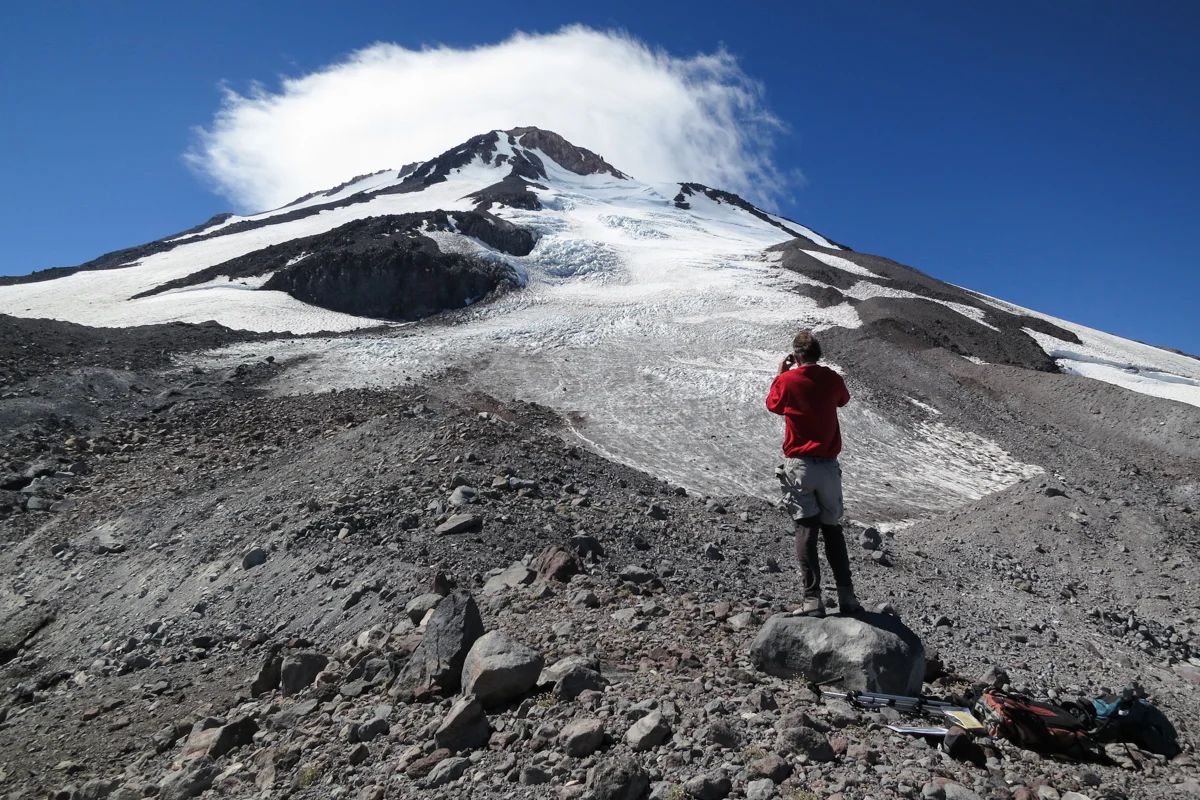
Mount Shasta, a solitary titan in Northern California’s dramatic landscape, pierces the sky with an imposing presence, its snow-capped summit visible from a hundred miles south, a stark contrast against the rolling oak savanna. Its isolation makes its immense stature undeniable, evoking comparisons to Tolkien’s Lonely Mountain, a sentiment amplified by a whimsical, 20-foot dragon sculpture adorning the plains to its north. This iconic stratovolcano, a geological marvel, is home to seven named glaciers, including the Whitney Glacier, California’s longest and the first in the continental United States to be definitively identified by modern scientists. Clarence King, leading the first U.S. Geological Survey expedition, described Shasta in The Atlantic Monthly as a "colossal cone of a burned-out volcano, springs upward from a plain… bearing upon its summit a cap of solid white." Historical photographs, such as one from September 11, 1870, vividly capture the Whitney Glacier, its icy expanse fractured by deep crevasses, a testament to its once formidable state.
However, like glaciers across the Western United States, Mount Shasta’s icy behemoths are in a state of undeniable retreat. For centuries, glaciers have symbolized permanence, their unhurried "glacial pace" a metaphor for enduring strength. Yet, these ancient ice formations are diminishing year by year, a process that, while imperceptible on a human timescale, is alarmingly rapid from a geological perspective. A child born today might easily mistake the current, diminished state of Shasta’s glaciers for their natural appearance, a phenomenon scientists term "shifting baseline syndrome." This concept describes our insidious capacity to adapt to and normalize deteriorating environmental conditions, a form of "great-getting-used-to" that obscures the extent of ecological loss.
Fortunately, a powerful countermeasure exists to reveal these profound environmental shifts: re-photography projects, where individuals meticulously recreate images from the same vantage points over decades. These long-term photographic records, spanning over 140 years for Mount Shasta’s glaciers, provide irrefutable evidence of Earth’s transformation due to climate change. Even in an era of sophisticated digital manipulation, the visual narrative presented by a century-long photographic archive is profoundly convincing, offering a tangible antidote to the complacency fostered by shifting baseline syndrome. The preservation of historical documentation, in all its forms—photographs, journals, scientific records, even antique maps—is the most potent defense against environmental amnesia. These primary sources act as crucial anchors, allowing us to connect with and understand past environmental states, thus highlighting the severity of present-day degradation.
A testament to this commitment to preserving environmental memory is Phil Rhodes, a dedicated citizen scientist who has been re-photographing the Shasta glaciers since the 1970s, amassing what is likely the most extensive private collection of such images. Rhodes, a tall, earnest man now in his seventies, cultivated a deep appreciation for nature during his childhood in Mill Valley, California. His fascination with the Whitney Glacier began in 1972 during his geology studies at Humboldt State University (now Cal Poly Humboldt), an encounter that ignited his concern over the glaciers’ unusual behavior and spurred his scientific inquiry.
Inspired by the book Exploring Glaciers—With a Camera, Rhodes established his first photographic station near the Whitney Glacier in 1974. He subsequently expanded his project to include 14 locations, capturing images of other significant glaciers on the mountain, including the Bolam, Hotlum, and Wintun. Rhodes saw his work as a continuation of the tradition of amateur naturalists like John Muir, individuals possessing profound scientific insight without formal professional credentials. Between 1983 and 1988, Rhodes lived in the town of Mount Shasta, serving as the caretaker of a mountaineering hut during the summers. Even after relocating to the San Francisco Bay Area to manage his family’s shipping business, he remained dedicated to the project, undertaking the arduous four-and-a-half-hour drive alone, ascending the mountain to meticulously document his chosen sites. "What I did was try to make this definable by setting up these photo stations: taking the same photo year after year after year," Rhodes explained. "You can look at these photos, and you can see changes."
Life’s demands eventually necessitated a transition for the project. In the early 2000s, Rhodes entrusted his extensive collection to a graduate student in Portland State University’s Geology Department. By approximately 2015, the responsibility shifted again, this time to eager Forest Service rangers seeking a new endeavor. It was through this lineage that I found myself accompanying Forrest Coots, a seasonal Forest Service ranger, on a spring weekend expedition to witness a photo station firsthand.
Coots, a native of the Mount Shasta region, possesses an intimate knowledge of the mountain, his personal baseline of environmental memory stretching back to his childhood. As we navigated the rugged backroads on the mountain’s north side, Coots shared poignant ecological observations accumulated over his four decades of life. He recalled a childhood where the certainty of winter’s arrival was unquestioned, a stark contrast to recent years, including one where the region experienced 36 consecutive days without precipitation, leaving the land "dry as a bone."
Our journey led us to a sandy wash, the boundary of the Mount Shasta Wilderness marked by a faded sign. Donning boots and shouldering packs, we began our ascent, a stark departure from the common southern approach. The north side offered a wild, untracked landscape. Coots expertly guided us through gullies, avalanche chutes, and dense stands of pine, many of which bore the telltale signs of stress and mortality—brown, crisp needles. He pointed southeast, indicating the Bolam Glacier, expressing grave doubt about its survival within his lifetime, while holding out a sliver of hope for the Hotlum and Whitney Glaciers. "The Bolam. I doubt it will be here at the end of my lifetime," he stated somberly.
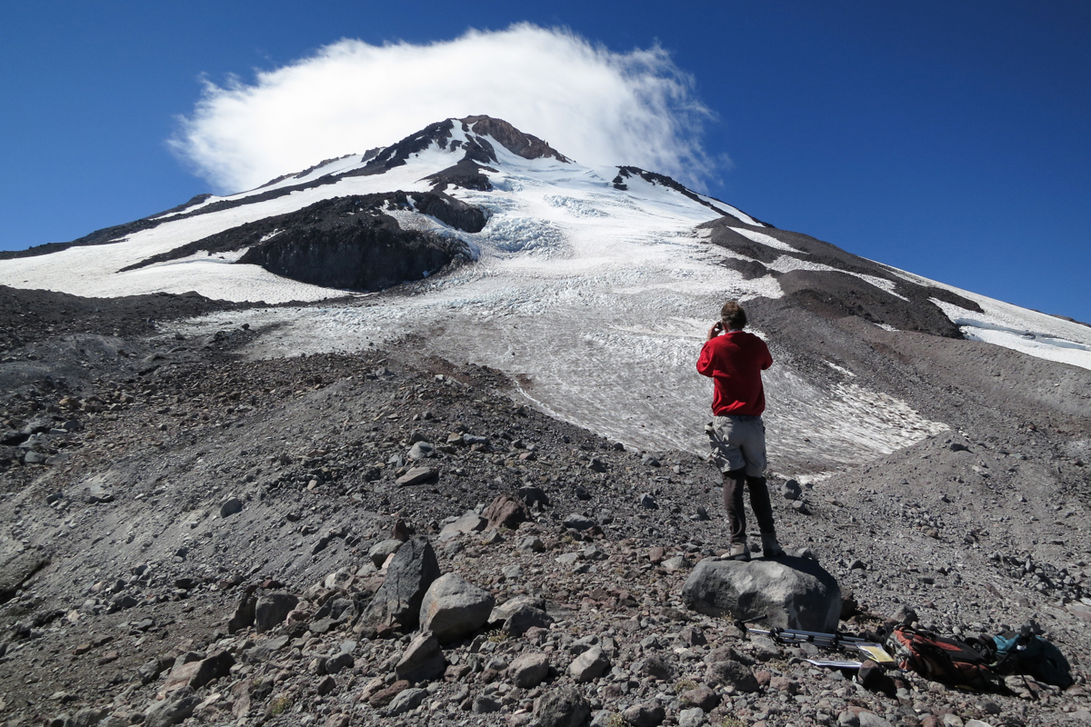
Beyond the tree line, the landscape transformed into a stark panorama of earth, rock, and ice. Coots led us to a rocky ledge overlooking a small ice pond. Above us, the Whitney Glacier gleamed, its ice a brilliant white against a backdrop of digital blue. "We’re here," he announced, indicating a medium-sized, salmon-colored boulder at the edge of the shelf. This unassuming rock, Photo Station Whitney #1, was the anonymous anchor point from which decades of environmental change had been meticulously documented. The solid, seemingly permanent boulder stood in poignant contrast to the ephemeral nature of the glacier it overlooked and the fragile thread of human memory upon which much of this historical record now depended.

During my time with Coots, I gained a deeper appreciation for the Mount Shasta glacier re-photography project—a remarkable narrative of citizen science and tenacious historical preservation, driven by individuals determined to combat ecological amnesia. Rhodes’s dedication, described by Coots as that of "the foremost expert on Shasta’s glaciers," in meticulously documenting these vanishing natural forces, often at his own expense and during his personal time, is profoundly inspiring. This, I realized, is how environmental memory endures across generations: through the often-unheralded efforts of those who strive to preserve invaluable remembrances.
However, even these dedicated efforts are vulnerable. A significant portion of Rhodes’s Mount Shasta glacier photos from 2015 to 2019 vanished when a thumb drive was misplaced, a loss that left Rhodes "distraught," according to Coots. The project’s continuity faced further challenges when Coots departed his Forest Service position. Responsibility then fell to Nick Meyers, the lead climbing and wilderness ranger for Mount Shasta. However, staffing shortages and adverse weather have hampered his team’s ability to maintain the photographic record. Meyers reported that only a "handful" of sites were photographed in 2023 and 2024, with many missed in 2025. While the project has not entirely ceased, Meyers acknowledged that the agency "doesn’t always have the capacity" to visit all locations, though he affirmed the agency’s commitment and openness to volunteer assistance. For now, the photo station at the base of the Whitney Glacier has returned to its primal state: a simple, ordinary rock, a silent witness to millennia of natural processes.
A partial collection of Rhodes’s Mount Shasta photographs had, at one point, been transferred to Andrew Fountain, a distinguished glaciologist at Portland State University. However, even this repository exists in a state of evidentiary limbo. Fountain has amassed over 10,000 glacier photographs throughout his career, some accessible on his website, Glaciers of the American West. Yet, many remain unseen, stored on digital servers and hard drives. While Glaciers of the American West offers a valuable resource for observing glacier loss through comparative photography, its interface is dated, navigation is challenging, and updates have ceased due to a lack of resources, particularly following Fountain’s retirement. The Glacier RePhoto Project section, intended to showcase these vital comparisons, now displays 404 error messages for Mount Shasta, Mount Hood, and Mount Rainier. "I’d like to get that site going again," Fountain expressed with evident weariness.
The question lingers: if a glacier melts into oblivion, and little publicly accessible visual evidence remains, did it ever truly exist? Fountain confessed that for much of his career, he maintained an "academic remove" from such existential contemplations. However, the stark realization that in the near future, perhaps by 2070, glaciers will become so diminished that his life’s work might become incomprehensible, led him to a "certain depression." This profound understanding, he admitted, now fuels a more urgent pace in his research, as he endeavors to create a comprehensive inventory of Western U.S. glaciers, mapping their locations and quantifying their sizes—an endeavor that may ultimately serve as a map of bygone eras.
As Coots and I descended from the Whitney Glacier, the pervasive sound of melting water accompanied our every step. The spring melt was in full swing, countless rivulets carving their paths downhill. The glacier was actively diminishing beneath us, and we were the sole witnesses to this poignant spectacle. A story, much like a glacier, only truly lives if it continues to flow and evolve. Our histories, like these ancient ice formations, require constant retelling and re-engagement to remain vibrant and relevant.