Rocky Georgio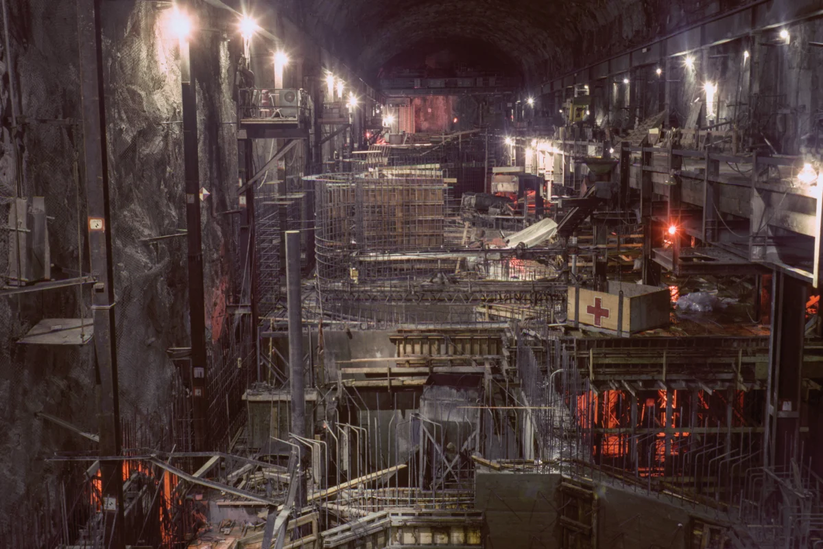
The Edward Hyatt Powerplant, a crucial component of California’s State Water Project located near Oroville Dam, exemplifies the ambition of mid-20th century engineering, utilizing a pumped-storage operation to maximize power generation by returning excess water to Lake Oroville during off-peak hours for use during peak demand. Construction of the State Water Project, initiated in 1961, stands as one of the most extensive water infrastructure undertakings in U.S. history, with initial water deliveries reaching Southern California by 1972. This monumental network, extending over 700 miles from the Feather River watershed in Northern California to Lake Perris in the south, embodies a significant era of engineering prowess and California’s proactive approach to managing its arid climate. The extensive public photo archive maintained by the California Department of Water Resources (DWR) captures this spirit, presenting a majestic portrayal of the state’s belief in its capacity to overcome water scarcity in the American West.

These historical photographs, primarily taken between 1962 and 1968, transcend mere documentation of construction; they convey a profound sense of utopian optimism rooted in the post-World War II era’s confidence in grand infrastructure projects to reshape and control natural resources. Such endeavors were not only utilitarian in their design to solve large-scale water challenges but also served as powerful political statements, symbolizing the nation’s, or in California’s case, its colossal state government’s, triumph over the arid West’s inherent limitations. The visual grandeur of these projects, as anthropologist Brian Larkin notes, often elevates the aesthetic dimension of infrastructure above its technical function, thereby performing significant political work. These images reflect a mid-century public enthusiasm for large-scale public works that contrasts sharply with contemporary attitudes, where the focus has shifted towards dismantling such structures, as seen in the recent removal of the Klamath dams and ongoing discussions about dam decommissioning.

The Sacramento and San Joaquin rivers converge in the Sacramento-San Joaquin Delta before flowing into the Pacific Ocean via San Francisco Bay. At this critical juncture, water is diverted into two immense concrete channels: the federal Central Valley Project (CVP) and the southern segment of the State Water Project (SWP). The delta itself is a complex landscape of over a thousand miles of levees, more than 50 reclaimed islands, and an intricate network of 700 miles of waterways, sprawling across an area roughly the size of Rhode Island. For decades, the dynamic flow of water into and out of this region has been a focal point of California’s water politics. The striking images of the California Aqueduct serve as a visual testament to this transformation, illustrating the evolution of California’s landscape into what Erwin Cooper, a former information officer for the DWR, aptly termed an "Aqueduct Empire." This vast network of canals, dams, and pumping stations was engineered not only to deliver water but also to project an image of control and progress.

The political vision and the sheer operational scale required to distribute water across California are palpable in both the physical landscape and these historical photographs. The earliest of these images predate Rachel Carson’s seminal 1962 publication, Silent Spring, marking the project’s inception at the very dawn of the modern environmental movement. More than six decades later, the optimistic engineering spirit of the mid-20th century confronts the harsh realities of the 21st century’s environmental crises, characterized by climate change and the overexploitation of water resources, which have inflicted considerable damage on the Western landscape. The colossal infrastructure that once symbolized hope and progress now stands as a historical artifact, often requiring extensive repairs. The significant failure of the Oroville Dam spillway in 2017, necessitating the evacuation of nearly 200,000 people, starkly illustrates the ongoing challenges of maintaining this aging water system.

The DWR Photography Unit, still operational today with a team of six photographers, plays a vital role in documenting the state’s water management efforts. Bill Kelley III, the unit’s archivist, meticulously scans archival images from a windowless room at the department’s Sacramento headquarters, a space designed for optimal scanning conditions. Kelley estimates that over 250,000 negatives and color slides await digitization, a task that will continue long after his tenure. "Initially, these photos started as engineering research," Kelley explained, "but I appreciate that DWR made the commitment to this position," highlighting the department’s dedication to the long-term photographic record of its water management activities. The sheer volume of work produced by this small unit over seven decades is remarkable, reflecting photography’s significant political influence. The Photography Unit serves not only as a visual archive of state water management but also as a tool to advocate for the DWR’s continued expansion and projects.

California’s population has surged dramatically, growing from 16 million at the time the SWP was approved in 1960 to over 39 million today. This imbalance between population growth and water resources has been a persistent challenge for the state’s development, particularly given that more than 90% of the population resides south of Sacramento, while approximately 75% of the state’s rainfall occurs north of the capital. The history of California is intrinsically linked to its water management, from the Gold Rush era to the present-day challenges posed by acute climate change. These photographs, however, do more than simply record historical events; they chronicle California’s enduring pursuit of a utopian ideal. This vision is one where water flows abundantly through rivers and aqueducts, sustaining the state’s farms, cities, and industries, perpetually defying the region’s inherent aridity and securing a prosperous future. While re-engineering the environment on such a massive scale is an undeniably ambitious undertaking, the American West, situated on the dry side of the 100th meridian, will forever grapple with its natural limitations, a reality that challenges the very notion of a perpetual water utopia, regardless of the scale of its infrastructure or the compelling nature of its imagery.