
The origins of this fraught relationship lie squarely in the "prior appropriation doctrine," the foundational principle of Western water law. This doctrine, often summarized as "first in time, first in right," grants water rights based on historical use, meaning the earliest entity to put water to "beneficial use" holds the most senior claim, regardless of their location on the river. By the early 20th century, California, with its burgeoning agricultural and urban centers, had enthusiastically embraced this principle, developing massive irrigation districts and securing senior water rights that dwarfed the nascent claims of less-developed upstream states. This imbalance created a profound sense of injustice and vulnerability among the headwaters states, who watched helplessly as a significant portion of "their" river was claimed by downstream users.
To mitigate this growing conflict and secure political support for ambitious federal water projects in the Lower Basin, the seven Colorado River Basin states — Colorado, Wyoming, Utah, New Mexico (Upper Basin) and Arizona, California, Nevada (Lower Basin) — convened in 1922 to forge the landmark Colorado River Compact. Signed at Lees Ferry, Arizona, the Compact aimed to divide the river’s flow equally between the two basins, allocating 7.5 million acre-feet (MAF) of water annually to each. However, a critical flaw in this foundational agreement was its optimistic estimation of the river’s annual flow, which was based on a historically wet period. The Compact assumed an average flow of 16.4 MAF per year, a figure that, as history has shown, was significantly higher than the river’s true long-term average. This overestimation sowed the seeds of future conflict, creating a system designed to distribute more water than the river could reliably provide.

Adding another layer of historical injustice and ongoing complexity, the 30 tribal nations whose ancestral lands encompass the Colorado River watershed were conspicuously excluded from the 1922 Compact negotiations. This blatant disregard for tribal sovereignty and existing water claims set the stage for future disputes. As the river’s most senior water users, many tribal nations hold "present perfected rights" that predate the Compact itself, yet these rights remain largely unquantified and unmet. While each tribe’s allocation is technically included within their respective basin and state allotments, the practical reality is that their water access has often been curtailed or denied. Current negotiations, focused on drastic cuts, must eventually confront how these critical tribal claims will be honored, especially as many tribes in the Lower Basin would likely be immune from cuts under the prior appropriation doctrine due to their seniority, further complicating the already intricate web of entitlements.
For decades, the inherent imperfections of the Compact were masked by periods of adequate flow. The Upper Basin states consistently used far less than their allotted 7.5 MAF, typically around 4 MAF, while the Lower Basin often exceeded its share, sometimes consuming as much as 11 MAF. This imbalance was sustainable only as long as the river had a surplus. However, since the turn of the 21st century, the basin has entered an era of unprecedented megadrought, profoundly exacerbated by accelerating climate change. Warming temperatures have led to diminished snowpack in the headwaters, increased evaporation from reservoirs and rivers, and altered precipitation patterns, drastically shrinking the river’s annual flow. The "natural flow" at Lees Ferry, the estimated amount of water the river would carry without human intervention, has averaged only about 12 MAF since 2000, plummeting to below 6 MAF in 2002 – a staggering figure that was barely half of what the Lower Basin alone was consuming at the time.
This stark hydrological reality fundamentally clashes with the numbers enshrined in the 1922 Compact, making compliance virtually impossible. A particularly contentious provision is the "non-depletion clause," which dictates that the Upper Basin "will not cause the flow of the river at Lee Ferry to be depleted below an aggregate of 75,000,000 acre feet for any period of ten consecutive years." While interpretations vary, this clause effectively binds the Upper Basin to deliver water downstream, even if it means sacrificing their own allocations, a scenario that now appears increasingly inevitable.

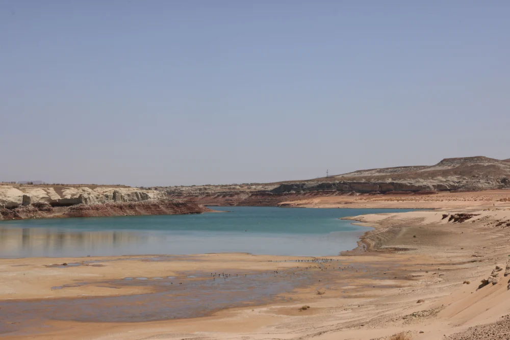
Glen Canyon Dam and its vast reservoir, Lake Powell, were initially conceived as the Upper Basin’s "savings account," designed to store water during wet years and release it to meet downstream obligations during dry periods. Yet, in recent decades, withdrawals have consistently outpaced inflows, leaving Lake Powell at approximately one-third of its full storage capacity. The reservoir’s surface level is now precariously close to "minimum power pool," the critical elevation at which water can no longer pass through the hydroelectric turbines to generate power. Should this threshold be breached – a possibility federal forecasts indicate could occur as early as this fall – the dam would cease producing hydropower for millions across the Southwest. Furthermore, water releases would be forced through lower river outlets not engineered for sustained use, risking compromise to the outlets and potentially the structural integrity of the dam itself. Bureau of Reclamation engineers have issued dire warnings against this scenario, effectively turning minimum power pool into the de facto "deadpool" for operational purposes.
Avoiding this catastrophic outcome, absent a rapid and improbable re-engineering of the dam, necessitates drastic measures. Either the Upper Basin must substantially curtail its water use and drain upstream reservoirs to boost Lake Powell’s inflows, or the Lower Basin must accept significant, potentially calamitous, reductions in releases from Glen Canyon Dam, impacting not only urban and agricultural users but also the fragile ecosystem of the Grand Canyon and its endangered native fish species.
Recognizing the escalating crisis, the Interior Department in 2022 mandated that the seven basin states develop a consensus plan to reduce overall consumptive use by 2 million to 4 million acre-feet annually – a staggering amount representing up to one-third of the river’s average flow. Despite numerous rounds of negotiations, the states have yet to reach a unified agreement, highlighting the deep divisions and entrenched interests. The Lower Basin states, having already made some cuts and facing immense pressure due to their higher historical consumption, have signaled a willingness to accept further reductions. However, their commitment is contingent on the Upper Basin implementing mandatory, verifiable cuts of its own and maintaining some version of the non-depletion provision.

Conversely, Upper Basin negotiators contend that they have never fully utilized their allocated share of the river and, in fact, consume significantly less than the Lower Basin. They argue that imposing further reductions on them is unfair, especially when many of their junior water rights holders, particularly in agricultural sectors, are already facing drastic curtailments during dry years due to limited storage capacity. For instance, in 2021, numerous farms in southwestern Colorado had their irrigation ditches shut off by June, forcing them to abandon crops, while the Ute Mountain Ute Tribe received only about 10% of its rightful allocation. Logistical challenges also abound in the Upper Basin, where water is drawn from hundreds of smaller diversions across the mainstem and its tributaries, making widespread, enforceable cuts far more complex than in the Lower Basin, which relies on a few enormous diversions like the Central Arizona Project canal, the All-American Canal serving the Imperial Irrigation District (the river’s largest single user), and the California Aqueduct.
The Upper Basin has proposed a "supply-driven" plan, which would tie releases from Lake Powell directly to the actual amount of water flowing into the river and stored in the reservoir, thereby acknowledging the current hydrological realities, if not the original figures, of the Colorado River Compact. While Lower Basin negotiators have shown some interest in this approach, a critical sticking point remains the specific details, such as the exact percentage of flows to be released and whether any minimum-flow requirement under a non-depletion clause would persist.
Ultimately, the relentless forces of climate and hydrology, not political deals or deadlines, are poised to dictate the river’s fate. As Lake Powell’s levels continue their downward trajectory, the Bureau of Reclamation will likely resort to emergency measures, drawing down upstream reservoirs like Flaming Gorge, Blue Mesa, and Navajo to temporarily bolster Lake Powell. However, once the reservoir hits minimum power pool, dam operators will face an impossible choice: risk catastrophic failure by releasing water through unsuited river outlets, or transition Glen Canyon Dam to a "run-of-the-river" operation. The latter would halt the reservoir’s decline by equating outflows to inflows, minus evaporation and seepage. The consequence would be a dramatic reduction in releases, causing Lake Mead’s levels to plummet and forcing the Lower Basin states into potentially devastating cuts. The Central Arizona Project, holding some of the basin’s most junior rights, would almost certainly lose its water, imperiling the cities and farms it serves across Arizona.

Should such diminished releases persist for an extended period, the Upper Basin would likely find itself in direct violation of the non-depletion clause, triggering a cascade of litigation from downstream users. This scenario would effectively hurl the entire watershed back into the anxious, combative pre-Compact era, undoing a century of water governance. The core flaw of the Colorado River Compact was not merely its overestimation of the river’s flow, but its foundational structure, which pitted states, tribes, and various water users against one another in a zero-sum game. This framework actively discouraged a collaborative, basin-wide approach to managing a shared, vital, and increasingly scarce resource. As the climate continues its inexorable warming and drying trend, the diminishing volume of water renders the original compact, and perhaps the entire prior appropriation doctrine for the Colorado River, an outdated relic. The path forward may necessitate a radical reimagining – a complete overhaul of the legal and cultural frameworks that govern this essential waterway – before there is literally nothing left to argue about.