
A deeply ingrained sentiment in the American West, often voiced by those living in the headwaters of major river systems, posits that water should be utilized locally rather than allowed to flow downstream to neighboring states. This perspective, particularly prevalent in the Colorado River Basin, stems from a complex interplay of regional pride, perceived scarcity, and the idiosyncratic nature of Western water law. For generations, the narrative was that if water wasn’t captured and put to use in states like Colorado, Wyoming, or Utah, it would simply journey south and west, benefiting downstream entities like California, often viewed with a mixture of envy and animosity. This long-held belief is now being tested as the Colorado River and its crucial reservoirs, Lake Powell and Lake Mead, face critically diminished levels, leaving the seven states reliant on its waters locked in protracted negotiations over how to manage this escalating crisis. The fundamental question has shifted from "how much water should we use" to "how much water can we afford to let flow downstream to California, Arizona, and Nevada?"

The historical roots of this conflict are deeply embedded in the doctrine of prior appropriation, a cornerstone of Western water law. This doctrine grants senior water rights holders, those who first put water to "beneficial use," the perpetual right to their allocated share, even if it means junior users face curtailment during times of scarcity. By the early 20th century, a rapidly expanding California was aggressively diverting significant portions of the Colorado River, securing vast amounts of senior water rights through large-scale irrigation projects. This left the less populated Upper Basin states – Colorado, Wyoming, Utah, and New Mexico – watching with growing concern as their downstream neighbors gained control over an ever-larger share of a river originating within their borders. To address this growing tension and secure the Upper Basin states’ cooperation for ambitious dam and water infrastructure projects planned for the lower river, the seven Colorado River Basin states convened to forge the Colorado River Compact of 1922. This landmark agreement divided the basin into two distinct regions: the Upper Basin, comprising Colorado, Wyoming, Utah, and New Mexico, and the Lower Basin, encompassing Arizona, California, and Nevada, with Lees Ferry in Arizona serving as the dividing line. The compact aimed for an equitable distribution, allocating each basin an exclusive right to 7.5 million acre-feet (MAF) of water annually, a provision that, at the time, was based on an optimistic assessment of the river’s historical flow.
Crucially, the 30 tribal nations residing within the Colorado River watershed, who are in fact the river’s most senior water users, were deliberately excluded from the 1922 compact negotiations. This exclusion represented a profound affront to tribal sovereignty and laid the groundwork for future conflicts as tribes sought to quantify and assert their water rights, many of which predate the compact itself. The allocations for these tribal nations are currently incorporated within the broader basin and state allotments. The ongoing negotiations primarily focus on how the necessary reductions in water use will be distributed between the Upper and Lower Basins. The ultimate impact on individual users, including tribal communities, will be determined within each basin through subsequent negotiations, likely guided by the prior appropriation doctrine. Those with pre-compact, "present perfected rights," a category that includes many Lower Basin tribes, would theoretically be shielded from any mandatory cuts under such a framework, highlighting the complex legal and historical layers of the water rights landscape.

While the Colorado River Compact was not without its flaws, the principle of an equal division of water between the Upper and Lower Basins generally held for decades. However, the reality of water use diverged significantly from the compact’s projections. The Upper Basin states consistently used far less than their allotted 7.5 MAF, typically around 4 MAF annually. In contrast, the Lower Basin, particularly California, frequently exceeded its share, consuming as much as 11 MAF in some years. This imbalance only became a critical issue when the river’s water supply began to dwindle, a trend exacerbated by a prolonged drought and rising global temperatures. For the past 26 years, the Colorado River has experienced significantly reduced flows, a stark departure from the abundant water imagined by the compact’s framers.
The warming climate has had a profound impact on the headwaters, significantly diminishing the snowpack that acts as the river’s natural reservoir. Since the turn of the century, the average annual "natural flow" of the Colorado River at Lees Ferry – the estimated volume of water the river would carry without any human diversions or consumption – has been approximately 12 MAF. However, this figure plummeted to below 6 MAF in 2002, representing less than half of the water consumed by the Lower Basin alone at that time. These meager flows are incompatible with the numbers enshrined in the 1922 Compact, making it exceedingly difficult, if not impossible, for the Upper Basin states to adhere to the compact’s "non-depletion clause." This clause mandates that the Upper Basin "will not cause the flow of the river at Lee Ferry to be depleted below an aggregate of 75,000,000 acre feet for any period of ten consecutive years." While interpretations vary, the clause appears to obligate the Upper Basin states to allow sufficient water to flow downstream to California, even if it means they must endure shortages themselves.

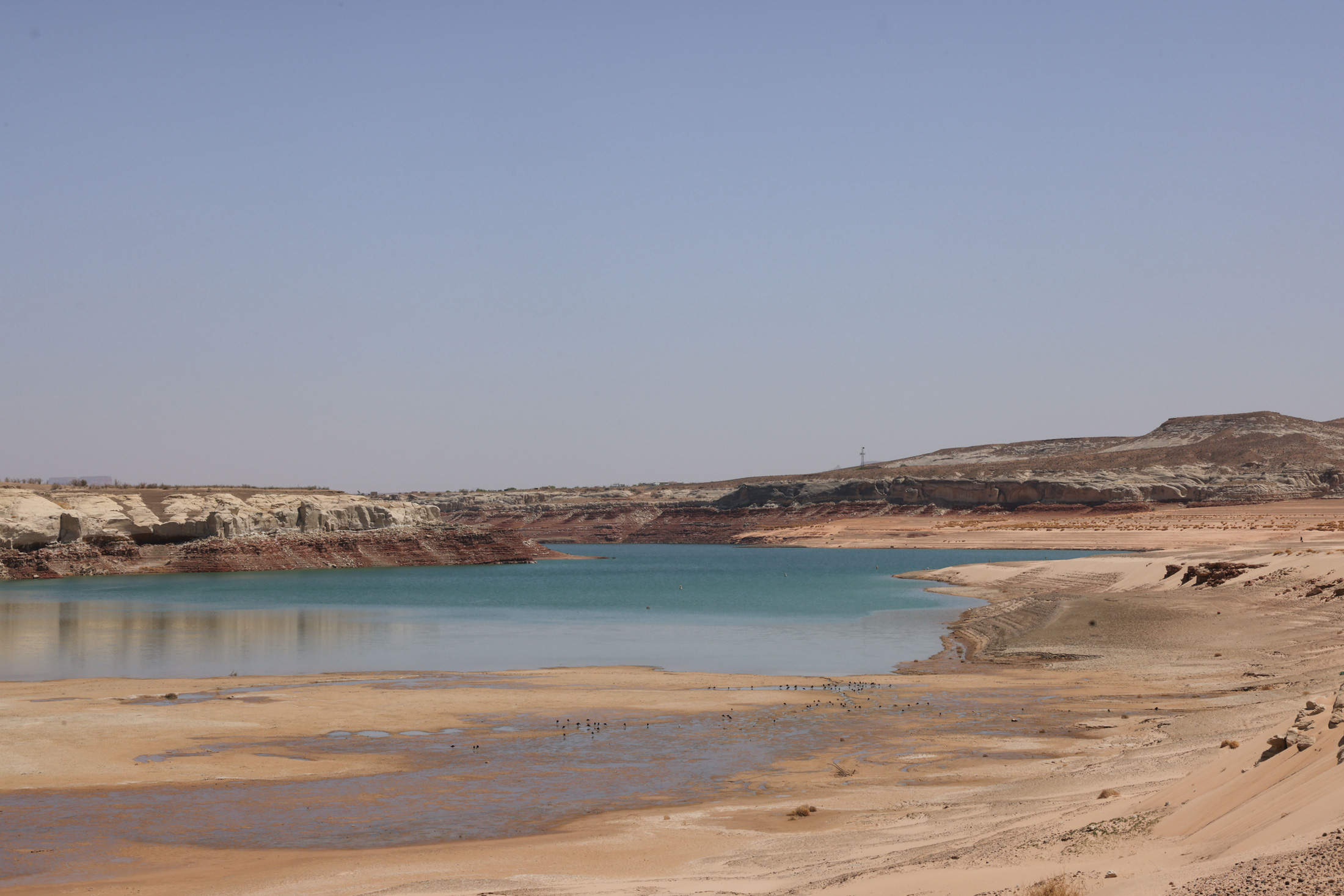
The construction of Glen Canyon Dam and the creation of Lake Powell were intended to serve as a vital water storage system for the Upper Basin, a buffer against dry years. However, in recent decades, withdrawals from Lake Powell have consistently outpaced inflows. As a result, the reservoir now hovers around one-third of its total storage capacity, and its surface level is alarmingly close to reaching the "minimum power pool." This critical threshold is the point at which water can no longer be released through the dam’s hydroelectric turbines to generate power for the millions of people in the Southwest who rely on it. Current federal forecasts suggest this could occur as early as the fall.
The implications of reaching minimum power pool are far-reaching. The dam will cease generating hydropower, impacting regional energy grids. Furthermore, all water releases would be forced through lower-level outlets, structures not designed for sustained, high-volume operation. Bureau of Reclamation engineers have issued stern warnings that this could compromise the outlets and potentially the dam’s integrity, effectively rendering the minimum power pool the "dead pool" – the point of no return for power generation. If current climate trends persist, avoiding this scenario necessitates either a substantial increase in water flowing into Lake Powell by curtailing Upper Basin water use and draining upstream reservoirs, or a significant reduction in releases from Glen Canyon Dam. The latter option would impose severe cutbacks on the Lower Basin and imperil the delicate ecosystem of the Grand Canyon, including its endangered native fish populations.

The path forward demands a significant reduction in overall water consumption across the basin, a goal that the federal government communicated to the seven states in 2022, urging them to find ways to cut usage by 2 to 4 million acre-feet annually. However, consensus remains elusive. The Lower Basin states, having consistently used more water than allocated, have already absorbed some cuts and have signaled a willingness to accept further reductions, but only if the Upper Basin commits to mandatory and verifiable conservation measures. Simultaneously, the Lower Basin advocates for the continued existence of the non-depletion provision in some form.
Upper Basin negotiators counter that their states have not yet reached their allocated water entitlements and that their overall consumption is significantly lower than that of the Lower Basin. They question why they should be compelled to make disproportionate cuts. Moreover, water users in the Upper Basin, particularly those with junior water rights, already face substantial reductions during dry years due to the region’s limited reservoir capacity, forcing their water use to be dictated by the river’s natural flow. In 2021, for instance, many farms in southwestern Colorado saw their water diversions halted as early as June, forcing them to abandon their crops for the season, while the Ute Mountain Ute Tribe received only about 10% of its water allocation.

Logistically, reducing water use is also more straightforward in the Lower Basin. Large-scale diversions, such as the Central Arizona Project canal serving Phoenix and Tucson, the All-American Canal supplying the vast agricultural operations of the Imperial Irrigation District, and the Colorado River Aqueduct supplying Southern California, are fed by a limited number of major reservoirs like Lake Mead. In contrast, the Upper Basin draws water from the river and its tributaries through hundreds of smaller, dispersed diversions. Achieving meaningful reductions in the Upper Basin would necessitate curtailing water to thousands of individual farmers and small users, a complex and potentially contentious undertaking.
In response to the impasse, Upper Basin negotiators have proposed a "supply-driven" plan. This approach would base releases from Lake Powell on the real-time volume of water in the river and reservoir, thereby respecting the spirit, if not the precise figures, of the Colorado River Compact. While Lower Basin negotiators have shown some interest in this concept, significant details, such as the specific percentage of flows to be released and whether a non-depletion minimum flow requirement would be maintained, remain points of contention.

Ultimately, the harsh realities of the basin’s climate and hydrology may dictate the outcome, irrespective of any negotiated agreement. As Lake Powell’s levels continue to fall, the Bureau of Reclamation is likely to draw down upstream reservoirs like Flaming Gorge, Blue Mesa, and Navajo to temporarily bolster Powell’s supply. However, once Lake Powell reaches its minimum power pool, dam operators will face an unenviable choice: release water through the river outlets, risking their failure, or transition Glen Canyon Dam to a "run-of-the-river" operation. This latter scenario would equalize reservoir releases with inflows minus evaporation and seepage, preventing further declines but resulting in drastically reduced outflows. Such a move would cause Lake Mead’s levels to plummet, forcing the Lower Basin states into potentially catastrophic water cutbacks. The Central Arizona Project, one of the basin’s most junior water rights holders, would almost certainly face significant reductions, jeopardizing the water supply for countless cities and farms. Should these diminished releases persist for an extended period, the Upper Basin could find itself in violation of the non-depletion clause, potentially triggering litigation from downstream users and plunging the entire watershed back into the contentious and uncertain era that preceded the 1922 Compact.
The author once pondered the anxiety surrounding Colorado’s water flowing downstream to California, viewing it as a potential benefit rather than a loss. The desire to conserve water originating within one’s own state is understandable, but the preference for wasting it or sequestering it in reservoirs over sharing it seemed counterintuitive. After all, every drop that travels from Colorado to California or Arizona remains within the river system for a longer duration, benefiting the aquatic life, ecosystems, and recreational users who depend on its flow. The most significant flaw of the Colorado River Compact may not have been its overestimation of the river’s water volume, but rather its adversarial approach, pitting states, tribes, and users against one another instead of fostering a collaborative framework for the entire watershed’s benefit. Perhaps the time has come to reconsider the compact entirely and, by extension, the prior appropriation doctrine on the Colorado River, starting anew with a system designed for a future of increasing aridity. As the climate continues to warm and dry, the dwindling water supply will leave less and less to dispute, rendering the Colorado River Compact increasingly irrelevant.