Rocky Georgio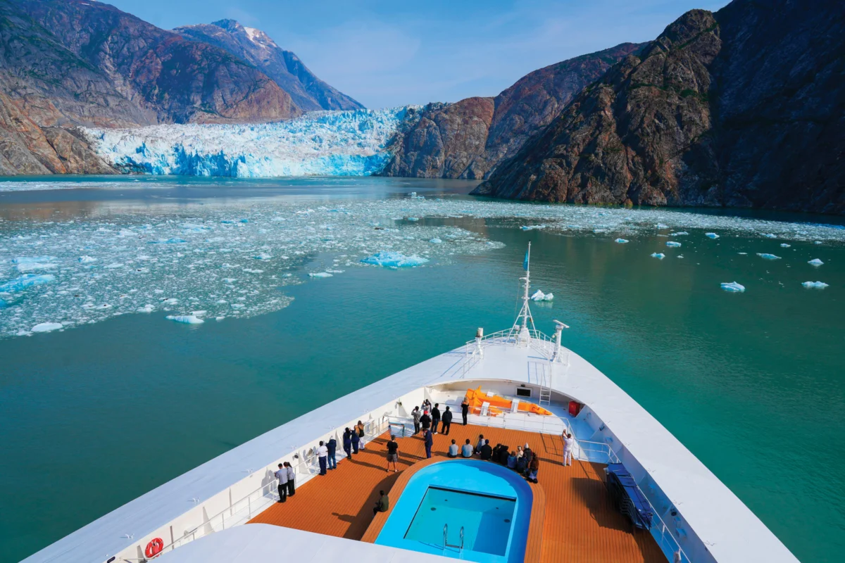
Sasha Calvey experienced the terrifying power of a tsunami firsthand on August 10, 2025, when an early morning sound—like a deep, rapidly approaching waterfall—jolted her awake during a sea kayaking expedition in Southeast Alaska. Camped with two friends on a remote island, 74 days into their journey from Washington, Calvey heard the familiar crashing of waves against the shore, but this new, resonant rumble grew ominously louder until it seemed to shake the very ground beneath their tent. Her instincts screamed for her to investigate, and what she and her companions discovered was a scene of startling devastation.
Fifteen-foot waves had surged inland, inundating the forest where their campsite was nestled. Seaweed lay scattered on the mossy ground beside their tent, a stark indicator of the ocean’s unexpected reach. Just a few steps away, water was draining back towards the gravel beach, revealing that half of their stored food and gear had been swept away. Their kayaks, their primary mode of transport and connection to the outside world, were in disarray: one wedged against a tree, another precariously hanging from a bluff, and the third bobbing in the distance. The trio was fortunate; had the tsunami struck just three hours earlier, when the tide was significantly higher, the water could have surged through their campsite with catastrophic force, potentially sweeping them away. For hours, the water remained turbulent, characterized by powerful swells and disorienting whirlpools, prompting the stranded kayakers to radio for rescue, thereby ending their ambitious trip.
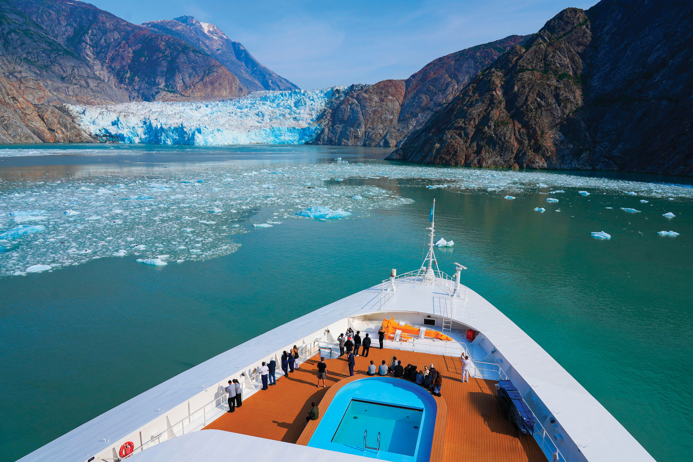
The source of this immense wave was later identified as a colossal landslide, approximately 30 miles away, occurring at the terminus of Tracy Arm fjord. This narrow, winding channel, situated south of Juneau, is known for the receding South Sawyer Glacier. Scientists hypothesize that glacial retreat plays a significant role in destabilizing the surrounding mountainsides, creating conditions ripe for such massive slides. The landslide, which left a dramatic bedrock scar visible above the glacier, generated a tsunami whose run-up—the maximum vertical height the water reached on land—was an astonishing 1,580 feet. This measurement signifies the second-largest run-up ever recorded, stripping vegetation and soil from steep shorelines along the fjord. The remnants of this powerful surge eventually reached Calvey’s campsite, located outside the fjord’s mouth.

This event is not an isolated incident; evidence suggests a concerning increase in landslide-generated tsunamis across Alaska in recent years. In 2015, a similar landslide in Taan Fjord, located about 400 miles northwest of Tracy Arm, produced a tsunami with a 630-foot run-up. Furthermore, a slow-moving landslide near the Barry Glacier in Prince William Sound is currently being monitored, with projections indicating it could potentially generate a tsunami even larger than the one at Tracy Arm. These escalating events are prompting urgent efforts from scientists, land managers, and tour operators to understand and mitigate the risks. With glaciers continuing their rapid retreat globally, this emerging climate-related hazard poses a significant threat to coastal communities, vital infrastructure, and the numerous vessels that navigate Alaskan waters, including the large cruise ships that annually bring nearly two million visitors to the state.
While researching her expedition, Calvey had encountered warnings about tsunamis in Alaska’s fjords, but these were predominantly linked to seismic activity, such as the infamous 1958 event in Lituya Bay that caused a landslide and a staggering 1,720-foot run-up. The possibility of massive, tsunami-inducing landslides triggered by retreating glaciers was not widely publicized, a gap she hopes will be addressed in light of recent events.

The sheer scale of the Tracy Arm landslide’s impact underscores the immense luck of Calvey and her friends. Tracy Arm is a popular destination, drawing over 200 cruise ship visits each summer, with an estimated 500,000 boat-based visitors annually venturing into the Tongass National Forest to witness the grandeur of the Sawyer and South Sawyer glaciers. While the landslide occurred during the early morning hours when visitor traffic is typically light, several vessels were in the vicinity. The cruise ship National Geographic Venture, carrying over 100 passengers, was in Tracy Arm but was approximately 20 miles from the landslide site when it occurred, in deep water and thus unharmed by the initial surge. Had the landslide happened just a few hours later, the Venture would have been closer to the glaciers, a location where passengers often disembark onto skiffs for a closer view. In such a scenario, the potential for devastating 100-foot-high waves filled with icebergs and debris could have annihilated the tour boat and any deployed skiffs.
Christine and Jeffrey Smith, owners of the 65-foot tour boat David B, also experienced a near miss. They had planned to anchor their vessel, with six guests aboard, within five miles of the South Sawyer Glacier the previous evening, putting them directly in the path of the tsunami. However, due to inclement weather, they altered their plans and anchored 45 miles away in the neighboring Endicott Arm. Despite the distance, the tsunami’s effects reached them. While preparing breakfast, Christine Smith observed 10-foot swells suddenly engulf a shoal and witnessed an 80-foot vessel struggling against an unusually strong current. The Smiths’ satellite text to their geologist friend, Jackie Caplan-Auerbach, a professor at Western Washington University, served as the first notification of the Tracy Arm tsunami to the outside world, initiating a swift scientific investigation.

Caplan-Auerbach, who was reviewing seismic data, quickly detected telltale signals of a significant landslide near Angoon, Alaska, a village located about 60 miles west of the David B. This discovery, coupled with data from other seismic stations, allowed scientists to pinpoint the landslide’s location in Tracy Arm. The magnitude of the event became apparent as the tsunami had traveled 45 miles to reach the Smiths’ boat, indicating a massive displacement of water. Intriguingly, Caplan-Auerbach also noted subtle seismic signals emanating from the slope for hours before the main landslide, signals that were too faint to have been noticed without the subsequent, dramatic event. These "precursory" signals, which she has studied for nearly two decades, raise the possibility of their use in future landslide warning systems, though she cautions that predicting landslides remains a complex challenge due to numerous influencing factors and the fact that such precursory signals do not precede every slide.
The ongoing retreat of glaciers worldwide is a critical factor contributing to these geological hazards. Bretwood “Hig” Higman, an independent geologist working with his nonprofit Ground Truth Alaska, has been actively investigating landslides linked to glacial retreat. His work, along with that of numerous other scientists, highlights the concept of "debuttressing," where the removal of glacial ice, which historically buttressed and eroded mountain slopes, leads to instability. As glaciers thin, the supporting ice diminishes, potentially causing steepened slopes to collapse. Climate change exacerbates this process by thawing permafrost and intensifying extreme rainfall events, further increasing landslide risk.

Higman’s research has focused on areas like Portage Lake, an hour southeast of Anchorage, where a slow-moving landslide above Portage Glacier is under intense scrutiny. The Barry Arm landslide, near the Barry Glacier in Prince William Sound, is another significant concern. Researchers warned of its potential to generate a catastrophic tsunami in 2020, leading to the deployment of extensive monitoring equipment, including weather stations, seismometers, and radar systems. This comprehensive monitoring effort, representing millions of dollars in investment, has not only provided real-time data on the unstable slope but has also enhanced the ability to detect more distant landslides, such as the one at Tracy Arm.
The conditions present at locations like Barry Arm and Portage Lake—unstable slopes perched above thinning ice, proximity to large bodies of water capable of generating tsunamis, and the presence of human infrastructure and populations—underscore the escalating risk. At Portage Lake, a visitor center bustles with tourists, and a popular tour boat operates daily, all within the potential path of a landslide-generated tsunami. The visible signs of instability, such as cracks in the ground and the slumping of the slope, are cause for concern. Scientists like Higman and others are working to understand the precise mechanisms and timing of these failures, recognizing that while glacial retreat is a significant precursor, the exact trigger for a catastrophic collapse remains difficult to predict.

The Tracy Arm landslide, detailed in a recent publication in the journal Science, provides a stark example of how rapid glacial retreat can destabilize a mountainside. Satellite imagery revealed that the South Sawyer Glacier withdrew significantly from beneath the doomed slope in the days leading up to its collapse. While scientists like Dennis Staley of the U.S. Geological Survey emphasize that multiple factors, including weather and inherent slope weakness, contribute to landslides, the timing of the glacier’s retreat in Tracy Arm is considered a critical element.
The implications of these events extend beyond scientific observation. Tour operators, local communities, and major cruise lines are reassessing their operations and safety protocols. Following the Tracy Arm tsunami, some tour operators have increased their caution, while major cruise lines have announced they will avoid Tracy Arm in 2026, rerouting hundreds of voyages to neighboring Endicott Arm. Communities like Yakutat, situated between Southeast Alaska and Prince William Sound, are also proactively engaging with scientists to understand local landslide risks, particularly in areas near the Hubbard Glacier, where potential landslides could impact cruise ship routes and the environment.

The need for enhanced monitoring and coordinated emergency planning is evident. Melenda Lekanof, secretary and treasurer of the Yakutat Tlingit Tribe Council, highlights the importance of combining Indigenous knowledge with Western science through initiatives like the Áut Geohazards Project. Traditional teachings about glaciers and tsunamis offer valuable insights, and Lekanof expresses concern over the potential impact of increased human activity, such as cruise ships sounding horns near glaciers, on the local ecosystem and sacred lands. The call for expanded funding for monitoring arrays, similar to the comprehensive system at Barry Arm, is growing, especially in areas like Disenchantment Bay, where the risk of a significant landslide and subsequent tsunami exists. The proactive measures taken by some tour operators, such as evacuating visitors from the Portage Lake visitor center due to heavy rainfall and landslide risk, demonstrate an evolving approach to operating in these dynamic environments. As glaciers continue to recede, the landscape of Alaska is transforming, and with it, the inherent risks that demand continued scientific investigation, community engagement, and adaptive management strategies.