Roger Danuarta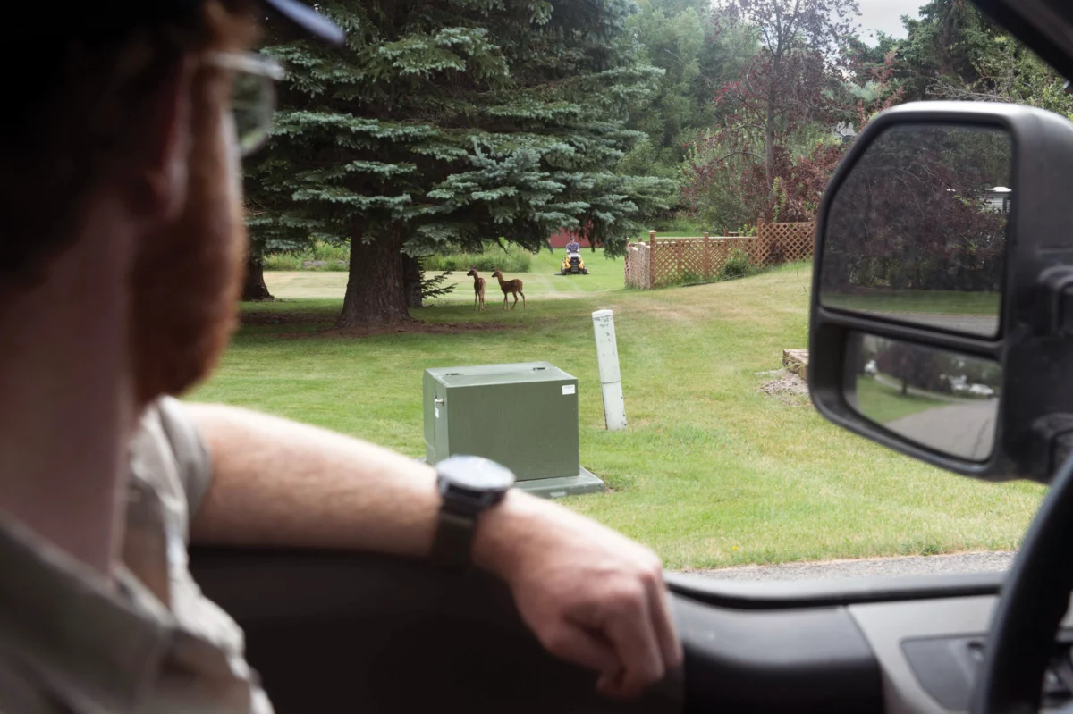
In the rapidly expanding urban landscape of Bozeman, Montana, a critical challenge unfolds where sprawling residential neighborhoods intersect with the rich biodiversity of the Rocky Mountains, leading to an alarming surge in human-wildlife conflicts. On a bright May day, Noah Starling, a dedicated wildlife technician with Montana Fish, Wildlife and Parks (FWP), navigated the fringes of Grafs East Park, a verdant expanse woven into a residential area and connected to Bozeman’s extensive 52-mile trail network, a scene emblematic of the friction between development and nature. A local resident, spotting Starling’s distinctive FWP truck, voiced a common sentiment, noting the irony of abundant deer in his yard that he is prohibited from hunting, highlighting the complex jurisdictional and ethical dilemmas at play.
Starling clarified that while the city holds primary responsibility for wildlife management within its limits, the state’s FWP typically intervenes in more serious encounters involving formidable species like bears and mountain lions, as well as addressing sick or injured deer. The burgeoning population and outward growth of Bozeman into previously undisturbed wildlife habitats have exacerbated these confrontations. The city’s south side, for instance, now harbors an estimated 60 to 80 deer per square mile, a density far exceeding natural levels for many ecosystems. Furthermore, the presence of black bears and mountain lions on Bozeman’s trails, green spaces, and even in backyards has become increasingly common, transforming what were once rare occurrences into routine concerns.

As one of eight FWP staff members designated as "first responders" to these incidents, Starling’s role often involves reacting to events rather than proactively preventing them. This reactive stance frequently culminates in the difficult decision to euthanize animals whose behaviors pose an undeniable risk to public safety. The emotional toll of this aspect of his job is palpable; during the unusually harsh winter of 2022, characterized by deep snow and scarce natural forage, hungry deer ventured onto city streets and highways in unprecedented numbers, resulting in a tragic increase in vehicle collisions. Starling personally had to euthanize as many as six deer daily during that period, totaling around 70 animals. The following summer of 2023 brought similar grim statistics for bears, with Starling euthanizing three in a single day, including one found consuming feed from a large bird feeder outside a Bozeman apartment.
"Teaching bears to be food-conditioned, thus making a dangerous bear, forces our hand as wildlife managers," Starling explained, articulating the profound frustration of his role. "Human safety will always come first, and so often, we end up being the bad guy." This profound personal experience spurred Starling to pursue a master’s degree at Montana State University, where he is now focusing his studies on the intricate dynamics of human-wildlife conflict. He recognized that true solutions require a fundamental shift from reactive intervention to proactive prevention, acknowledging that "realistically, human-wildlife conflict is a human deal. Ultimately, it takes a community to fix it."
As part of his graduate research, Starling is developing an innovative interactive map of Bozeman and its surrounding Gallatin County, designed to pinpoint areas where human-wildlife conflicts are most likely to occur. This sophisticated Geographic Information System (GIS) tool integrates data from past incidents—such as locations of deer-vehicle collisions and instances of bears accessing human attractants like trash cans—with comprehensive habitat suitability data for black bears and two subspecies of deer native to the region. By merging historical conflict hotspots with ecological suitability models, Starling aims to create a predictive framework. This collaborative endeavor, undertaken with Montana FWP and the Gallatin County Planning Office, seeks to equip city, county, and state officials with a powerful resource to prevent future conflicts and, crucially, reduce the number of animals that must be euthanized.

"This is a tool that I hope will give decision-makers a way to know where conflict is occurring," Starling emphasized, highlighting the project’s core objective. "We can’t stop the increase of humans, but we can help increase knowledge." The potential impact of such a tool resonates with existing preventative strategies implemented in other communities. Cities like Missoula, Montana, and Durango, Colorado, for instance, have mandated the use of bear-proof trash cans in specific areas. Local "bear smart" initiatives actively educate residents on the importance of securing attractants, ranging from pet food and bird feeders to barbeque grill grease traps. Durango recently pushed the envelope further by approving an ordinance that permits residents to deploy electric fencing and electrified "unwelcome mats" within city limits as non-lethal deterrents for bears. Bozeman itself already offers bear-proof trash containers for a fee in neighborhoods frequently visited by these large omnivores.
Lisa Upson, executive director of the nonprofit People and Carnivores, lauded Starling’s project, noting its capacity to precisely identify critical areas where such preventative measures are most needed. This localized intelligence would enable officials and residents to address problems holistically across entire communities, rather than merely displacing conflicts from one property to another. "The thing with these issues," Upson explained, "is that if you prevent a conflict on one property, the conflict just moves down the road." By fostering a community-wide approach, the map could cultivate more sustainable and effective solutions.
Beyond immediate mitigation, mapping tools like Starling’s hold significant promise for longer-term urban planning and development strategies. Sean O’Callaghan, Gallatin County Chief Planning Officer and a member of Starling’s master’s committee, affirmed that robust data on conflict probabilities could fundamentally transform how the county prepares for future growth. "Wildlife conflict could happen anywhere, in theory," O’Callaghan stated. "Having data and some predictive tools to help us understand the contributing factors and address them in a more meaningful manner will certainly be helpful." This proactive integration of wildlife considerations into land-use planning represents a crucial step toward sustainable coexistence.

The challenges faced by Bozeman are not unique; they mirror a global phenomenon driven by human expansion. Chris Wilmers, an ecologist at the University of California, Santa Cruz, and leader of the Santa Cruz Puma Project, points out that regional development patterns have historically overlooked the fundamental need for large animals to traverse landscapes. "For 20 to 30 years, throughout the Intermountain West, it’s been 30 acres and a house here, 10 acres and a house there," Wilmers observed. "So, you need a huge amount of land to support that kind of building, and then it takes away all that land from wildlife. This is what is creating massive conflicts." His project, by meticulously tracking mountain lion movements and studying their behavior in the Santa Cruz Mountains, has successfully identified crucial habitat corridors and optimal locations for wildlife crossings, demonstrating tangible ways to mitigate conflicts.
Furthermore, wildlife behavior itself is not static, constantly adapting to environmental pressures. Urbanization and the accelerating pace of climate disruption are driving significant behavioral shifts. Wilmers and his team have documented how mountain lions, while generally reclusive, are increasingly forced to inhabit urban parks and green spaces, where they may prey on domestic cats or raccoons. Similarly, recent research by Julie Young, a professor of ecology at Utah State University, indicates that coyotes residing in and around cities are exhibiting bolder behaviors compared to their rural counterparts, a direct consequence of adapting to human presence.
Climate change introduces yet another layer of complexity and unpredictability, creating what Young describes as a "new norm of no norm." Erratic weather patterns, including extreme droughts, unseasonal freezes, and intense heatwaves, disrupt natural food cycles, making it exceedingly difficult to predict when resource scarcity will compel animals to seek sustenance closer to human settlements. Warming temperatures also alter the seasonal timing of crucial food sources like nuts and berries, while influencing deer birthing cycles. Early evidence even suggests that some carnivores may be adjusting their reproductive patterns in response to these changing conditions. These cascading ecological impacts underscore the urgency for adaptable and forward-thinking wildlife management strategies.

Despite the multitude of variables and the escalating complexity of these interactions, Starling remains optimistic that innovative mapping tools, such as the one he is developing, can serve as a vital blueprint for fostering safer coexistence between humans and wildlife. His vision extends beyond Bozeman, hoping that the success of his model could lead to its expansion across the American West and potentially to other regions facing similar challenges. "Hopefully, if I do this right, this tool may be expanded across the West," Starling concluded, emphasizing a universal truth: "Living with wildlife looks similar across many landscapes; it’s just a matter of people doing it." This commitment to data-driven solutions and community engagement offers a beacon of hope for navigating the intricate path toward a future where both human communities and wild ecosystems can thrive.