Rocky Gerung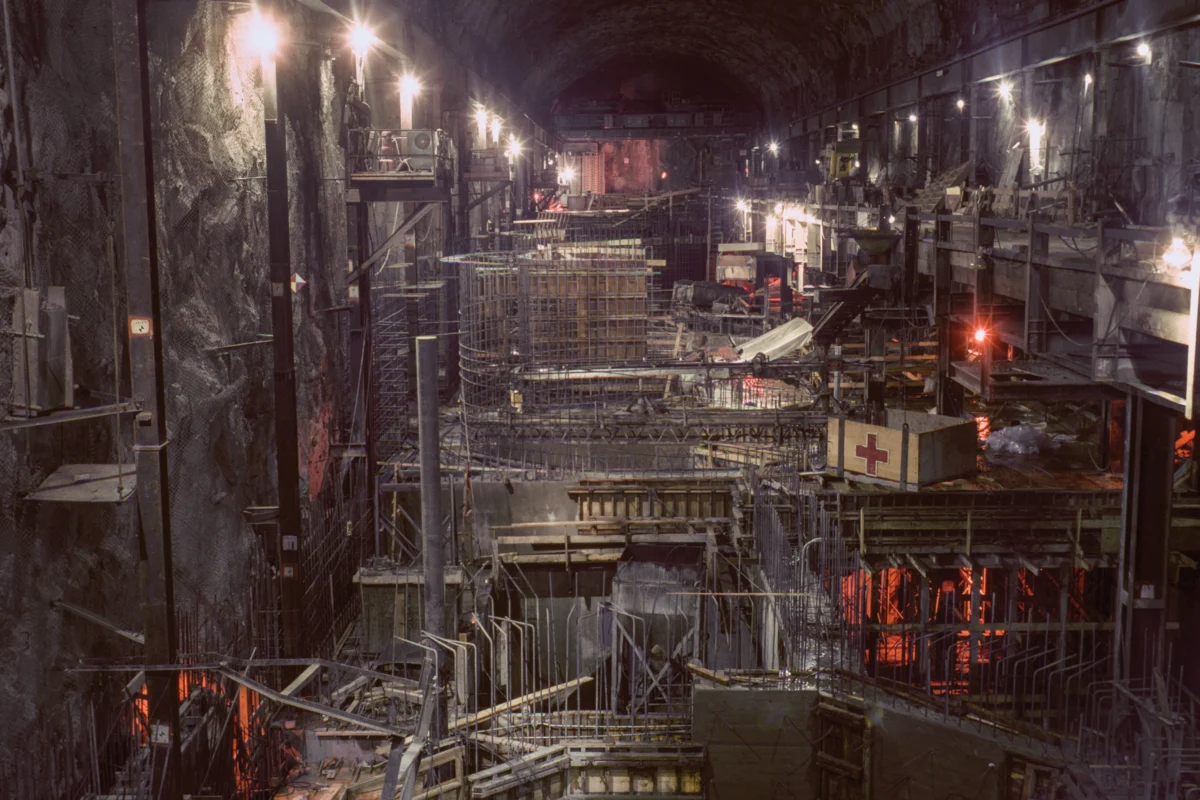
The State Water Project, a colossal undertaking that began in 1961, stands as a testament to mid-20th century American engineering prowess and a bold vision for taming the arid West. This ambitious network, stretching over 700 miles from the northern Feather River watershed to Lake Perris in Southern California, was designed to deliver water to millions and fuel the state’s burgeoning population and agricultural economy. The California Department of Water Resources (DWR) meticulously documented its construction through a vast public photo archive, images that now offer a fascinating glimpse into an era of unbridled optimism and faith in the power of large-scale infrastructure to reshape landscapes and solve complex societal challenges. These photographs, many taken between 1962 and 1968, capture not just the physical construction of dams, canals, and pumping plants, but also a prevailing belief that human ingenuity could overcome natural limitations.

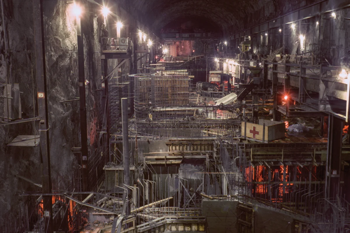
One striking example of this ambition is the Edward Hyatt Powerplant, nestled near the Oroville Dam in Butte County and completed in 1967. This facility, part of the State Water Project, exemplifies a sophisticated pumped-storage operation. Water is released from Lake Oroville to generate electricity when demand is high, and then pumped back into the reservoir during off-peak periods, maximizing power production and optimizing water management. Similarly, the Dos Amigos Pumping Plant, completed in 1966 in Merced County, played a crucial role in the California Aqueduct’s journey southward. Workers were captured assembling rebar for its discharge lines, illustrating the intensive labor involved in lifting waters over 100 feet to continue their flow. The construction of diversion tunnels for the Oroville Dam, also photographed in detail, highlights the intricate processes required to manage river flows during dam construction, tunnels that would later serve a vital role in discharging water from the Edward Hyatt Powerplant. These images collectively paint a picture of a state actively engaged in a monumental effort to engineer its own destiny, transforming the natural environment to meet human needs.

The visual narrative conveyed by these photographs goes beyond mere technical documentation; it speaks to a profound sense of political and social aspiration. As anthropologist Brian Larkin notes, such grand infrastructure projects carry significant aesthetic and symbolic weight, often rearranging priorities so that the visual and conceptual impact of infrastructure takes precedence over its purely technical function. The mid-20th century witnessed a public embrace of such grand public works, a collective rally behind the spectacle of human achievement. This era of optimism, predating the widespread environmental consciousness sparked by Rachel Carson’s "Silent Spring" in 1962, saw massive projects like the State Water Project as solutions to pressing resource scarcity. They were presented not just as utilitarian necessities but as symbols of national or, in California’s case, a colossal state’s capacity to conquer challenges and secure a prosperous future.

The State Water Project’s intricate network originates at the confluence of the Sacramento and San Joaquin rivers in the Sacramento-San Joaquin Delta. This vital estuary, a complex web of over a thousand miles of levees, 50 reclaimed islands, and hundreds of miles of waterways, serves as the critical nexus for both the federal Central Valley Project and the southern portion of the State Water Project. The captured delta water fuels two massive concrete arteries that traverse the state, a system that has been the focal point of California’s water politics for decades. Erwin Cooper, a former information officer for the DWR, aptly dubbed this transformation an "Aqueduct Empire," a phrase that captures the sheer scale and ambition of the project. The photographs from this period visually narrate this imperial reach, showcasing the profound alteration of the California landscape.

The optimism embedded in these images, however, stands in stark contrast to the environmental realities of the 21st century. The mid-century confidence in human control over nature has been profoundly challenged by the escalating impacts of climate change and the long-term consequences of intensive water resource development. What were once celebrated as marvels of engineering and symbols of progress are now often viewed as aging infrastructure, increasingly vulnerable to the strains of a changing climate. The significant failure of the Oroville Dam’s spillway in 2017, which necessitated the evacuation of nearly 200,000 residents, serves as a stark reminder of the potential risks associated with these massive, complex systems. The historical context of these photographs, produced at the cusp of the modern environmental movement, highlights a significant shift in public perception, where the elimination of certain water infrastructures, like the recent removal of the Klamath dams, is now sometimes celebrated more readily than their construction.

The DWR’s Photography Unit continues its work today, with a dedicated team of photographers documenting the state’s water management efforts. Bill Kelley III, the unit’s archivist, oversees the painstaking process of scanning an immense backlog of negatives and slides, a task that represents a significant commitment to preserving the visual history of California’s water endeavors. Kelley estimates that hundreds of thousands of images await digitization, a project that underscores the long-term dedication to documenting the state’s relationship with its most precious resource. He notes that these photographs initially served as engineering research but have evolved into a crucial tool for justifying the DWR’s ongoing work and its continued relevance. The sheer volume of visual material produced over seven decades speaks volumes about the political power inherent in imagery, with the Photography Unit acting as both a historical record and a strategic asset for the department.

California’s population has more than doubled since the State Water Project was approved in 1960, from 16 million to over 39 million today. This dramatic growth has exacerbated the perennial challenge of balancing the state’s water supply with its demand, particularly given that the majority of its population resides south of the capital, while the bulk of its precipitation falls to the north. The history of California is intrinsically linked to its water resources, from the gold rush era to the current climate crisis. These photographs, therefore, do more than simply chronicle historical construction; they represent an ongoing narrative of California’s pursuit of an idealized future—a utopia where water flows perpetually to sustain its agricultural heartland, vibrant cities, and robust industries, perpetually defying the region’s inherent aridity. The ambition to engineer the environment on such a grand scale is undeniable, yet the fundamental reality of the West, situated on the dry side of the 100th meridian, continues to pose a profound challenge to this vision, irrespective of the ingenuity of its infrastructure or the artistry of its documentation. The enduring tension between human ambition and natural constraints remains a defining characteristic of the California experience.