Rocky Gerung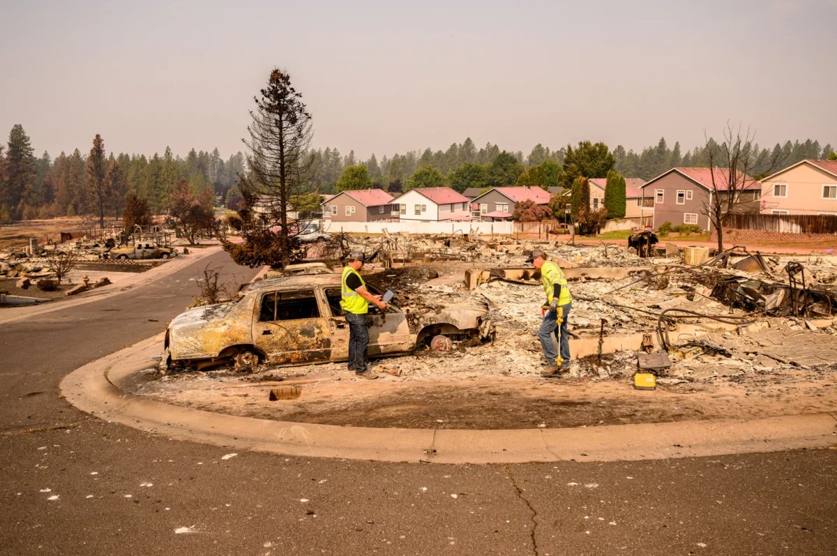
An initial ember, fanned by powerful winds, ignited a devastating blaze that surged across the Spokane River, transforming a portion of Spokane, Washington, into a scene of destruction. The Old Trails Fire, which began near Riverside State Park and is under investigation for alleged arson, rapidly advanced into the Indian Trail neighborhood, necessitating widespread evacuations on Saturday afternoon. The inferno, along with the Autumn Lane Fire in the Suncrest area and the Fairview Fire in Mead, continues to rage, impacting over 10,000 acres collectively as of Tuesday, according to data from the fire tracking app Watch Duty. Spokane Mayor Lisa Brown described the fires as "the worst natural disaster the region has faced," a stark assessment underscoring the scale of the unfolding crisis. Initial reports from the Spokesman-Review indicated that between 700 and 1,100 structures were lost across these three ongoing fires.
These catastrophic events are unfolding within what fire experts term the "wildland-urban interface" (WUI), a zone characterized by high fire risk where human development intersects with natural landscapes abundant in flammable vegetation like trees, grasses, and brush. This definition, as clarified by FEMA, encompasses the transitional area between undeveloped land and populated areas, often conjuring images of remote mountain towns or isolated rural homesteads. However, the Old Trails Fire serves as a potent illustration that the WUI is not confined to remote locales; it extends deeply into suburban environments, redefining our understanding of where such risks are most acute.
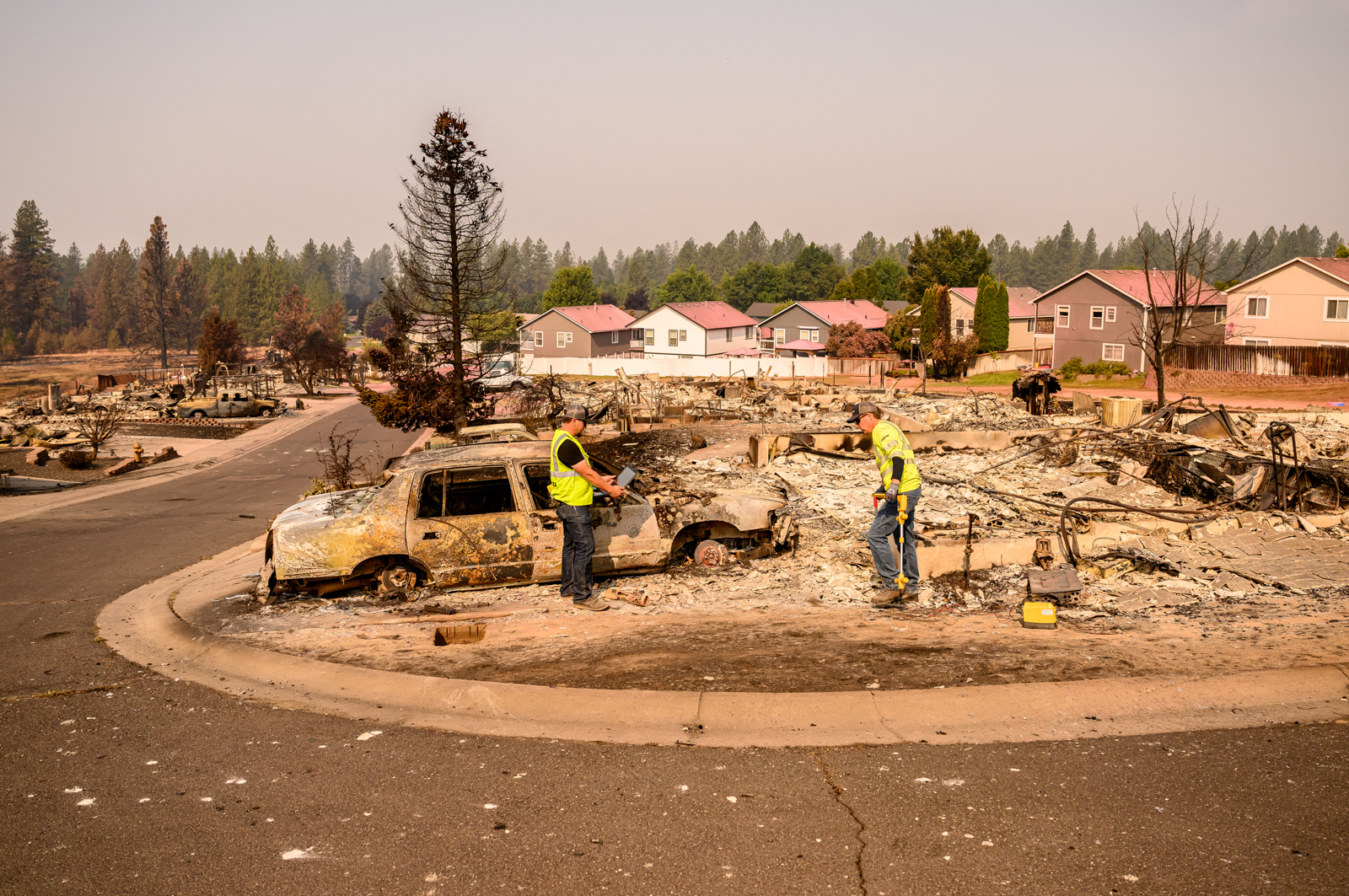
This phenomenon is not isolated to Spokane, as recent years have witnessed similar urban-wildfire conflagrations. The Eaton and Palisades fires in the Los Angeles area in January 2025 and the 2021 Marshall fire in Colorado, which became the costliest wildfire in that state’s history, serve as chilling precedents. Each of these incidents was ignited on the periphery of suburban areas and rapidly propelled into residential neighborhoods by strong, gusty winds, vividly demonstrating the vulnerability of communities under specific environmental conditions. The sheer speed at which these neighborhoods can ignite underscores the critical need for robust preparedness strategies.
The Indian Trail neighborhood, a suburban enclave in northern Spokane largely developed between the 1980s and the 2010s, represents a significant portion of a broader development trend across the Western United States in fire-prone regions. These neighborhoods, characterized by their blend of residential housing, recreational facilities like sports complexes, educational institutions, community gathering places such as churches, and everyday amenities like grocery stores, are often perceived as safe havens. Yet, their proximity to natural areas, like the adjacent state park trails that are a popular draw for residents, places them directly within the WUI. Indian Trail’s location, approximately 15 minutes from downtown Spokane, a city with a metropolitan population exceeding 600,000, further emphasizes the pervasive nature of the WUI in seemingly well-established urban and suburban settings.
The prevalence of housing situated within the wildland-urban interface is a growing concern nationwide. According to 2020 research from the U.S. Forest Service, nearly one-third of all housing units in the United States are located in these high-risk zones. This trend is amplified by the increasing frequency and intensity of wildfires, a phenomenon widely attributed to climate change, which is priming landscapes for more extreme fire behavior. As global temperatures rise and weather patterns become more volatile, areas previously considered low-risk are finding themselves increasingly exposed to the devastating impact of wildfires.

FEMA maps indicate that much of northern Spokane, extending eastward towards the major arterial street Division Street, faces a significant risk of ember-driven wildfires. Further analysis from Forest Service maps reveals that homes within Spokane County exhibit a higher fire risk than those in approximately 82% of counties nationwide. Intriguingly, some of the areas most severely impacted by the Old Trails Fire were previously classified as having only moderate fire risk, and substantial portions of the evacuated zones were even designated as low risk. This discrepancy highlights the complex and often unpredictable nature of wildfire behavior, particularly when influenced by extreme weather events.
In Spokane’s case, the critical factor exacerbating the fire risk was the presence of high winds. For the first time in Washington state’s history, the National Weather Service issued a "particularly dangerous situation" warning, underscoring the extreme fire weather conditions. These same powerful winds that fueled the fires in Spokane contributed to the ignition of multiple other wildfires across north-central Washington. Among these were the Sinlahekin Fire, which had grown to nearly 74,000 acres by August 3rd, the Little Giant Fire, which impressively spanned Lake Chelan following weekend growth, and the Kaiser Canyon Fire on the Colville Indian Reservation, which had surpassed 136,000 acres at the time of reporting.
The pervasive smoke emanating from these widespread fires has drifted across the northern Rockies, blanketing communities and serving as a stark reminder of the interconnectedness of environmental challenges. Communities throughout the Western United States are now acutely focused on wildfire preparedness, with an increased sense of urgency among those whose neighborhoods may have previously been considered impervious to such threats. The events in Spokane underscore a critical need for enhanced public awareness, updated building codes in fire-prone areas, improved land management practices, and robust emergency response strategies to mitigate the escalating risks posed by the expanding wildland-urban interface in an era of climate change. The rebuilding efforts in Spokane will undoubtedly be long and arduous, but the lessons learned from this devastating event have far-reaching implications for communities across the nation grappling with similar vulnerabilities.