
 Rocky Georgio
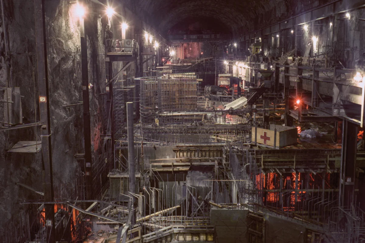
The ambitious undertaking of California’s State Water Project, initiated in 1961, stands as one of the most significant water infrastructure endeavors in American history. This colossal network, stretching over 700 miles from the Feather River watershed in Northern California to Lake Perris in the south, was completed with the first water deliveries reaching Southern California in 1972, symbolizing a mid-20th-century triumph of engineering and a bold vision for a thriving arid West. The project’s construction, meticulously documented by the California Department of Water Resources (DWR) through an extensive public photo archive, captured a powerful narrative of the state’s belief in its capacity to overcome natural limitations. These images, imbued with a sense of majestic optimism, celebrated a technological prowess that aimed to fundamentally re-engineer the landscape to secure water for its burgeoning population and economy.

The Edward Hyatt Powerplant, a crucial component of the State Water Project located near Oroville Dam, was completed in 1967. This facility exemplifies the project’s multifaceted design, maximizing power generation through a sophisticated pumped-storage operation. During periods of surplus energy, water is pumped back into Lake Oroville, and during peak demand, this stored water is released to generate electricity. This dual function not only provides power but also contributes to the overall management of the state’s water resources, a testament to the forward-thinking engineering of the era.

The construction phase of the project involved numerous critical sites, including the Dos Amigos Pumping Plant on the California Aqueduct-San Luis Canal in Merced County. Completed in 1966, this facility was instrumental in lifting water more than 100 feet, enabling its continued journey southward. The meticulous assembly of rebar for discharge lines at this site, as captured in photographs from March 12, 1965, highlights the sheer scale and detailed labor involved in building such a vast system. Similarly, the construction of the Oroville Dam Diversion Tunnels in Butte County, photographed on August 30, 1963, reveals the monumental efforts required to manage water flow during dam construction. Initially built to divert the Feather River, these 35-foot diameter tunnels were later plugged but now serve to discharge water from the Edward Hyatt Powerplant, showcasing the enduring utility and adaptability of the project’s infrastructure.

The South Bay Aqueduct Surge Tank, painted by a worker on May 7, 1965, in Alameda County, is another example of the project’s extensive reach, with vital components situated to manage water pressure and flow across diverse terrains. These images, taken between 1962 and 1968, predate the widespread environmental consciousness sparked by Rachel Carson’s "Silent Spring," reflecting a period when grand infrastructure projects were viewed with unreserved public admiration. They embody a post-World War II confidence, a belief that human ingenuity could conquer natural challenges, particularly the pervasive issue of water scarcity in the American West. As anthropologist Brian Larkin has observed, such large-scale infrastructure projects possess a significant aesthetic dimension that transcends their technical functions, serving to "rearrange the hierarchy of its functions so that the aesthetic dimension of infrastructure (rather than its technical one) is dominant." This political work, embedded in the visual grandeur of the aqueduct, underscored a societal willingness to rally behind public works, a sentiment that has shifted considerably in recent decades, with contemporary discussions often favoring the removal of dams, such as the ongoing efforts with the Klamath dams, over their construction.

The Sacramento-San Joaquin Delta, a critical confluence where the Sacramento and San Joaquin rivers meet before emptying into the San Francisco Bay, serves as the nexus for both the federal Central Valley Project (CVP) and the southern segment of the State Water Project (SWP). This intricate network of over a thousand miles of levees, 50 reclaimed islands, and 700 miles of waterways, spanning an area comparable to Rhode Island, has been a focal point of California water politics for over 70 years. The photographs of the California Aqueduct, part of what former DWR information officer Erwin Cooper termed an "Aqueduct Empire," vividly illustrate the profound transformation of the California landscape, a testament to the state’s ability to redirect and control its most precious resource.

The political vision that fueled the State Water Project is evident not only in its operational scale but also in the very way its construction was presented. The project emerged during a pivotal moment in American history, just as the environmental movement was gaining momentum with the publication of "Silent Spring." However, the optimistic outlook of the 1960s, which saw these massive structures as symbols of progress and problem-solving, has increasingly collided with the stark realities of the 21st century. Climate change, prolonged droughts, and the over-allocation of water resources have taken a significant toll on the Western landscape, prompting a re-evaluation of the long-term sustainability of such monumental engineering feats. The very infrastructure that once symbolized hope and ambition now faces scrutiny as aging systems in need of constant repair, a vulnerability starkly highlighted by the 2017 Oroville Dam spillway crisis, which necessitated the evacuation of nearly 200,000 residents.

The B.F. Sisk Dam and San Luis Reservoir, a joint-use facility managed by both the federal Bureau of Reclamation and the California Department of Water Resources, represents another key element of this vast water management system. Photographed on August 16, 1966, its completed inlet and outlet works, connected by a long access bridge, underscore the integrated nature of the project. The Whiskeytown Dam, an earth-fill structure, and its associated "Glory Hole" overflow drain, completed by the U.S. Bureau of Reclamation in 1963 and dedicated by President John F. Kennedy, further illustrate the extensive network of dams and reservoirs designed to capture and control water across the state.

The Delta Pumping Plant, the first major facility constructed for the California State Water Project, captured on July 2, 1965, shows a family observing its development, a scene that reflects the public engagement with these transformative projects. These photographs, therefore, are more than mere historical records; they chronicle California’s persistent pursuit of a utopian ideal – a vision of perpetual abundance where water flows effortlessly to sustain its farms, cities, and industries, defying the region’s inherent aridity and securing a prosperous future. This ambition, however, is continually tested by the fundamental geographical reality of the West, situated on the dry side of the 100th meridian, a fact that challenges the sustainability of this engineered utopia, regardless of the scale of the infrastructure or the optimism conveyed by the images.

The DWR’s Photography Unit, still active today with six photographers and an archivist, plays a vital role in documenting the state’s water management efforts. Bill Kelley III, the unit’s archivist, works in a windowless room at the department’s Sacramento headquarters, meticulously scanning a vast collection of negatives and slides. Kelley estimates that over 250,000 images await digitization, a task that will likely continue for years to come. He notes that while these photographs initially served as engineering research, the DWR’s commitment to maintaining this archive is crucial. The sheer volume of work produced by this small unit over seven decades speaks to the enduring political power of photography, serving not only as a visual record but also as a tool to advocate for the department’s ongoing initiatives and expansion.

California’s population has surged from 16 million at the time the SWP was approved in 1960 to an estimated 39 million today, exacerbating the inherent imbalance between its inhabitants and its water resources. This challenge is particularly acute given that over 90% of the state’s population resides south of Sacramento, while approximately 75% of its rainfall occurs in the northern regions. The history of California is inextricably linked to its water, from the Gold Rush era to the present-day crisis of climate change. The photographs of the State Water Project serve as a powerful reminder of the state’s historical approach to water management, an approach characterized by ambitious engineering and a persistent belief in its ability to shape its environment. Yet, as the West grapples with increasing aridity and the consequences of past development, the long-term viability of this "Aqueduct Empire" and the utopian vision it represents remains a subject of critical examination.