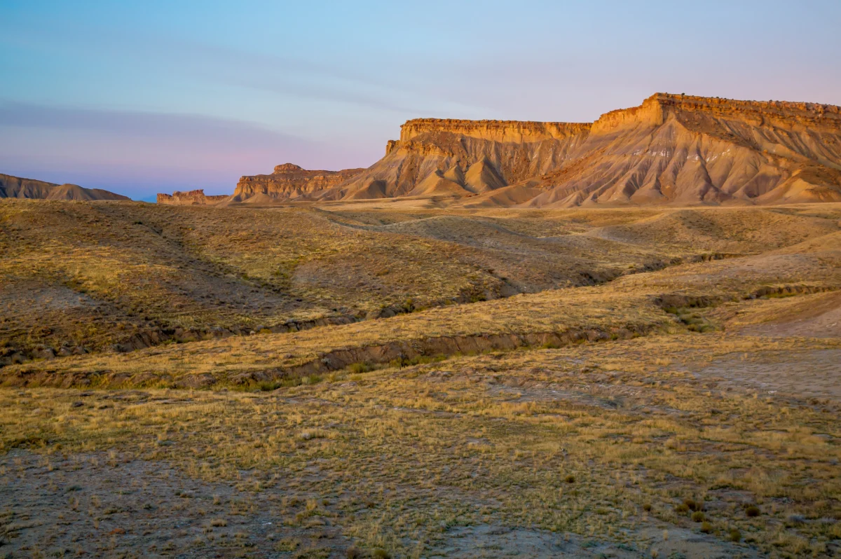

Across the rugged expanse of California’s Los Padres National Forest, from its chaparral-dotted valleys to its windswept coastal ridgelines, trails etched into ancient sandstone embody a profound fragility, now exacerbated by the relentless march of climate change. These pathways, some dating back to the footsteps of the Chumash people long before European colonization, others remnants of early U.S. Forest Service fire patrols, cattle drives, and mining prospecting, were never engineered for permanence. Sections of these historic routes precariously cling to steep slopes, seemingly defying gravity, yet yielding soil and stone with each successive winter storm. Careful observation reveals the ghost of old bench cuts and hand-built retaining walls, now half-buried or swallowed by encroaching manzanita, testaments to a bygone era of trail-building ingenuity.

Today, this inherent vulnerability has accelerated dramatically. Prolonged droughts intensify, followed by atmospheric rivers that unleash torrential floods, carving deep drainages into the sandstone and obliterating entire trail segments overnight. What remains is a sprawling network increasingly defined by the forces of erosion and abandonment rather than the diligent oversight of the agencies mandated to sustain it. The ground truth often contradicts official maps; trails listed as open on federal databases simply vanish, consumed by landslides or dense vegetation. This discrepancy has profound implications, as a single missing trail line in a dataset can translate into hundreds of thousands of dollars lost in federal budget requests, directly tied to the total mileage an agency’s database claims to manage. Conversely, an "open" symbol on the U.S. Geological Survey’s National Map can mask years of storm damage and neglect, while painstakingly cleared corridors can become impassable within a single season without constant, dedicated maintenance.
The U.S. Forest Service, a cornerstone of American conservation, stewards an immense infrastructure: over 370,000 miles of roads, enough to circumnavigate the Earth nearly fifteen times, and approximately 160,000 miles of trails, representing a staggering 85% of all federal land trails. Yet, this vast network faces a critical deficit. A 2013 Government Accountability Office report revealed that merely 25% of these trails met the agency’s standards for maintenance, public safety, and environmental integrity. More concerning still, only 37% of the national trail network receives any maintenance attention annually, consigning countless miles to fade from both the physical landscape and public consciousness. This systemic neglect mirrors challenges faced by public land management agencies in other developed nations, from Canada’s vast wilderness parks to Europe’s extensive national forest systems, all grappling with the dual pressures of increasing climate impacts and constrained resources.

The alarming state of America’s trails was starkly illuminated in December 2025, when an internal Forest Service report surfaced, detailing a crisis within the agency’s trail program. The "Trail Program Status Report" painted a grim picture: districts reported losing up to 100% of their trails staff, resulting in the forfeiture of hundreds of years of invaluable trail expertise. The report cited "widespread burnout and declining morale" among remaining personnel, with trail miles maintained plummeting by 22% below average and the number of miles meeting maintenance standards dropping by 19%—the lowest levels recorded in 15 years. This human toll directly translates into a diminished capacity to manage and restore vital public access points.
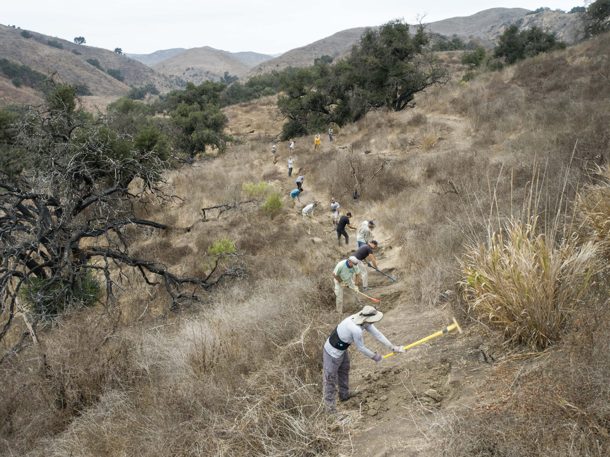
Decades of chronic underfunding have undeniably contributed to this escalating decay. A 2022 Congressional report estimated a staggering $460 million backlog in trail maintenance alone, part of a larger, overarching $10.8 billion infrastructure deficit plaguing the agency. This financial shortfall, coupled with the escalating frequency and intensity of natural disasters—wildfires, floods, and devastating insect infestations—erases critical infrastructure faster than staff can possibly rebuild it. Across the Western United States, and indeed nationwide, a patchwork of dedicated volunteers and small non-profit organizations has stepped into the breach, becoming the de facto caretakers of these national treasures, performing essential work that federal agencies can no longer sustain.

The immediate consequences of this deferred maintenance are palpable. In late summer, a personal journey into the Los Padres National Forest north of Santa Barbara sought to verify a trail clearly marked on both the National Map and commercial paper maps. What should have been a well-trodden path, pressed by centuries of foot and hoof prints, had been utterly consumed by chaparral and agave. Boots sank into soft dust, following only the faintest suggestion of a ridgeline, until the dense brush formed an impenetrable wall. Pushing through thorny chamise and crawling under agave fronds, the trail bed, according to every official source, should have been directly beneath hands and knees. Yet, it was gone—a corridor so utterly neglected it had become indistinguishable from the surrounding hillside. This microcosm of neglect in Los Padres, where volunteer crews now shoulder much of the burden for hundreds of miles of trails, illustrates how countless routes, and their histories, are being erased.
The systemic contraction of the Forest Service workforce underpins much of this decline. Staffing reports from 2019 indicate a roughly 20% reduction over the past three decades, with an additional 10% decrease in full-time personnel during the Trump administration due to layoffs. While a recent Congressional appropriations bill offered a reprieve from the most drastic proposed budget cuts, the core issue of understaffing persists. Recreational trail staff, once a robust component of the agency in the 1980s, has dwindled dramatically, with many districts now reporting zero or just one permanent recreation staff member and fewer than three seasonal employees to oversee hundreds of miles of trail. A confidential internal report from July 2025 concluded that each of the agency’s nine regions faced up to an 80% deficit in trail and recreation workers. This human cost was echoed by anonymous rangers in the December report, one lamenting, "We lost 200 years of trail experience this year," and another contemplating an end to a multi-decade career, stating, "It feels like 24 years of trails and wilderness work rolling back to the bottom of the hill."

The immense dedication of volunteers underscores the value Americans place on access to public lands. In fiscal year 2023 alone, a staggering 71,660 volunteers contributed 2.6 million hours of service to the Forest Service—more than double the hours logged by agency employees. While this tidal wave of donated labor is invaluable, it can only slow, not reverse, the cumulative decline of infrastructure compounded by decades of mismanagement and underinvestment. At the highest echelons of government, the issue garners bipartisan acknowledgment. During his Senate confirmation hearing, Secretary of the Interior Doug Burgum emphasized the critical need to address the maintenance backlog, stating, "We just have to make sure not just the national parks, but across the whole department, we have to get the formulas right, because we are creating liabilities for future generations if we are not taking care of that deferred maintenance."
Our reliance on maps as definitive guides to our shared inheritance—marking where we can go, what is real, and what laws guarantee access—is being challenged. These governmental cartographic resources guide wildfire response and inform billions in recreation spending. Yet, for decades, even federal land managers have struggled to pinpoint where legal access truly exists, with vital information often trapped in handwritten easements in filing cabinets, decades-old agreements never digitized, or trails appearing on one map but absent from another. Recognizing this critical disconnect, Congress passed the bipartisan MAPLand Act (Modernizing Access to Our Public Land) in 2022. This legislation mandated that the Forest Service, Bureau of Land Management, National Park Service, and Fish and Wildlife Service locate, digitize, and publicly release all recorded access easements, trails, roads, and boundaries by 2027. The objective is clear: consolidate a century of fragmented records into a single, authoritative digital basemap.

However, the implementation of the MAPLand Act is proving far more complex than its mandate suggests. The National Map currently lists approximately 300,000 miles of official public land trails. In contrast, OpenStreetMap, the public, volunteer-driven dataset underpinning popular private navigation apps like Gaia GPS, Strava, Apple Maps, and AllTrails, shows hundreds of thousands more, encompassing both sanctioned routes and informal paths generated from user GPS data. Errors and omissions in federal datasets directly propagate into these widely used apps, creating confusion and potentially unsafe situations. Conversely, the proliferation of unsanctioned, user-generated trails feeds back into agency workloads, complicating maintenance priorities and further stretching already meager resources. The latest MAPLand implementation update, presented in September, revealed that while agencies have made strides in compiling existing digital layers, vast swaths of paper maps, access agreements, and legacy easements remain undigitized. Crucially, the Forest Service has not met its annual goal of verifying 1% of its trails in the field since 2012, indicating a deep-seated disconnect between digital ambition and on-the-ground reality.
While the effort has not entirely stalled, with Interior Secretary Burgum redirecting limited funds towards digitization despite broader budget cuts, this political momentum has yet to resolve the fundamental problem: a severe lack of personnel on the ground. The emerging basemap, though ambitious, remains incomplete and often inaccurate. Current funding primarily supports the compilation of existing digital layers, not the costly and time-consuming deployment of staff into the field to research paper records and rediscover trail segments lost to the system decades ago. This prioritization risks producing a visually polished digital product that, while appearing authoritative, ultimately obscures the very gaps and inaccuracies the MAPLand Act was designed to rectify. The public may thus inherit a seemingly comprehensive map that masks a reality of inaccessible or non-existent trails.

The ramifications of the Forest Service’s underfunding manifest in diverse forms across the nation. In Oregon’s Oakridge-to-Ashland corridor, for instance, a combination of prolonged drought and widespread beetle kill—a problem exacerbated by climate change delaying autumn freezes—has left vast slopes blanketed with standing dead trees. When fierce winter windstorms sweep through, hundreds of thousands of these beetle-killed trunks topple like matchsticks, burying trails under impenetrable tangles of blowdown. Crews returning each spring find once-beloved routes impassable for months, sometimes years. The sheer scale of this disturbance overwhelms even fully staffed trail crews, let alone volunteer groups. Beyond access, these downed trees also dramatically increase the forest’s susceptibility to catastrophic wildfires, creating a dangerous feedback loop.
Perhaps no threat looms larger over the forests of the West than wildfire. A 2023 report by the Outdoor Alliance, "Wildfire and Outdoor Recreation in the West," found that over 5,000 miles of trail are impacted by wildfire annually. Colorado’s 2020 fire season, the worst on record, scorched more than 665,000 acres and over 200 miles of trail. With extreme fires now six times more common than in the 1990s, many trails simply vanish beneath deadfall and unstable, burned-out slopes. Post-fire landscapes introduce a second wave of destruction: massive tree fall, highly unstable slopes prone to sloughing off during subsequent storms, and pervasive safety hazards that can keep entire trail networks closed for extended periods. While millions of dollars flow through the federal Burned Area Emergency Response (BAER) program to protect roads, culverts, and utilities, trail reconstruction rarely receives adequate funding, leading to the functional disappearance of many routes. Colorado’s 2020 Cameron Peak Fire, one of nine significant wildfires in the Roosevelt National Forest over the last decade, exemplifies this challenge, burning hundreds of miles of trail in a high-recreation-use district. Volunteers tirelessly work to restore what they can, often with the tacit understanding that another fire is almost guaranteed, making their efforts feel Sisyphean.

Federal agencies like the Forest Service are frequently criticized for perceived failures in effective public land management, often providing a rationale for further budget cuts. As Jamie Ervin, senior policy manager at the Outdoor Alliance, observes, "Agencies’ ability to respond to increasingly worsening climate disasters is hamstrung. Even with good intentions from local staff and volunteers, as well as funding from Congress in the case of disaster relief, a lessened Forest Service staff cannot organize to restore public land infrastructure for years after wildfire or hurricanes." This highlights a critical disconnect: climate change is now outpacing not only the physical infrastructure on the ground but also the institutional capacity designed to care for it. A stark illustration unfolded in North Carolina after Hurricane Helene, when torrential rains triggered devastating landslides in the Pisgah and Nantahala National Forests. Trails were buried under tons of mud, bedrock fractured, and timber toppled, with entire segments vanishing overnight. With roads, bridges, and community infrastructure across western North Carolina also devastated, emergency funds and agency staff were necessarily diverted to protect vital travel corridors and utilities. Public land trails, already burdened by years of deferred maintenance, plummeted to the bottom of the priority list. Many remain closed, not solely due to the complexity of the work, but because no dedicated crews exist to reopen them, underscoring how swiftly a maintenance backlog can escalate into a complete loss of public access. Climate events, in this manner, do more than reshape the physical landscape; they divert critical attention and scarce resources away from its ongoing stewardship.
While it is tempting to solely attribute these losses to governmental shortcomings, users of public lands also bear a degree of responsibility. All too often, outdoor recreation culture—and the burgeoning industry that profits from it—has fostered a mindset of entitlement rather than stewardship. People enjoy access to public lands with little engagement in the labor or funding required to maintain them. Americans collectively spend an estimated $1 trillion annually on outdoor recreation. Yet, the specific federal accounts dedicated to funding the physical foundation of this activity—roads, conserved landscapes, and trails—are so woefully limited that their combined totals are often smaller than the annual operating budgets of some individual state park systems. This stark disparity underscores a fundamental imbalance in how we value and invest in our natural infrastructure.

The ideal resolution to this complex crisis would involve federal agencies and the public working in concert to maintain trails as living infrastructure. This would be guided by accurate, up-to-date mapping and supported by full Congressional funding commensurate with the scale of the challenge. Outdoor recreationists could also play a more proactive role, potentially through the implementation of an excise tax on outdoor gear or other dedicated funding streams that directly support public lands, akin to how hunters and anglers have consistently fueled federal conservation efforts through excise taxes and license fees for decades.
Maps, in their essence, are more than mere charts of terrain. They function as a profound social contract between the public and the agencies entrusted with stewardship: a promise that what is depicted can be found, utilized, and defended. Each trail represents not just an opportunity for recreation but a vital chance to remain connected with the landscape and the nation’s rich history embedded within it. As the physical terrain transforms at a pace far exceeding the capacity of maps or management budgets to keep pace, that foundational contract frays. When landscapes become inaccessible, when their integrity is no longer believable, people lose their ability to advocate for them. We have inherited an expansive network of roads, trails, and easements carved through virtually every U.S. ecosystem. While some may naturally and deservedly fade back into the wilderness, others represent critical lifelines for access, identity, and ecological health. The profound challenge before us is to discern which lines to maintain, which to thoughtfully erase, and which to fiercely fight to redraw, recognizing that every map revision carries a significant moral weight and shapes the future of America’s cherished public lands.