Rocky Gerung
Rising majestically from the northern California landscape, Mount Shasta stands as a solitary sentinel, its imposing peak unmarred by neighboring mountains that might diminish its grandeur or offer a sense of scale. Visible from over a hundred miles south, its snow-capped summit pierces the sky above the rolling oak savanna, evoking comparisons to the iconic Lonely Mountain from J.R.R. Tolkien’s "The Hobbit," a sentiment even underscored by a nearby 20-foot metal dragon sculpture. This iconic stratovolcano, a dormant giant, is not merely a geological marvel but a crucial indicator of environmental shifts, particularly concerning its seven named glaciers, including the Whitney Glacier, the longest in California and a landmark of early scientific exploration.
The Whitney Glacier holds a significant place in American geological history, having been identified by Clarence King’s U.S. Geological Survey expedition in the 19th century. King described Mount Shasta in glowing terms for The Atlantic Monthly, noting its "colossal cone of a burned-out volcano" crowned with "a cap of solid white." An 1870 photograph of the Whitney Glacier vividly captures its past glory, showcasing vast expanses of ice crisscrossed by deep crevasses. However, this image, like many historical records of glaciers worldwide, now serves as a poignant testament to a disappearing natural phenomenon.
Today, the glaciers of Mount Shasta, mirroring a global trend, are in a state of significant retreat. Once symbols of enduring permanence, associated with the phrase "glacial pace," they are visibly dwindling year by year. While this diminishment unfolds at a rate imperceptible to the casual observer on a human timescale, it represents an alarmingly rapid transformation from a geological perspective. For a child born today, the current diminished and fragmented state of Shasta’s glaciers might easily be perceived as their natural, unchanging form, a phenomenon scientists refer to as "shifting baseline syndrome." This psychological adaptation to worsening environmental conditions, a gradual acclimatization to loss, can obscure the reality of profound ecological change.
Fortunately, mechanisms exist to reveal these transformations, to peel back the layers of time and expose the present reality. For approximately 140 years, individuals have revisited the same vantage points to photograph Mount Shasta’s glaciers, creating a powerful, long-term visual archive. These "re-photography" projects provide irrefutable evidence of climate change’s impact on Earth’s landscapes. Even in an era saturated with digitally generated imagery, the compelling narrative of a century-long photographic record remains a potent and persuasive form of evidence. Such historical documentation is an essential bulwark against shifting baseline syndrome, acting as a critical antidote to environmental amnesia. The preservation of natural history, in all its forms – from photographs and journals to scientific records and artwork – is paramount in combating this insidious form of ecological forgetfulness. The danger, however, lies in the potential ephemerality of these very records, which chronicle landscapes that are themselves subject to rapid change.
A dedicated citizen-scientist, Phil Rhodes, has been at the forefront of documenting the Mount Shasta glaciers through re-photography since the 1970s, amassing what is likely the most extensive private collection of these images. A tall, earnest man now in his seventies, Rhodes developed a profound connection with the natural world during his childhood in Mill Valley, California, exploring the local creeks. His fascination with Mount Shasta’s glaciers began in 1972 during a geology study at Humboldt State University. He quickly observed the glaciers’ "unusual manner" of behavior, which spurred his deep scientific inquiry into their dynamics.
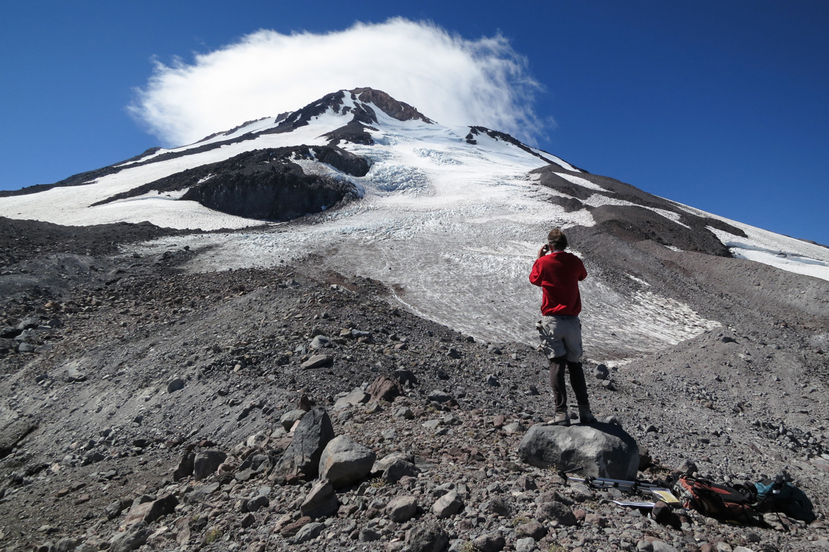
Inspired by the book Exploring Glaciers—With a Camera, Rhodes established his first photo station near the Whitney Glacier in 1974. Over time, he expanded his efforts to encompass other glaciers on the mountain, including the Bolam, Hotlum, and Wintun, setting up a total of 14 distinct photographic locations. Rhodes views his work as a continuation of the tradition of amateur naturalists and scientists, such as John Muir, who possessed significant expertise without necessarily holding formal professional titles.
From 1983 to 1988, Rhodes resided in the town of Mount Shasta, spending his summers as the caretaker of a hut serving as a base for mountaineers. Even after relocating to the San Francisco Bay Area to manage his family’s shipping-export business, he remained committed to his project, undertaking the arduous four-and-a-half-hour drive north alone each year to ascend the mountain and meticulously document his chosen sites. "What I did was try to make this definable by setting up these photo stations: taking the same photo year after year after year," he explained. "You can look at these photos, and you can see changes."
Eventually, life’s demands led Rhodes to pass on the project. In the early 2000s, he entrusted his collection to a graduate student in the Portland State Geology Department. Later, around 2015, the responsibility shifted to Forest Service rangers who embraced the endeavor as a welcome diversion.
It was through this evolving custodianship that I found myself accompanying Forrest Coots, a Forest Service seasonal ranger, on a spring weekend expedition to witness a photo station firsthand. Coots, a native of the Mount Shasta region, possesses an intimate knowledge of the mountain, with his personal baseline of environmental memory stretching back to his earliest childhood. As we navigated the rugged backroads on the mountain’s north side, he shared poignant observations of the changes he has witnessed in his lifetime. "I remember, as a kid, you never doubted that winter would come," he recalled, contrasting it with recent experiences of prolonged dry spells, including one winter where "we went 36 days without any precipitation. Like, dry as a bone."
Our journey continued on foot after the dirt road dissolved into a sandy wash, marked by a faded sign indicating the boundary of the Mount Shasta Wilderness. We donned our gear and began the ascent, a path less traveled than the popular southern approach. Coots expertly guided us through a wild, trackless terrain, navigating gullies, avalanche chutes, and stands of pine trees, many of which displayed signs of stress and mortality, their needles brown and brittle. Pointing towards the southeast, he indicated the Bolam Glacier, expressing doubt about its survival beyond his own lifetime, while offering a more uncertain hope for the Hotlum and Whitney Glaciers. "The Bolam," he stated with a somber certainty, "It’ll be gone."
Emerging above the tree line, we entered a stark landscape of rock, dirt, and ice. Coots led us to a rocky outcrop overlooking a small, icy pond. Above us, the Whitney Glacier gleamed, its ice a brilliant white tinged with an ethereal blue. "We’re here," he announced, "This is the spot." It took a moment to comprehend that our destination, Photo Station Whitney #1, was marked not by any elaborate structure, but by a nondescript, salmon-colored boulder, an ordinary stone amidst an extraordinary landscape. This unassuming rock had, for decades, served as a silent witness to profound environmental transformations. Yet, even this solid anchor of memory was vulnerable, its role as a historical marker relying on the fragile thread of human recollection.

During my time with Coots, I gained a deeper appreciation for the dedication behind the Mount Shasta glacier re-photography project. It is a remarkable narrative of citizen science and resourceful historical preservation, fueled by a collective effort to resist ecological amnesia. Rhodes’s tireless work, undertaken at his own expense and during his personal time, as described by Coots as "the foremost expert on Shasta’s glaciers," embodies a profound commitment to documenting these vanishing natural forces. This dedication, I realized, is how environmental memory persists across generations – through the often-unrecognized efforts of individuals striving to preserve invaluable historical records.
However, the continuity of this memory is not guaranteed. A significant portion of Rhodes’s Mount Shasta glacier photos from 2015 to 2019 were lost when a thumb drive was misplaced, a loss that left Rhodes, according to Coots, "distraught." The project’s momentum continued to wane. The summer after our expedition, Coots departed from his Forest Service position. Responsibility then fell to Nick Meyers, the lead climbing and wilderness ranger for Mount Shasta. However, staffing shortages and challenging weather conditions have hampered his team’s ability to maintain the rigorous schedule of re-photography. Meyers reported photographing only "a handful" of sites in recent years and missing others entirely. While the project has not ceased, he acknowledged that the agency "doesn’t always have the capacity" to visit all locations, though they remain committed and welcome volunteer assistance. For now, the crucial photo station at the base of the Whitney Glacier has reverted to its ancient state: a simple, solitary rock.
A partial collection of Rhodes’s Mount Shasta photographs had been transferred to Andrew Fountain, a distinguished glaciologist at Portland State University. However, even this transfer represents a form of evidentiary limbo. Fountain has accumulated over 10,000 glacier photographs throughout his career, some of which are accessible on his website, Glaciers of the American West. Yet, a substantial number remain unseen, stored on digital servers and hard drives. While his website offers a glimpse into glacial decline through comparative photography, its interface is described as clunky and difficult to navigate, with outdated content resulting from a lack of resources, particularly since Fountain’s retirement. Attempts to access the Mount Shasta photo gallery within the Glacier RePhoto Project now yield a 404 error, with similar issues affecting galleries for Mount Hood and Mount Rainier. "I’d like to get that site going again," Fountain expressed, a palpable weariness in his voice.
The question arises: if a glacier melts away from a mountainside, and there is little publicly accessible visual evidence of its existence, did it truly exist at all? Fountain admitted that for much of his career, he maintained an "academic remove" from such existential considerations. However, he eventually confronted the stark reality that "in the near future, like maybe 2070 or whatever, glaciers will get so small that nobody will read my work." This realization led him to "a certain depression," but it also spurred him to work with increased urgency. "Right now what I’m doing is developing an inventory of all the glaciers in the Western U.S., trying to tie down where they all are and how big they are. It might be a map of what times used to be," he explained.
As Coots and I descended from the Whitney Glacier, the sounds of melting ice were omnipresent, the spring melt in full force, sending countless streams cascading down the mountainside. The glacier was visibly receding beneath our feet, and we were the sole witnesses to its poignant, silent retreat. A story, much like a glacier, remains alive only as long as it is retold and continues to move.